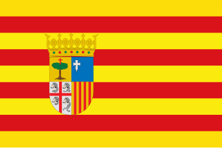
Aragon is an autonomous community in Spain, coextensive with the medieval Kingdom of Aragon. In northeastern Spain, the Aragonese autonomous community comprises three provinces : Huesca, Zaragoza, and Teruel. Its capital is Zaragoza. The current Statute of Autonomy declares Aragon a historic nationality of Spain.

Benabarre, in Ribagorçan and Aragonese: Benavarri is a town and municipality in the Aragonese comarca of Ribagorza, in the province of Huesca, Spain.

Alboraya or Alboraia is a town and municipality of the province of Valencia, Spain. It is situated very close to the city of Valencia.
Castelló de Rugat is a municipality in the comarca of Vall d'Albaida in the Valencian Community, Spain.
Moncada is a municipality in the comarca of Horta Nord in the Valencian Community, Spain.
Terrateig is a municipality in the comarca of Vall d'Albaida in the Valencian Community, Spain.

Monasterio de Piedra is a monastery, hotel and park complex in the Iberian System mountain ranges, near Nuévalos, province of Zaragoza, Aragon, Spain. The monastery was founded in 1194 by Alfonso II of Aragon, with thirteen Cistercian monks from Poblet Monastery, in an old castle next to the Piedra River, and was dedicated to St. Mary the White. On February 16, 1983, the entire complex was declared a national monument.

Navarrete is a municipality of the autonomous community of La Rioja. Named a Conjunto Histórico-Artístico of Spain, due to its historical and monumental character. Navarrete is located between Logroño and Nájera on the French Way, the most popular path on the Way of St. James, a medieval pilgrim route. Currently, Navarrete is the only pottery centre in La Rioja, and it has been one of the most important centres in Northern Spain.
Alacón is a municipality located in the province of Teruel, Aragon, Spain. According to the 2004 census (INE), the municipality had a population of 470 inhabitants, and is at an altitude of 704 meters (2,310 ft).

Oliete is a municipality located in the province of Teruel, Aragon, Spain. According to the 2017 census (INE), the municipality has a population of 357 inhabitants.
Torrijo del Campo is a municipality located in the province of Teruel, Aragon, Spain. According to the 2018 census (INE), the municipality has a population of 447 inhabitants.

Manchones is a municipality in the province of Zaragoza, Aragon, Spain. According to the Spanish Statistical Institute (INE), the municipality had a population of 123 inhabitants in 2010. The pueblo is in the comarca of Campo de Daroca, about 6 kilometres (3.7 mi) northwest of Daroca and just southeast of Murero in the Calatayud-Daroca depression. The Jiloca River passes to the west.

Torralbilla is a municipality located in the province of Zaragoza, Aragon, Spain. According to the 2004 census (INE), the municipality has a population of 71.
Villadoz is a municipality located in the province of Zaragoza, Aragon, Spain. According to the 2020 census, the municipality has a population of 95 inhabitants.
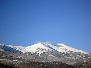
The Iberian System is one of the major systems of mountain ranges in Spain. It consists of a vast and complex area of mostly relatively high and rugged mountain chains and massifs located in the central region of the Iberian Peninsula, but reaching almost the Mediterranean coast in the Valencian Community in the east.

Campo de Daroca is one of the comarcas of Aragon, in the Province of Zaragoza, Aragon, Spain. It is located in the mountainous Iberian System area.

The Guayadeque ravine, in Spanish Barranco de Guayadeque, is a ravine-type valley located on the Spanish municipalities of Ingenio and Agüimes, in the province of Las Palmas on Grand Canary island, off the coast of Morocco.

The Sierra Espuña is a mountain range in the Region of Murcia, Spain. It is part of the Penibaetic System. The Sierra Espuña Regional Park protects 17,804 ha of the mountain range in the municipalities of Alhama de Murcia, Totana and Mula. The highest peak, also known as Espuña, is at 1,583 metres. The summit itself is a military area. It houses the 13th Air Surveillance Squadron radar station, part of the Spanish Air and Space Force.

The Imperial Canal of Aragon is a 110-kilometre (68 mi) zanja and navigation canal built from 1776 to 1790 between Fontellas (Navarre) and Fuentes de Ebro (Aragón). Its construction was intended to improve the irrigation of the old Acequia Imperial de Aragón, bringing water from the Ebro River to Zaragoza and allowing the irrigation system to be extended in the region. It also established a passenger and freight transport service between Tudela and Zaragoza.

Ruesta is a former settlement in the province of Zaragoza, in the autonomous community of Aragon (Spain), today belonging to the municipality of Urriés, in the region of Cinco Villas, judicial district of Ejea de los Caballeros.


