
The Blackfoot Confederacy, Niitsitapi or Siksikaitsitapi, is a historic collective name for linguistically related groups that make up the Blackfoot or Blackfeet people: the Siksika ("Blackfoot"), the Kainai or Blood, and two sections of the Peigan or Piikani – the Northern Piikani (Aapátohsipikáni) and the Southern Piikani. Broader definitions include groups such as the Tsúùtínà (Sarcee) and A'aninin who spoke quite different languages but allied with or joined the Blackfoot Confederacy.
The bow and arrow is a ranged weapon system consisting of an elastic launching device (bow) and long-shafted projectiles (arrows).

Head-Smashed-In Buffalo Jump is a buffalo jump located where the foothills of the Rocky Mountains begin to rise from the prairie 18 km (11.2 mi) west of Fort Macleod, Alberta, Canada on highway 785. It is a UNESCO World Heritage Site and home of a museum of Blackfoot culture. Joe Crowshoe Sr. (1903–1999) – Aapohsoy’yiis – a ceremonial Elder of the Piikani Nation in southern Alberta, was instrumental in the development of the site. The Joe Crow Shoe Sr. Lodge is dedicated to his memory. He dedicated his life to preserving Aboriginal culture and promoting the relationship between Aboriginal and non-Aboriginal people and in 1998 was awarded the National Aboriginal Achievement Award for "saving the knowledge and practices of the Blackfoot people."

Monte Verde is an archaeological site in southern Chile, located near Puerto Montt, Southern Chile, which has been dated to as early as 18,500 cal BP. Previously, the widely accepted date for early occupation at Monte Verde was ~14,500 years cal BP. This dating added to the evidence showing that the human settlement of the Americas pre-dates the Clovis culture by roughly 1000 years. This contradicts the previously accepted "Clovis first" model which holds that settlement of the Americas began after 13,500 cal BP. The Monte Verde findings were initially dismissed by most of the scientific community, but the evidence then became more accepted in archaeological circles.

An arrowhead or point is the usually sharpened and hardened tip of an arrow, which contributes a majority of the projectile mass and is responsible for impacting and penetrating a target, as well as to fulfill some special purposes such as signaling.

To some indigenous peoples of North America, the medicine wheel is a metaphor for a variety of spiritual concepts. A medicine wheel may also be a stone monument that illustrates this metaphor.

Nose Hill Park is a natural park in the northwest quadrant of Calgary, Alberta which covers over 11 km2 (4.2 sq mi). It is the fourth-largest urban park in Canada, and one of the largest urban parks in North America. It is a municipal park, unlike Fish Creek, which is a provincial park. It was created in 1980.

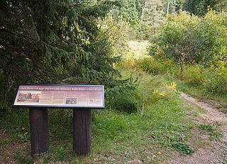
Writing-on-Stone Provincial Park is located about 100 kilometres (60 mi) southeast of Lethbridge, Alberta, Canada, or 44 kilometres (30 mi) east of the community of Milk River, and straddles the Milk River itself. It is one of the largest areas of protected prairie in the Alberta park system, and serves as both a nature preserve and protection for many First Nations (indigenous) rock carvings and paintings. The park is sacred to the Blackfoot and many other aboriginal tribes.

The Tsodilo Hills are a UNESCO World Heritage Site (WHS), consisting of rock art, rock shelters, depressions, and caves in southern Africa. It gained its WHS listing in 2001 because of its unique religious and spiritual significance to local peoples, as well as its unique record of human settlement over many millennia. UNESCO estimates there are over 4500 rock paintings at the site. The site consists of a few main hills known as the Child Hill, Female Hill, and Male Hill.
The Medicine Wheel/Medicine Mountain National Historic Landmark is a medicine wheel located in the Bighorn National Forest, in the U.S. state of Wyoming. The Medicine Wheel at Medicine Mountain is a large stone structure made of local white limestone laid upon a bedrock of limestone. It is both a place of sacred ceremony and scientific inquiry. In Native Science these uses are not distinguished as separate as they are in Western science.

The Cairn of Barnenez is a Neolithic monument located near Plouezoc'h, on the Kernéléhen peninsula in northern Finistère, Brittany (France). It dates to the early Neolithic, about 4800 BC. Along with the Tumulus of Bougon and Locmariaquer megaliths, also located in Great West France, it is one of the earliest megalithic monuments in Europe and one of the oldest man-made structures in the world. It is also remarkable for the presence of megalithic art.

Parc Cwm long cairn, also known as Parc le Breos burial chamber, is a partly restored Neolithic chambered tomb, identified in 1937 as a Severn-Cotswold type of chambered long barrow. The cromlech, a megalithic burial chamber, was built around 5850 years before present (BP), during the early Neolithic. It is about seven 1⁄2 miles (12 km) west south–west of Swansea, Wales, in what is now known as Coed y Parc Cwm at Parc le Breos, on the Gower Peninsula.
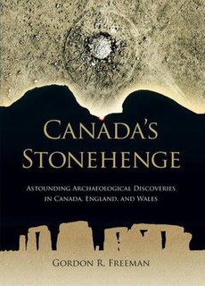
Canada's Stonehenge: Astounding Archaeological Discoveries in Canada, England, and Wales is a 2009 self-published book by retired chemistry professor Gordon Freeman, in which the author claims that the Majorville Cairn and Medicine Wheel site, located south of Bassano, Alberta is actually a precise 5,000-year-old calendar. He also discusses Stonehenge, which he believes was also a calendar.

Sibudu Cave is a rock shelter in a sandstone cliff in northern KwaZulu-Natal, South Africa. It is an important Middle Stone Age site occupied, with some gaps, from 77,000 years ago to 38,000 years ago.

Poverty Point State Historic Site/Poverty Point National Monument is a prehistoric earthwork constructed by the Poverty Point culture. The Poverty Point site is located in present-day northeastern Louisiana though evidence of the Poverty Point culture extends throughout much of the Southeastern Woodlands. The culture extended 100 miles (160 km) across the Mississippi Delta and south to the Gulf Coast. The Poverty Point site has been designated as a state historic site, U.S. National Monument, a U.S. National Historic Landmark, and UNESCO World Heritage Site. Located in the Southern United States, the site is 15.5 miles (24.9 km) from the current flow of the Mississippi River, and is situated on the edge of Macon Ridge, near the village of Epps in West Carroll Parish, Louisiana.

George Millward McDougall was a Methodist missionary in Canada who assisted in negotiations leading to Treaty 6 and Treaty 7 between the Canadian government and the Indian tribes of western Canada. He was also responsible for the theft of the Manitou Stone. Holly Quan wrote: "To the Blackfoot and Cree of the western plains, the Iron Stone was the embodiment of powerful spirits, a source of strength, power, protection and luck...To the Reverend George McDougall, the Iron Stone was a pagan symbol. With considerable effort, in the early spring of 1866 he had the stone dug from its resting place...to be proudly displayed on the lawn of the Methodist college where he was trained...That spring, when the Cree and Blackfoot came again to visit the Iron Stone...their link with the buffalo spirits...had mysteriously vanished. The elders predicted war disease and starvation. All their predictions came true."

Zengpiyan is a Neolithic cave site in southern China. It is located in the Guilin region on the south-western fringes of the Dushan Mountain in the autonomous region Guangxi and is considered to be one of the most important cave sites of the Neolithic in China as it is one of the many independent centers for the introduction of animal domestication and pottery.
The game drive system is a hunting strategy in which game are herded into confined or dangerous places where they can be more easily killed. It can also be used for animal capture as well as for hunting, such as for capturing mustangs. The use of the strategy dates back into prehistory. Once a site is identified or manipulated to be used as a game drive site, it may be repeatedly used over many years.

The Fisher Mound Group is a group of burial mounds with an associated village site located on the DesPlaines River near its convergence with the Kankakee River where they combine to form the Illinois River, in Will County, Illinois, about 60 miles southwest of Chicago. It is a multi-component stratified site representing several Prehistoric Upper Mississippian occupations as well as minor Late Woodland and Early Historic components.

Old Women's Buffalo Jump is a historic site and former aboriginal buffalo jump near present-day Cayley, Alberta. It is known by the indigenous name Aakíípisskan.


