The Battle of Loon Lake, also known as the Battle of Steele Narrows, concluded the North-West Rebellion on June 3, 1885, and was the last battle fought on Canadian soil. It was fought in what was then the District of Saskatchewan of the North-West Territories, at what is now known as Steele Narrows at Makwa Lake, in Saskatchewan's Steele Narrows Provincial Park. Steele Narrows is a channel that separates Sanderson Bay from Makwa Lake.

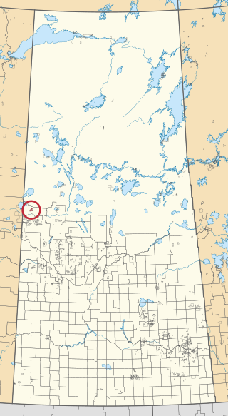
Loon Lake is a village in the Canadian province of Saskatchewan within the Rural Municipality of Loon Lake No. 561 and Census Division No. 17. The Makwa Sahgaiehcan First Nation reserve is to the east of the village. The village is located on Highway 26 north-east of the city of Lloydminster.

Division No. 17 is one of eighteen census divisions in the province of Saskatchewan, Canada, as defined by Statistics Canada. It is located in the west-northwest part of the province, bordering Alberta. The most populous community in this division is the interprovincial city of Lloydminster. Another important population centre is the town of Meadow Lake.
Makwa Sahgaiehcan is a Cree First Nation band government in Loon Lake, Saskatchewan, Canada. Their reserve is northeast of Lloydminster. The English translation of "Makwa Sahgaiehcan" is from Plains Cree language ᒫᑿ ᓵᑲᐦᐃᑲᐣ, mâkwa sâkahikan, meaning "loon lake". It is also the administrative headquarters of the Eagles Lake band government.

Seekaskootch 119 is an Indian reserve of the Onion Lake Cree Nation in Saskatchewan. It is 142 kilometres northwest of North Battleford. In the 2016 Canadian Census, it recorded a population of 2574 living in 578 of its 639 total private dwellings. In the same year, its Community Well-Being index was calculated at 53 of 100, compared to 58.4 for the average First Nations community and 77.5 for the average non-Indigenous community.
Fowler Lake is a lake in the Canadian province of Saskatchewan. The lake is in the RM of Loon Lake No. 561, west of Makwa Lake and Makwa Lake Provincial Park. West of and upstream of Fowler Lake is Murphy Lake, which is separated by an isthmus and connected by a short stream. Fowler Lake's outflow is at the eastern end and it flows eastward meandering through forest and muskeg before emptying into Makwa Lake. Access to the lake and its amenities is from Highway 699.

Waterhen 130 is an Indian reserve of the Waterhen Lake First Nation in Saskatchewan. It is 39 kilometers north of Meadow Lake. In the 2016 Canadian Census, it recorded a population of 672 living in 196 of its 213 total private dwellings. In the same year, its Community Well-Being index was calculated at 51 of 100, compared to 58.4 for the average First Nations community and 77.5 for the average non-Indigenous community.
Big Island Lake Cree Territory is an Indian reserve of the Big Island Lake Cree Nation in Saskatchewan. It is 39 kilometres east of Cold Lake, Alberta. In the 2016 Canadian Census, it recorded a population of 808 living in 132 of its 165 total private dwellings. In the same year, its Community Well-Being index was calculated at 37 of 100, compared to 58.4 for the average First Nations community and 77.5 for the average non-Indigenous community.

Buffalo River Dene Nation 193 is an Indian reserve of the Buffalo River Dene Nation in Saskatchewan. It is 84 kilometres northwest of Île-à-la-Crosse. In the 2016 Canadian Census, it recorded a population of 783 living in 233 of its 260 total private dwellings. In the same year, its Community Well-Being index was calculated at 54 of 100, compared to 58.4 for the average First Nations community and 77.5 for the average non-Indigenous community.

Fishing Lake 89 is an Indian reserve of the Fishing Lake First Nation in Saskatchewan. It is 119 kilometres (74 mi) north of Fort Qu'Appelle. In the 2016 Canadian Census, it recorded a population of 406 living in 128 of its 161 total private dwellings. In the same year, its Community Well-Being index was calculated at 54 of 100, compared to 58.4 for the average First Nations community and 77.5 for the average non-Indigenous community.
Eagles Lake 165C is an Indian reserve of the Canoe Lake Cree First Nation in Saskatchewan. It consists of all that portion of Township 59, Range 14, west of the Third Meridian. In the 2016 Canadian Census, it recorded a population of 92 living in 29 of its 32 total private dwellings. In the same year, its Community Well-Being index was calculated at 72 of 100, compared to 58.4 for the average First Nations community and 77.5 for the average non-Indigenous community.

Flying Dust 105 is an Indian reserve of the Flying Dust First Nation in Saskatchewan. It is less than a kilometre north-west of Meadow Lake. In the 2016 Canadian Census, it recorded a population of 577 living in 169 of its 187 total private dwellings. In the same year, its Community Well-Being index was calculated at 63 of 100, compared to 58.4 for the average First Nations community and 77.5 for the average non-Indigenous community.

Makwa Lake 129 is an Indian reserve of the Makwa Sahgaiehcan First Nation in Saskatchewan. It is about 151 kilometres (94 mi) north-west of North Battleford. In the 2016 Canadian Census, it recorded a population of 15 living in 5 of its 5 total private dwellings.

Makwa Lake 129A is an Indian reserve of the Makwa Sahgaiehcan First Nation in Saskatchewan. It is about 95 miles north-west of North Battleford.

Makwa Lake 129B is an Indian reserve of the Makwa Sahgaiehcan First Nation in Saskatchewan. It is about 95 miles north-west of North Battleford. In the 2016 Canadian Census, it recorded a population of 982 living in 226 of its 444 total private dwellings. In the same year, its Community Well-Being index was calculated at 47 of 100, compared to 58.4 for the average First Nations community and 77.5 for the average non-Indigenous community.

Meadow Lake 105A is an Indian reserve of the Flying Dust First Nation in Saskatchewan. It is 7 miles southwest of Meadow Lake. In the 2016 Canadian Census, it recorded a population of 0 living in 0 of its 1 total private dwellings.

Ministikwan 161 is an Indian reserve of the Ministikwan Lake Cree Nation in Saskatchewan. It is 161 kilometres northwest of North Battleford. In the 2016 Canadian Census, it recorded a population of 624 living in 128 of its 150 total private dwellings. In the same year, its Community Well-Being index was calculated at 38 of 100, compared to 58.4 for the average First Nations community and 77.5 for the average non-Indigenous community.

Ministikwan 161A is an Indian reserve of the Ministikwan Lake Cree Nation in Saskatchewan. It is 177 kilometres northwest of North Battleford. In the 2016 Canadian Census, it recorded a population of 223 living in 40 of its 42 total private dwellings. In the same year, its Community Well-Being index was calculated at 35 of 100, compared to 58.4 for the average First Nations community and 77.5 for the average non-Indigenous community.

Muscowpetung 80 is an Indian reserve of the Muscowpetung First Nation in Saskatchewan. It is 31 kilometres west of Fort Qu'Appelle along the south-west shore of Pasqua Lake, which is one of four Fishing Lakes. In the 2016 Canadian Census, it recorded a population of 275 living in 87 of its 112 total private dwellings. In the same year, its Community Well-Being index was calculated at 54 of 100, compared to 58.4 for the average First Nations community and 77.5 for the average non-Indigenous community.

Makwa River is a river in the Canadian province of Saskatchewan in the transition zone between parkland and boreal forest. Makwa is Cree for Loon. The upper reaches of the Makwa River's watershed reach just across the border into Alberta and includes lakes such as Hewett, Ministikwan, Makwa, and Jumbo.

