
Inglewood is an inner-city suburb of Perth, Western Australia, 4 kilometres (2 mi) north-east of its central business district. It is located within the local government area of the City of Stirling.

Woodlands is a suburb of Perth, Western Australia. Its local government area is the City of Stirling and it is in the federal Division of Curtin.

Claremont is a western suburb of Perth, Western Australia, on the north bank of the Swan River.

Cottesloe is a western suburb of Perth, Western Australia, within the Town of Cottesloe. Cottesloe was named for Thomas Fremantle, 1st Baron Cottesloe, a prominent Tory politician and the brother of Admiral Sir Charles Fremantle for whom the city of Fremantle was named. The nearby suburb of Swanbourne was named for the Fremantle family seat, Swanbourne House, in Swanbourne, Buckinghamshire.

Peppermint Grove is an affluent western suburb of Perth, Western Australia on the north bank of the Swan River at Freshwater Bay. Its local government area, the smallest in the country, is the Shire of Peppermint Grove. The suburb was named after its trademark Swan River peppermint trees lining many streets. The suburb has long been associated with Western Australia's wealthiest and oldest families. Their prosperity is reflected in the many historical houses in the area, such as The Cliffe and the Federation Queen Anne style St Just. Colin Barnett, a former Premier of Western Australia, dubbed the suburb "Monaco of WA" due to its small size and concentration of wealth.

Bull Creek is a suburb of Perth, Western Australia, located within the local government area of City of Melville. The suburb lies to the south of a creek of the same name, which flows into the Canning River.

Karawara is a suburb of Perth, Western Australia. In 2016 census, the total population was at 2,061.

Waterford is a small riverside suburb of Perth, the state capital of Western Australia. Its local government area is the City of South Perth.

Riverton is a southeastern suburb of Perth, the capital city of Western Australia. Its local government area is the City of Canning.

Parkwood is a southeastern suburb of Perth, the capital city of Western Australia. Its local government area is the City of Canning.

Duncraig is a northern suburb of Perth, the capital city of Western Australia, and is located 16 kilometres (10 mi) north of Perth's central business district (CBD) between Marmion Avenue and Mitchell Freeway. Its local government area is the City of Joondalup.

Floreat is a residential suburb 8 kilometres (5 mi) west-northwest of the central business district of Perth, the capital of Western Australia. It is bordered on Underwood Avenue, Selby Street, Cromarty Road and Durston Road. It is the head of the Town of Cambridge, which has its municipal offices and library in the suburb. The name of the suburb stems from the Latin word for "flourish" or "prosper", which is also the motto of the City of Perth, of which Floreat was a part when it was first built.

Cannington is a southern suburb of Perth, Western Australia. Its local government area is the City of Canning.
Shelley is a suburb of Perth, Western Australia, located within the City of Canning.

Willetton is a large southern suburb of Perth, Western Australia. Its local government area is the City of Canning.
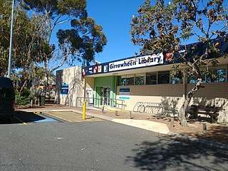
Girrawheen is a northern suburb of Perth, the capital city of Western Australia. Its local government area is the City of Wanneroo.

Hamilton Hill is a suburb of Perth, the capital city of Western Australia, located 23 kilometres (14 mi) southwest the central business district. Its local government area is the City of Cockburn.
Hillarys is a northern coastal suburb of Perth, the capital city of Western Australia, in the local government area of the City of Joondalup. It is part of the Whitfords precinct, and is located 21 km north-northwest of Perth's central business district via Mitchell Freeway and Hepburn Avenue.

Daglish is a small western suburb of Perth, the capital of Western Australia. It is approximately 4 kilometres (2.5 mi) west of the Perth central business district, and within the City of Subiaco local government area. It was named after Henry Daglish, who was the Mayor of Subiaco, member for the electoral district of Subiaco and Premier of Western Australia from 1904 to 1905. The Daglish railway station opened in 1924 in response to population growth in the neighbouring suburb of Subiaco. The following year, the Municipality of Subiaco bought the land west of the railway station to sell for housing. Development occurred over the following 20 years. The initial development next to the railway station used the garden suburb principles, with large lots and gardens, curved streets, and lots of green space. Today, the suburb has significant heritage value due to its uniform streetscape, with most original homes still standing. It has a population of 1,419 as of the 2016 Australian census.

East Fremantle is a suburb of Perth, Western Australia, located 13 kilometres (8.1 mi) south-west of the central business district. The suburb is mainly residential, and is coterminous with the Town of East Fremantle local government area.
