Mansa district, India

Last updated

Mansa district
Old well in Raipur, Mansa.jpg
Old well in Raipur village
Mansa in Punjab (India).svg
Location in Punjab
Coordinates: 29°59′N75°23′E / 29.983°N 75.383°E / 29.983; 75.383
CountryFlag of India.svg  India
State Punjab
Headquarters Mansa
Area
  Total2,174 km2 (839 sq mi)
Population
 (2011)
  Total769,751
  Density350/km2 (900/sq mi)
Languages
  Official Punjabi
Time zone UTC+5:30 (IST)
ISO 3166 code IN-PB
Sex ratio 1000/880 /
Literacy63%
Website www.mansa.nic.in

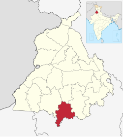
Mansa district is a district in the state of Punjab, India. The district headquarters is Mansa city. Mansa district was formed on 13 April 1992 from the erst while district of Bathinda. [1] The district has three tehsils: Mansa, Budhlada and Sardulgarh; and five development blocks: Mansa, Budhlada, Sardulgarh, Bhikhi and Jhunir. [2]

Contents

Geography

The district is roughly triangular in shape and is bounded on the northwest by Bathinda district, on the northeast by Sangrur district, and on the south by Haryana state. It is situated on the Bathinda-Jind-Delhi railway and the Barnala-Sardulgarh-Sirsa road. The district is divided into three tehsils, Budhlada, Mansa, and Sardulgarh. The Ghaggar River flows through the Sardulgarh Tehsil in the southwestern corner of the district.

History

Mansa District was formerly a part of the Phulkia Sikh Dynasty (1722–1948) then part of Kaithal Sikh Kingdom (1762–1857). The present district was formed on 13 April 1992 from the erstwhile Bathinda district. The town is said to have been founded by Bhai Gurdas who hailed from Dhingar, Mansa district. He is said to have been married at this place among the Dhaliwal Jat Sikh. Once he came to his in-laws to take his wife along with him but they refused to send her. At this, Bhai Gurdas sat in meditation before the house of his in-laws. After some time, the parents of the girl agreed to send their daughter with Bhai Gurdas. But he refused to take her along with him, stating that he had now renounced the worldly way of life. In his memory, his Smadh was constructed where a fair is held every year in March–April. People in large numbers attend the fair and offer Laddus and Gur (jaggery) at Smadh. Class ‘A’ municipality has been functioning in the town since 1952. The town has two Colleges, viz. Govt. Nehru Memorial Post Graduate College and S.D. Kanya Mahavidyalaya College, 3 Senior Secondary Schools, 90 High Schools, 1 Middle School, 1 Primary School, and one District Library and has one civil hospital, 3 Dispensaries, 1 Ayurvedic, and 4 Homeopathic dispensaries. There are two police stations i.e. PS City and PS Sadar and also a railway station.

Ancient period

The ancient history of the Mansa district has been traced to the Indus Valley civilization. The archaeological finds at different villages of Mansa district are almost similar to those of Harappa and Mohenjo-Daro. [3] [4] It is divided into three parts Pre-Harappa, Harappa and Late Harappa.

Demographics

Historical population
YearPop.±% p.a.
1951241,932    
1961319,389+2.82%
1971402,099+2.33%
1981486,842+1.93%
1991574,662+1.67%
2001688,758+1.83%
20112,423,655+13.41%
source: [5]

According to the 2011 census Mansa district has a population of 2,423,655. [6] This gives it a ranking of 489th in India (out of a total of 640). The district has a population density of 352 inhabitants per square kilometre (910/sq mi), which was second lowest in Punjab. Its population growth rate over the decade 2001-2011 was 11.62%. Mansa has a sex ratio of 880 females for every 1000 males and a literacy rate of 90%. [6]

Gender

The table below shows the sex ratio of Mansa district through decades.

Sex ratio of Mansa district [7]
Census YearRatio
2011883
2001879
1991873
1981869
1971852
1961830
1951824

The table below shows the child sex ratio of children below the age of 6 years in the rural and urban areas of Mansa district.

Child sex ratio of children below the age of 6 years in Mansa district [8]
YearUrbanRural
2011820840
2001778783

Religions

Religion in Mansa district (2011) [9]
ReligionPercent
Sikhism
77.75%
Hinduism
20.34%
Islam
1.35%
Other or not stated
0.57%

The table below shows the population of different religions in absolute numbers in the urban and rural areas of Mansa district.

Absolute numbers of different religious groups in Mansa district [10]
ReligionUrban (2011)Rural (2011)Urban (2001)Rural (2001)
Hindu89,26267,27780,27258,953
Sikh70,2615,28,18258,8684,80,646
Muslim2,1458,2301,3705,701
Christian17174671327
Other religions1,7651,7221,848702

Languages

Languages of Mansa district (2011) [11]

   Punjabi (98.9%)
   Hindi (1%)
  Others (0.1%)

At the time of the 2011 census, 98.9% of the population spoke Punjabi and 1% Hindi as their first language. [11]

Health

The table below shows the data from the district nutrition profile of children below the age of 5 years, in Mansa, as of year 2020.

District nutrition profile of children under 5 years of age in Mansa, year 2020 [12]
IndicatorsNumber of children (<5 years)Percent (2020)Percent (2016)
Stunted21,47737%30%
Wasted7,09112%16%
Severely wasted1,9883%7%
Underweight13,29623%25%
Overweight/obesity1,8123%1%
Anemia41,22078%52%
Total children58,648

The table below shows the district nutrition profile of Mansa of women between the ages of 15 to 49 years, as of year 2020.

District nutritional profile of Mansa of women of 15-49 years, in 2020 [13]
IndicatorsNumber of women (15-49 years)Percent (2020)Percent (2016)
Underweight (BMI <18.5 kg/m^2)38,20016%19%
Overweight/obesity78,20533%24%
Hypertension71,74430%20%
Diabetes27,62812%NA
Anemia (non-preg)143,01260%50%
Anemia (preg)7,54068%38%
Total women (preg)11,052
Total women237,562

Agriculture and industry

Mansa is situated in the cotton belt of Punjab and therefore popularly called the "Area of white gold". Indeed, agriculture forms the backbone of the district economy.

Mansa is home to the largest Thermal Power Plant of Punjab. The Thermal Power Plant has the capacity to produce 1980MW of electricity

Industrially, the district is very deficient, yet some trade and industry is being carried out in urban areas.

Major cities and towns

Village Ubha

Ubha is situated in Mansa District. It is famous for its temple.

Bareta

Bareta is situated on BathindaDelhi railway line.

Budhlada or Badlada

Badlada was named after the Budha Singh Badholada, who was a khatri sikh by caste. It is also situated on Bathinda-Delhi railway line. It was the largest market of Eastern Punjab and a very big recruitment centre for military personnel. [14]

Politics

No.ConstituencyName of MLAPartyBench
96 Mansa Vijay Singla Aam Aadmi Party Government
97 Sardulgarh Gurpreet Singh Banawali Aam Aadmi Party Government
98 Budhlada (SC) Budhram Singh Aam Aadmi Party Government

Notable people

Related Research Articles

<span class="mw-page-title-main">Panchkula district</span> District of Haryana in India

Panchkula district was formed as the 17th district of the Indian state of Haryana on 15 August 1995. It comprises two sub divisions and two tehsils: Panchkula and Kalka. It has 264 villages, out of which 12 are uninhabited and ten wholly merged with towns or treated as census towns according to the 1991 census. There are five towns in the district: Barwala, Kalka, Panchkula, Pinjore and Raipur Rani. The total population of the district is 319,398 out of which 173,557 are males and 145,841 are females.

<span class="mw-page-title-main">Gurdaspur district</span> District in Punjab, India

Gurdaspur district is a district in the Majha region of the state of Punjab, India. Gurdaspur is the district headquarters. It internationally borders Narowal District of Pakistani Punjab, and the districts of Amritsar, Pathankot, Kapurthala and Hoshiarpur. Two main rivers Beas and Ravi passes through the district. The Mughal emperor Akbar is said to have been enthroned in a garden near Kalanaur, a historically important town in the district. The district is at the foothills of the Himalayas.

<span class="mw-page-title-main">Hoshiarpur district</span> District in Punjab, India

Hoshiarpur district is a district of Punjab state in northern India. Hoshiarpur, one of the oldest districts of Punjab, is located in the North-east part of the Punjab state and shares common boundaries with Gurdaspur district in the north-west, Jalandhar district and Kapurthala district in south-west, Kangra district and Una district of Himachal Pradesh in the north-east. Hoshiarpur district comprises 4 sub-divisions, 10 community development blocks, 9 urban local bodies and 1417 villages. The district has an area of 3365 km2. and a population of 1,586,625 persons as per census 2011.

<span class="mw-page-title-main">Amritsar district</span> District in Charda Punjab, India

Amritsar district is one of the twenty three districts that make up the Indian state of Punjab. Located in the Majha region of Punjab, the city of Amritsar is the headquarters of this district.

<span class="mw-page-title-main">Mansa, Punjab</span> City in Punjab, India

Mansa is a city of Punjab. It is the administrative headquarters of Mansa district and is situated on the Bathinda-Jind-Delhi railway line and also on the Barnala-Sardulgarh-Sirsa state highway.

<span class="mw-page-title-main">Bathinda district</span> District of Punjab in India

Bathinda district is in Malwa region of Punjab, India. The district encompasses an area of 3,385 square kilometers. By area, Bathinda district is the second-largest in Punjab, after Ludhiana district. It is bounded by Faridkot district and Moga district on the north, Muktsar district on the west, Barnala and Mansa districts on the east, and the state of Haryana on the south. Bathinda is cotton producing belt of Punjab.

<span class="mw-page-title-main">Patiala district</span> District in Punjab, India

Patiala district is one of the twenty three districts in the state of Punjab in north-west India.

<span class="mw-page-title-main">Kapurthala district</span> District of Punjab in India

Kapurthala district is a district of Punjab state in northern India. The city of Kapurthala is the district headquarters.

<span class="mw-page-title-main">Firozpur district</span> District in Punjab, India

Firozpur district, also known as Ferozepur district, is one of the twenty-three districts in the state of Punjab, India. Firozpur district comprises an area of 2,190 km2 (850 sq mi).

<span class="mw-page-title-main">Hanumangarh district</span> District in Rajasthan, India

Hanumangarh district is a district in the state of Rajasthan in India. The city of Hanumangarh is the district headquarters and its largest city.

<span class="mw-page-title-main">Jalandhar district</span> District in Punjab, India

Jalandhar district is a district in Doaba region of the state of Punjab, India. The district headquarters is the city of Jalandhar.

<span class="mw-page-title-main">Faridkot district</span> District of Punjab in India

Faridkot district is a district lying in the South-Western part of Punjab, India with Faridkot city as the district headquarters.

<span class="mw-page-title-main">Sri Muktsar Sahib district</span> District of Punjab in India

Sri Muktsar Sahib district, is one of the 23 districts in the Indian state of Punjab. The capital city of district is Sri Muktsar Sahib. The district itself was historically referred as Khidrane Di Dhaab. There are 4 Tehsils in District which consists of total 234 villages. 1. Sri Muktsar Sahib 2. Lambi 3. Gidderbaha 4. Malout

<span class="mw-page-title-main">Moga district</span> District of Punjab in India

Moga district is one of the twenty-two districts in the state of Punjab, India. It became the 17th district of Punjab State on 24 November 1995 cut from Faridkot district. Moga District is among the largest producers of wheat and rice in Punjab, India. People from Moga City and Moga District belong to the Malwa culture. The district is noted for being the homeland for a high proportion of Indian Punjabi expatriates who emigrated abroad and their descendents, which has given it the nickname of "NRI district".

<span class="mw-page-title-main">Budhlada</span> Place in Punjab, India

Budhlada is a municipal council located in the Mansa district of the state of Punjab, India. The area's main industry is agriculture, which provides the majority of employment opportunities in the region. The municipal council of Budhlada is divided into 19 wards, and regular elections are held every five years. It has held the status of a Class II Municipal Council since the 1950s.

<span class="mw-page-title-main">Barnala district</span> District of Punjab in India

Barnala is one of the districts of Indian state of Punjab. It was carved out of Sangrur district, in November 2006. It is a centrally located district bordered by Ludhiana district on the north, Moga district on northwest, Bathinda district on west, Sangrur district on east and Mansa district on south. As per census 2011, Population of District Barnala is 5,96,294. Barnala boasts a significant number of colleges that offer a diverse range of educational opportunities in fields such as engineering, arts, medicine, and commerce. Furthermore, the town is renowned for its thriving industrial sector. Two main Industries: Trident Group and a large Industry producing Combines, Standard Combines were also established here.

<span class="mw-page-title-main">Sangrur district</span> District of Punjab in India

Sangrur district is in the state of Punjab in northern India. Sangrur city is the district headquarters. It is one of the five districts in Patiala Division in the Indian state of Punjab. Neighbouring districts are Malerkotla (north), Barnala (west), Patiala (east), Mansa (southwest) and Fatehabad (Haryana) and Jind (Haryana) (south).

<span class="mw-page-title-main">Fazilka district</span> District of Punjab in India

Fazilka district is one of 23 districts in the state of Punjab in India. The district headquarters of the Fazilka District are at Fazilka.

<span class="mw-page-title-main">Chhattiana, Punjab</span> Village in Punjab, India

Chhattiana is a village in the Giddarbaha tehsil of Sri Muktsar Sahib district in Punjab, India.'

Jhunir, sometimes spelled Jhuner, is a town in the Sardulgarh tehsil of Mansa district in Punjab, India. It is also a block of the district.

References

  1. "About | Mansa". www.mansa.nic.in. Retrieved 6 July 2016.
  2. "Gurpreet gets Mansa seat". News in English. Ludhiana. The Tribune. 10 January 2012. Retrieved 17 July 2012.
  3. Lal, B.B; Gupta, S.P. (1984) [1981-82]. Frontier of Indus Valley Civilization. Delhi.{{cite book}}: CS1 maint: location missing publisher (link)
  4. "Ancient history of Mansa district". B.B. Lal and S.P. Gupta. www.punjabrevenue.nic.in. Archived from the original on 18 July 2011. Retrieved 23 January 2012.
  5. "Census of India Website : Office of the Registrar General & Census Commissioner, India". www.censusindia.gov.in.
  6. 1 2 "District Census Hand Book – Mansa" (PDF). Census of India . Registrar General and Census Commissioner of India.
  7. "District-wise Decadal Sex ratio in Punjab". Open Government Data (OGD) Platform India. 21 January 2022. Retrieved 20 November 2023.
  8. https://punjab.data.gov.in/catalog/district-wise-rural-and-urban-child-population-0-6-years-and-their-sex-ratio-punjab
  9. "Table C-01 Population by Religious Community: Punjab". censusindia.gov.in. Registrar General and Census Commissioner of India.
  10. https://punjab.data.gov.in/catalog/district-wise-population-religion-punjab
  11. 1 2 "Table C-16 Population by Mother Tongue: Punjab". censusindia.gov.in. Registrar General and Census Commissioner of India.
  12. https://www.niti.gov.in/sites/default/files/2022-07/Mansa-Punjab.pdf
  13. https://www.niti.gov.in/sites/default/files/2022-07/Mansa-Punjab.pdf
  14. Moga, Parminder Singh Grover; Singh, Davinderjit (20 May 2011). Discover Punjab: Attractions of Punjab. Parminder Singh Grover.