Mantee, Mississippi

Last updated

Mantee, Mississippi
Webster County Mississippi Incorporated and Unincorporated areas Mantee Highlighted.svg
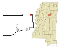
Location of Mantee, Mississippi
Usa edcp location map.svg
Red pog.svg
Mantee, Mississippi
Location in the United States
Coordinates: 33°43′50″N89°3′36″W / 33.73056°N 89.06000°W / 33.73056; -89.06000
Country United States
State Mississippi
County Webster
Area
[1]
  Total4.60 sq mi (11.93 km2)
  Land4.55 sq mi (11.79 km2)
  Water0.05 sq mi (0.13 km2)
Elevation
335 ft (102 m)
Population
 (2020)
  Total237
  Density52.05/sq mi (20.10/km2)
Time zone UTC-6 (Central (CST))
  Summer (DST) UTC-5 (CDT)
FIPS code 28-44960
GNIS feature ID0673117

Mantee is a village in Webster County, Mississippi. The population was 232 at the 2010 census.

Contents

Geography

Mantee is located at 33°43′50″N89°3′36″W / 33.73056°N 89.06000°W / 33.73056; -89.06000 (33.730615, -89.060074). [2]

According to the United States Census Bureau, the village has a total area of 1.7 square miles (4.4 km2), of which 1.6 square miles (4.1 km2) is land and 0.1 square miles (0.26 km2) (3.51%) is water.

Demographics

Historical population
CensusPop.Note
1910 222
1920 24912.2%
1930 219−12.0%
1940 24110.0%
1950 189−21.6%
1960 166−12.2%
1970 142−14.5%
1980 15811.3%
1990 134−15.2%
2000 16926.1%
2010 23237.3%
2020 2372.2%
U.S. Decennial Census [3]

As of the 2010 census, [4] there were 232 people, 95 households, and 70 families residing in the village. There were 115 housing units of which 20 were reported vacant. The racial makeup of the village was 99.1% White and 0.4% African American. [4]

There were 115 households, out of which 23.7% had children under the age of 18 living with them, 65.3% were married couples living together, 6.3% had a female householder with no husband present, and 26.3% were non-families. 22.1% of all households were made up of individuals, and 30.5% had someone living alone who was 65 years of age or older. The average household size was 2.44 and the average family size was 2.89. [4]

In the village, the population was spread out, with 7.3% under the age of five, 19,4% from five to 19, 1.7% from 20 to 24, 27,9% from 25 to 44, 26,2% from 45 to 64, and 17.2% who were 65 years of age or older. The median age was 41.5 years. For every 100 males, there were 127 females. [4]

The median income for a household in the village was $49,375, and the median home price was $105,600. [5] Males had a median income of $32,500 versus $23,750 for females. The per capita income for the village was $18,871. About 3.5% of families and 6.3% of the population were below the poverty line, including 9.7% of those under the age of eighteen and 8.2% of those 65 or over.[ citation needed ]

Education

The Village of Mantee is served by the Webster County School District.

Related Research Articles

<span class="mw-page-title-main">Damiansville, Illinois</span> Village in Illinois, United States

Damiansville is a village in Clinton County, Illinois, United States. The population was 564 at the 2020 census, up from 491 at the 2010 census.

<span class="mw-page-title-main">Woodland, Illinois</span> Village in Illinois, United States

Woodland is a village in Belmont Township, Iroquois County, Illinois, United States. The population was 324 as of the 2010 census.

<span class="mw-page-title-main">Tower Hill, Illinois</span> Village in Illinois, United States

Tower Hill is a village in Shelby County, Illinois, United States. The population was 611 at the 2010 census.

<span class="mw-page-title-main">Starks, Maine</span> Town in the state of Maine, United States

Starks is a town in Somerset County, Maine, United States. The town was named after General John Stark of the Revolutionary War. The population was 593 at the 2020 census.

<span class="mw-page-title-main">Green Township, Michigan</span> Civil township in Michigan, United States

Green Township is a civil township of Alpena County in the U.S. state of Michigan. The population was 1,117 at the 2020 census.
<span class="mw-page-title-main">New Lothrop, Michigan</span> Village in Michigan, United States

New Lothrop is a village in Shiawassee County in the U.S. state of Michigan. The population was 565 at the 2020 census. The village is located within Hazelton Township.

<span class="mw-page-title-main">Walthall, Mississippi</span> Village in Mississippi, United States

Walthall is a village in Webster County, Mississippi. The population was 144 at the 2010 census. It is the county seat of Webster County, designated in 1876.

<span class="mw-page-title-main">Flemington, Missouri</span> Village in Missouri, United States

Flemington is a village in Polk County, Missouri, United States. The population was 148 at the 2010 census. It is part of the Springfield, Missouri Metropolitan Statistical Area.

<span class="mw-page-title-main">Rio Communities North, New Mexico</span> CDP in New Mexico, United States

Rio Communities North is a census-designated place (CDP) in Valencia County, New Mexico, United States. The population was 1,588 at the 2000 census. It is part of the Albuquerque Metropolitan Statistical Area.

<span class="mw-page-title-main">Middle Point, Ohio</span> Village in Ohio, United States

Middle Point is a village in Van Wert County, Ohio, United States. The population was 566 at the 2020 census. It is included within the Van Wert, Ohio Micropolitan Statistical Area.

<span class="mw-page-title-main">Hopewell Township, Bedford County, Pennsylvania</span> Township in Pennsylvania, United States

Hopewell Township is a township in Bedford County, Pennsylvania, United States. The population was 1,890 at the 2020 census.

<span class="mw-page-title-main">Camden-on-Gauley, West Virginia</span> Town in West Virginia, United States

Camden-on-Gauley is a town in Webster County, West Virginia, United States, along the Gauley River. The population was 126 at the 2020 census.

<span class="mw-page-title-main">Otter Lake, Michigan</span> Village in Michigan, United States

Otter Lake is a village in the U.S. state of Michigan. The village is split between Marathon Township in Lapeer County to the east and Forest Township in Genesee County to the west. The population was 426 at the 2020 census.

Mason is a town in Bayfield County, Wisconsin, United States. The population was 315 at the 2010 census. The Village of Mason is located within the town. The unincorporated community of Sutherland is located partially in the town.
<span class="mw-page-title-main">Withee, Wisconsin</span> Village in Wisconsin, United States

Withee is a village in Clark County in the U.S. state of Wisconsin. The population was 487 at the 2010 census. The village is located mostly within the Town of Hixon, with a small portion extending south into the Town of Longwood.
<span class="mw-page-title-main">Arena, Wisconsin</span> Village in Wisconsin, United States

Arena is a village in Iowa County, Wisconsin, United States. The population was 834 at the 2010 census. The village is located within the Town of Arena. It is part of the Madison Metropolitan Statistical Area.
<span class="mw-page-title-main">Ridgeway, Wisconsin</span> Village in Wisconsin, United States

Ridgeway is a village in Iowa County, Wisconsin, United States. The population was 624 at the 2020 census. The village is adjacent to the Town of Ridgeway. It is part of the Madison Metropolitan Statistical Area.
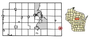
<span class="mw-page-title-main">Elderon, Wisconsin</span> Village in Wisconsin, United States

Elderon is a village in Marathon County, Wisconsin, United States. It is part of the Wausau, Wisconsin Metropolitan Statistical Area. The population was 179 at the 2010 census.
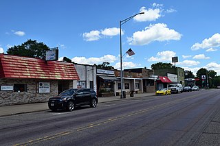
<span class="mw-page-title-main">Oxford, Wisconsin</span> Village in Wisconsin, United States

Oxford is a village in Marquette County, Wisconsin, United States. The population was 537 at the 2020 census. The village is located within the Town of Oxford. The Union Pacific Railroad runs through the town and over Neenah Lake to the northwest.

<span class="mw-page-title-main">Hancock, Wisconsin</span> Village in Wisconsin, United States

Hancock is a village in Waushara County, Wisconsin, United States. The population was 417 at the 2010 census. The village is located within the Town of Hancock.
References

  1. "2020 U.S. Gazetteer Files". United States Census Bureau. Retrieved July 24, 2022.
  2. "US Gazetteer files: 2010, 2000, and 1990". United States Census Bureau. February 12, 2011. Retrieved April 23, 2011.
  3. "Census of Population and Housing". Census.gov. Retrieved June 4, 2015.
  4. 1 2 3 4 United States Census Bureau "U.S. Census website — Profile of General Population and Housing Characteristics: 2010" , Retrieved on July 23, 2019.
  5. Livability.com, "Mantee, MS: What you need to know", Retrieved on July 23, 2019.