Walthall, Mississippi

Last updated

Walthall, Mississippi
Webster County Mississippi Incorporated and Unincorporated areas Walthall Highlighted.svg
Location of Walthall, Mississippi
Usa edcp location map.svg
Red pog.svg
Walthall, Mississippi
Location in the United States
Coordinates: 33°36′24″N89°16′44″W / 33.60667°N 89.27889°W / 33.60667; -89.27889
Country United States
State Mississippi
County Webster
Area
[1]
  Total0.98 sq mi (2.53 km2)
  Land0.97 sq mi (2.52 km2)
  Water0.00 sq mi (0.01 km2)
Elevation
466 ft (142 m)
Population
 (2020)
  Total116
  Density119.10/sq mi (45.99/km2)
Time zone UTC-6 (Central (CST))
  Summer (DST) UTC-5 (CDT)
ZIP code
39771
Area code 662
FIPS code 28-77640
GNIS feature ID0679315

Walthall is a village in Webster County, Mississippi. The population was 144 at the 2010 census. It is the county seat of Webster County, designated in 1876. [2]

Contents

Geography

Walthall is located at 33°36′24″N89°16′44″W / 33.60667°N 89.27889°W / 33.60667; -89.27889 (33.606588, -89.279000). [3]

According to the United States Census Bureau, the village has a total area of 1.0 square mile (2.6 km2), all land.

Demographics

Historical population
CensusPop.Note
1880 101
1890 12220.8%
1900 17039.3%
1910 1710.6%
1920 114−33.3%
1930 1248.8%
1940 14214.5%
1950 1494.9%
1960 1532.7%
1970 1615.2%
1980 20628.0%
1990 167−18.9%
2000 1701.8%
2010 144−15.3%
2020 116−19.4%
U.S. Decennial Census [4]

As of the census [5] of 2000, there were 170 people, 61 households, and 50 families residing in the village. The population density was 173.0 inhabitants per square mile (66.8/km2). There were 69 housing units at an average density of 70.2 per square mile (27.1/km2). The racial makeup of the village was 92.94% White, 3.53% African American, 0.59% Asian, 0.59% from other races, and 2.35% from two or more races. Hispanic or Latino of any race were 1.18% of the population.

There were 61 households, out of which 41.0% had children under the age of 18 living with them, 68.9% were married couples living together, 6.6% had a female householder with no husband present, and 18.0% were non-families. 18.0% of all households were made up of individuals, and 9.8% had someone living alone who was 65 years of age or older. The average household size was 2.79 and the average family size was 3.18.

In the village, the population was spread out, with 31.8% under the age of 18, 10.6% from 18 to 24, 25.3% from 25 to 44, 21.2% from 45 to 64, and 11.2% who were 65 years of age or older. The median age was 30 years. For every 100 females, there were 107.3 males. For every 100 females age 18 and over, there were 93.3 males.

The median income for a household in the village was $31,000, and the median income for a family was $36,875. Males had a median income of $30,417 versus $23,750 for females. The per capita income for the village was $14,903. About 24.6% of families and 21.2% of the population were below the poverty line, including 22.4% of those under the age of eighteen and 57.9% of those 65 or over.

Education

The Village of Walthall is served by the Webster County School District.

Related Research Articles

<span class="mw-page-title-main">Webster County, Mississippi</span> County in Mississippi, United States

Webster County is a county located in center of the U.S. state of Mississippi, bordered on the south by the Big Black River. As of the 2020 census, the population was 9,926.

<span class="mw-page-title-main">Walthall County, Mississippi</span> County in Mississippi, United States

Walthall County is a county located in the U.S. state of Mississippi. As of the 2020 census, the population was 13,884. Its county seat is Tylertown. The county is named after Civil War Confederate general and Mississippi Senator Edward C. Walthall.

<span class="mw-page-title-main">Choctaw County, Mississippi</span> County in Mississippi, United States

Choctaw County is a county located in the central part of the U.S. state of Mississippi. As of the 2020 census, the population was 8,246. Its northern border is the Big Black River, which flows southwest into the Mississippi River south of Vicksburg. The county seat is Ackerman.

<span class="mw-page-title-main">Percy, Illinois</span> Village in Illinois, United States

Percy is a village in Randolph County, Illinois, United States. The population was 970 at the 2010 census.

<span class="mw-page-title-main">Alpha, Michigan</span> Village in Michigan, United States

Alpha is a village in Mastodon Township, Iron County of the U.S. state of Michigan. The population was 126 at the 2020 census. Alpha is the only village of Iron County.

<span class="mw-page-title-main">Mantee, Mississippi</span> Village in Mississippi, United States

Mantee is a village in Webster County, Mississippi. The population was 232 at the 2010 census.

<span class="mw-page-title-main">Redford, New York</span> Census-designated place in New York, United States

Redford is a hamlet and census-designated place in the town of Saranac in Clinton County, New York, United States. The population was 477 at the 2010 census.

<span class="mw-page-title-main">Sloan, New York</span> Village in New York, United States

Sloan is a village in Erie County, New York, United States. The population was 3,661 at the 2010 census. It is part of the Buffalo–Niagara Falls Metropolitan Statistical Area and is in the town of Cheektowaga.

<span class="mw-page-title-main">Whispering Pines, North Carolina</span> Village in North Carolina, United States

Whispering Pines is a village in Moore County, North Carolina, United States. The population was 2,928 at the 2010 census.
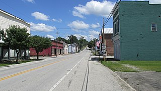
<span class="mw-page-title-main">Clarksville, Ohio</span> Village in Ohio, United States

Clarksville is a village in Clinton County, Ohio, United States. The population was 534 at the 2020 census. It is served by the Clinton Massie branch of the Wilmington Public Library of Clinton County.

<span class="mw-page-title-main">Addyston, Ohio</span> Village in Ohio, United States

Addyston is a village in Miami Township, Hamilton County, Ohio, United States. Located along the Ohio River, it is a western suburb of the neighboring city of Cincinnati. The population was 927 at the 2020 census.
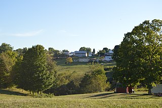
<span class="mw-page-title-main">Antioch, Ohio</span> Village in Ohio, United States

Antioch is a village in Monroe County, Ohio, United States. The population was 71 at the 2020 census.

<span class="mw-page-title-main">Terrace Heights, Washington</span> CDP in Washington, United States

Terrace Heights is a census-designated place (CDP) in Yakima County, Washington, United States. The population was 9,244 at the 2020 census. It is essentially a suburb of the city of Yakima.

<span class="mw-page-title-main">Hamlin, West Virginia</span> Town in West Virginia, United States

Hamlin is a town in and the county seat of Lincoln County, West Virginia, United States, along the Mud River. The population was recorded as 1,040 at the 2020 census. It is part of the Huntington–Ashland metropolitan area.

<span class="mw-page-title-main">Mount Sterling, Wisconsin</span> Village in Wisconsin, United States

Mount Sterling is a village in Crawford County, Wisconsin, United States. The population was 211 at the 2010 census.

Delhi is a village and the county seat of Delaware County, New York, United States. The population was 3,087 at the 2010 census.

<span class="mw-page-title-main">Mazomanie (town), Wisconsin</span>

Mazomanie is a town in Dane County, Wisconsin. The population was 1,185 at the time of the 2000 census. The Village of Mazomanie is located within the town.

Palmyra is a town in Jefferson County, Wisconsin, United States. The population was 1,707 at the 2020 census. The village of Palmyra is located within the town.

The Town of Spencer is located in Marathon County, Wisconsin, United States. It is part of the Wausau, WI Metropolitan Statistical Area. The population was 1,581 at the 2010 census. The village of Spencer is located in the northeastern part of the town.The unincorporated community of Mann also is located in the town.

<span class="mw-page-title-main">Aniwa (town), Wisconsin</span>

Aniwa is a town in Shawano County, Wisconsin, United States. The population was 586 at the 2000 census. The Village of Aniwa is located within the town.

References

  1. "2020 U.S. Gazetteer Files". United States Census Bureau. Retrieved July 24, 2022.
  2. "Find a County". National Association of Counties. Retrieved June 7, 2011.
  3. "US Gazetteer files: 2010, 2000, and 1990". United States Census Bureau. February 12, 2011. Retrieved April 23, 2011.
  4. "Census of Population and Housing". Census.gov. Retrieved June 4, 2015.
  5. "U.S. Census website". United States Census Bureau . Retrieved January 31, 2008.