
Simpson County is a county located in the U.S. state of Mississippi. Its western border is formed by the Pearl River, an important transportation route in the 19th century. As of the 2020 census, the population was 25,949. The county seat is Mendenhall. The county is named for Josiah Simpson (1787-1817), a territorial judge who also served as a delegate to Mississippi's Constitutional Convention.

Calhoun County is a county located in the U.S. state of Mississippi. As of the 2020 census, the population was 13,266. Its county seat is Pittsboro. The county is named after John C. Calhoun, the U.S. Vice President and U.S. Senator from South Carolina.
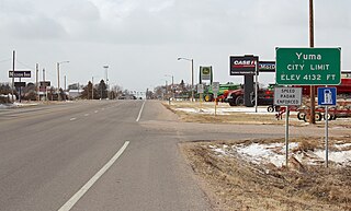
Yuma is a home rule municipality that is the most populous municipality in Yuma County, Colorado, United States. The population was 3,456 at the 2020 census.

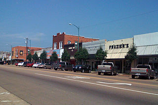
Corinth is a city in and the county seat of Alcorn County, Mississippi, United States. The population was 14,573 at the 2010 census. Its ZIP codes are 38834 and 38835. It lies on the state line with Tennessee.

Glen is a town in Alcorn County, Mississippi. The population was 382 at the 2020 census, down from 412 at the 2010 census.

St. Martin is a census-designated place (CDP) in Jackson County, Mississippi, United States. It is part of the Pascagoula Metropolitan Statistical Area. The population was 7,730 at the 2010 census, up from 6,676 at the 2000 census.

Picayune is the largest city in Pearl River County, Mississippi, United States. The population was 11,885 at the 2020 census. The city is located approximately 45 miles (72 km) from New Orleans, Hattiesburg, and Gulfport–Biloxi. The Stennis Space Center is 10 miles (16 km) away. Picayune is part of the New Orleans–Metairie–Hammond combined statistical area.

Braxton is a village in Simpson County, Mississippi, United States. The village's population was 181 at the 2000 census. It is part of the Jackson, Mississippi Metropolitan Statistical Area. Its zip code is 39044.

Magee is a city in Simpson County, Mississippi, United States. It is part of the Jackson metropolitan area.
Louisville is a city in Winston County, Mississippi. The population was 6,631 at the 2010 census. It is the county seat of Winston County.

Hattiesburg is the 5th most populous city in the U.S. state of Mississippi, located primarily in Forrest County and extending west into Lamar County. The city population was 45,989 at the 2010 census, with the population now being 48,730 in 2020. Hattiesburg is the principal city of the Hattiesburg Metropolitan Statistical Area, which encompasses Covington, Forrest, Lamar, and Perry counties. The city is located in the Pine Belt region.

Mississippi Highway 469 is a state highway in central Mississippi, located in Simpson and Rankin counties. The route starts at MS 28 near Georgetown, and it travels north through western Simpson County. The road enters the community of Harrisville and enters Rankin County soon after. It intersects U.S. Route 49 in Florence, and it ends at MS 468 near Whitfield. The route was designated in 1953, and it was extended southwards to MS 20 in 1956. By 1960, all of the route was paved with asphalt.

Ida is an unincorporated community and census-designated place (CDP) in Monroe County in the U.S. state of Michigan. The CDP had a population of 790 at the 2020 census. The community is mostly within Ida Township with a smaller portion extending north into Raisinville Township.
University is a census-designated place (CDP) and the official name for an area covering a portion of the University of Mississippi campus, in Lafayette County, Mississippi, United States. The CDP is surrounded by the city of Oxford. Its official United States Postal Service designation is "University, Mississippi", with a ZIP Code of 38677.
Moro is an unincorporated community and census-designated place (CDP) in Madison County, Illinois, United States. As of the 2020 census it had a population of 387. Moro, like all of Madison County, is part of the Illinois Metro-East region of the Greater St. Louis metropolitan area.
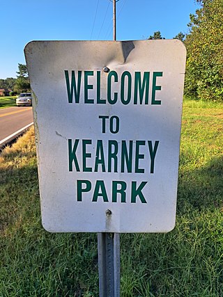
Kearney Park is an unincorporated community and census-designated place (CDP) located on Livingston-Vernon Road in western Madison County, Mississippi, United States. As of the 2020 census, the population was 1,048. Kearney Park is part of the Jackson Metropolitan Statistical Area.
DeLisle is a census-designated place (CDP) in Harrison County, Mississippi, United States. It is part of the Gulfport–Biloxi Metropolitan Statistical Area. The population was 1,147 at the 2010 census.

Toomsuba is a census-designated place (CDP) and unincorporated community in Lauderdale County, Mississippi, United States. Its population was 778 as of the 2020 census. Its ZIP code is 39364.
Bethlehem is a census-designated place and unincorporated community in Marshall County, Mississippi, United States. Its ZIP code is 38659.
Garrison is an unincorporated community and census-designated place in Lewis County, Kentucky, United States. Its population was 731 as of the 2020 census. Garrison has a post office with ZIP code 41141, which opened on February 26, 1886. The community is located along the Ohio River and Kentucky Route 8.


