Related Research Articles

Simpson County is a county located in the U.S. state of Mississippi. Its western border is formed by the Pearl River, an important transportation route in the 19th century. As of the 2020 census, the population was 25,949. The county seat is Mendenhall. The county is named for Josiah Simpson (1787-1817), a territorial judge who also served as a delegate to Mississippi's Constitutional Convention.

Madison County is a county located in the U.S. state of Mississippi. As of the 2020 census, the population was 109,145. The county seat is Canton. The county is named for Founding Father and U.S. President James Madison.

Lincoln County is a county located in the U.S. state of Mississippi. As of the 2020 census, the population was 34,907. Its county seat is Brookhaven.
Jackson County is a county located in the U.S. state of Mississippi. As of the 2020 census, the population was 143,252, making it the fifth-most populous county in Mississippi. Its county seat is Pascagoula. The county was named for Andrew Jackson, general in the United States Army and afterward President of the United States.
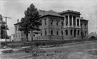
Covington County is a county located in the U.S. state of Mississippi. As of the 2020 census, the population was 18,340. Its county seat is Collins. The county is named for U.S. Army officer and Congressman Leonard Covington.
Copiah County is a county located in the U.S. state of Mississippi. As of the 2020 census, the population was 28,368. The county seat is Hazlehurst.

Coahoma County is a county located in the U.S. state of Mississippi. As of the 2020 census, the population was 21,390. Its county seat is Clarksdale.

Alcona County is a county of the U.S. state of Michigan. As of the 2020 Census, the population was 10,167. Its county seat is Harrisville. Alphabetically it is the first county in Michigan; as its flag states, it is the "First of 83".

Mississippi Highway 555 is a state highway in southwestern Mississippi. The route has two sections, both in Adams County. The first section starts at Ogden Road and travels northwestward to its terminus at US 61. The second section starts at the concurrency of MS 930 and MS 932 and the concurrency of US 61 and US 84 in Natchez. MS 555 travels northward through Pine Ridge and ends at Anna's Bottom Road near the Anna site. The route travels by a few historical locations, including the Pine Ridge Presbyterian Church.

Mississippi Highway 469 is a state highway in central Mississippi, located in Simpson and Rankin counties. The route starts at MS 28 near Georgetown, and it travels north through western Simpson County. The road enters the community of Harrisville and enters Rankin County soon after. It intersects U.S. Route 49 in Florence, and it ends at MS 468 near Whitfield. The route was designated in 1953, and it was extended southwards to MS 20 in 1956. By 1960, all of the route was paved with asphalt.

French Village is an unincorporated community in eastern St. Francois County, Missouri, United States. It is located approximately ten miles east of Bonne Terre and has a population of 1,226. The ZIP Code for French Village is 63036.

Area codes 601 and 769 are telephone area codes in the North American Numbering Plan (NANP) for central and southern Mississippi, excluding the three counties of the Gulf Coast.
The Village of Holly Bluff is a small unincorporated community in Yazoo County, Mississippi.

Jackson, MS Metropolitan Statistical Area is a metropolitan statistical area (MSA) in the central region of the U.S. state of Mississippi that covers seven counties: Copiah, Hinds, Holmes, Madison, Rankin, Simpson, and Yazoo. As of the 2010 census, the Jackson MSA had a population of 586,320. According to 2019 estimates, the population has slightly increased to 594,806. Jackson is the principal city of the MSA.
Westfield in an unincorporated community in Surry and Stokes counties in North Carolina, United States. The community itself is located almost entirely within Surry County, with a small portion extending east into Stokes County. The majority of Westfield's Zip Code Tabulation Area is located within Stokes County.
Modoc is an unincorporated community in Randolph County, Illinois, United States, located four miles southeast of Prairie du Rocher under the bluffs of the Mississippi River.

Filmore is a neighborhood of the city of New Orleans. A subdistrict of the Gentilly District Area, its boundaries as defined by the City Planning Commission are: * Allen Toussaint Boulevard to the north, London Avenue Canal to the east, Press Drive, Paris Avenue and Harrison Avenue to the south and Bayou St. John to the west.

Florence is a census-designated place in and the county seat of Florence County, Wisconsin, United States. Florence is located in northern Florence County, in the town of Florence. Florence has a post office with ZIP code 54121. The community was named a census-designated place in 2010. As of the 2010 census, its population was 592.

Mississippi Highway 540 (MS 540) is a state highway through Simpson and Smith counties in central Mississippi. First created in 1958, the highway consists of two segments- one running about 10+1⁄2 miles (16.9 km) from Harrisville to D'Lo and a second 21.7-mile-long (34.9 km) road from Mendenhall to Raleigh.
References
- ↑ Harrisville demographics, mississippi.hometownlocator.com; accessed December 18, 2017.
Municipalities and communities of Simpson County, Mississippi, United States | ||
|---|---|---|
| Cities |  | |
| Town | ||
| Village | ||
| Unincorporated communities | ||
| Ghost town | ||
31°58′21″N90°04′40″W / 31.97250°N 90.07778°W
| | This Simpson County, Mississippi state location article is a stub. You can help Wikipedia by expanding it. |