Braxton, Mississippi

Last updated

Braxton, Mississippi
Braxton Community Center.jpg
Braxton Community Center
Simpson County Mississippi Incorporated and Unincorporated areas Braxton Highlighted.svg
Location of Braxton, Mississippi
Usa edcp location map.svg
Red pog.svg
Braxton, Mississippi
Location in the United States
Coordinates: 32°1′26″N89°58′14″W / 32.02389°N 89.97056°W / 32.02389; -89.97056
Country United States
State Mississippi
County Simpson
Government
  Type Mayor-Council
   Mayor Rodney Barnett
   Board of Aldermen Georgia Smith
Area
[1]
  Total0.59 sq mi (1.52 km2)
  Land0.59 sq mi (1.52 km2)
  Water0.00 sq mi (0.00 km2)
Elevation
354 ft (108 m)
Population
 (2020)
  Total186
  Density315.79/sq mi (122.02/km2)
Time zone UTC-6 (Central (CST))
  Summer (DST) UTC-5 (CDT)
ZIP code
39044
Area code 601
FIPS code 28-08460
GNIS feature ID0667533

Braxton is a village in Simpson County, Mississippi, United States. The village's population was 181 at the 2000 census. It is part of the Jackson, Mississippi Metropolitan Statistical Area. Its zip code is 39044.

Contents

History

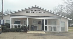
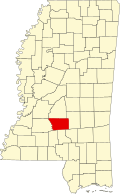
The village of Braxton was named after Ira Braxton Standifer, the son of a physician. [2] The population of Braxton as of 2015 was 181. Braxton is approximately 9 miles north of Mendenhall, the county seat of Simpson County and 19 miles north of Magee, Simpson County's largest city. [3] [4] In 2015, the town of Braxton welcomed a brand new town hall. [5] The current Mayor of Braxton is Stephanie Lee. [6] In 2020, the population of Braxton was 179. [7]

Geography

According to the United States Census Bureau, the village has a total area of 0.6 square miles (1.6 km2), all of it land.

Demographics

Historical population
CensusPop.Note
1910 286
1920 237−17.1%
1930 222−6.3%
1940 220−0.9%
1950 206−6.4%
1960 191−7.3%
1970 180−5.8%
1980 172−4.4%
1990 141−18.0%
2000 18128.4%
2010 1831.1%
2020 1861.6%
U.S. Decennial Census [8]
Braxton This is a photo of the town of Braxton,Mississippi.jpg
Braxton

As of the census [9] of 2000, there were 181 people, 74 households, and 44 families residing in the village. The population density was 304.0 inhabitants per square mile (117.4/km2). There were 86 housing units at an average density of 144.5 per square mile (55.8/km2). The racial makeup of the village was 96.13% White, 3.31% African American and 0.55% Native American.

There were 74 households, out of which 27.0% had children under the age of 18 living with them, 48.6% were married couples living together, 9.5% had a female householder with no husband present, and 39.2% were non-families. 35.1% of all households were made up of individuals, and 18.9% had someone living alone who was 65 years of age or older. The average household size was 2.45 and the average family size was 3.09.

In the village, the population was spread out, with 27.1% under the age of 18, 5.5% from 18 to 24, 29.3% from 25 to 44, 23.2% from 45 to 64, and 14.9% who were 65 years of age or older. The median age was 36 years. For every 100 females, there were 86.6 males. For every 100 females age 18 and over, there were 80.8 males.

The median income for a household in the village was $26,250, and the median income for a family was $43,036. Males had a median income of $37,500 versus $12,500 for females. The per capita income for the village was $14,527. About 11.6% of families and 17.0% of the population were below the poverty line, including 4.5% of those under the age of eighteen and 29.3% of those 65 or over.

Education

The Village of Braxton is served by the Simpson County School District.

Notable people

Related Research Articles

<span class="mw-page-title-main">Tunica County, Mississippi</span> County in Mississippi, United States

Tunica County is a county located in the U.S. state of Mississippi. As of the 2020 census, the population was 9,782. Its county seat is Tunica. The county is named for the Tunica Native Americans. Most migrated to central Louisiana during the colonial period.

<span class="mw-page-title-main">Tate County, Mississippi</span> County in Mississippi, United States

Tate County is a county located in the northwestern portion of the U.S. state of Mississippi. As of the 2020 census, the population was 28,064. Its county seat is Senatobia. Organized in 1873 during the Reconstruction era, from portions of DeSoto, Marshall, and Tunica counties, the county is named for Thomas Simpson Tate, one of the first prominent American settlers of the area.

<span class="mw-page-title-main">Simpson County, Mississippi</span> County in Mississippi, United States

Simpson County is a county located in the U.S. state of Mississippi. Its western border is formed by the Pearl River, an important transportation route in the 19th century. As of the 2020 census, the population was 25,949. The county seat is Mendenhall. The county is named for Josiah Simpson (1787-1817), a territorial judge who also served as a delegate to Mississippi's Constitutional Convention.

<span class="mw-page-title-main">Leake County, Mississippi</span> County in Mississippi, United States

Leake County is a county in the center of the U.S. state of Mississippi. As of the 2020 census, the population was 21,275. Its county seat is Carthage. The county is named for Walter Leake, the Governor of Mississippi from 1822 to 1825.

<span class="mw-page-title-main">Calhoun County, Mississippi</span> County in Mississippi, United States

Calhoun County is a county located in the U.S. state of Mississippi. As of the 2020 census, the population was 13,266. Its county seat is Pittsboro. The county is named after John C. Calhoun, the U.S. Vice President and U.S. Senator from South Carolina.

<span class="mw-page-title-main">Kossuth, Mississippi</span> Village in Mississippi, United States

Kossuth is a village in Alcorn County, Mississippi, United States. The population was 209 at the 2010 census.

<span class="mw-page-title-main">Boyle, Mississippi</span> Town in Mississippi, United States

Boyle is a town in Bolivar County, Mississippi, United States. The population was 650 at the 2010 census.

<span class="mw-page-title-main">Ackerman, Mississippi</span> Town in Mississippi, United States

Ackerman is a town in Choctaw County, Mississippi, United States. The population was 1,594 according to 2020 census, which shows an increase from 1,510 reported in the 2010 census It is the county seat of Choctaw County.

<span class="mw-page-title-main">Georgetown, Mississippi</span> Town in Mississippi, United States

Georgetown is a town in Copiah County, Mississippi, United States. The population was 286 at the 2010 census. With its eastern border formed by the Pearl River, it is part of the Jackson Metropolitan Statistical Area.

<span class="mw-page-title-main">Gattman, Mississippi</span> Village in Mississippi, United States

Gattman is a village in Monroe County, Mississippi. The population was 77 at the 2020 census, down from 90 in 2010.

<span class="mw-page-title-main">Pelahatchie, Mississippi</span> Town in Mississippi, United States

Pelahatchie is a town in Rankin County, Mississippi, United States. The town's population was 1,334 at the 2010 census. It is part of the Jackson, Mississippi Metropolitan Statistical Area. Its zip code is 39145.

<span class="mw-page-title-main">Magee, Mississippi</span> City in Mississippi, United States

Magee is a city in Simpson County, Mississippi, United States. It is part of the Jackson metropolitan area.

<span class="mw-page-title-main">Mendenhall, Mississippi</span> City in Mississippi, United States

Mendenhall is a city in Simpson County, Mississippi, United States. The population was 2,504 at the 2010 census. It is the county seat of Simpson County. Mendenhall is part of the Jackson Metropolitan Statistical Area.

<span class="mw-page-title-main">Taylorsville, Mississippi</span> Town in Mississippi, United States

Taylorsville is a town located in southeastern Smith County, Mississippi, United States. With a population of 1,148 in the 2020 census, the town is the most populous city in Smith County.

<span class="mw-page-title-main">Tylertown, Mississippi</span> Town in Mississippi, United States

Tylertown is a town in and the county seat of Walthall County, Mississippi, United States. The population was 1,609 at the 2010 census.

<span class="mw-page-title-main">Sutton, West Virginia</span> Town in West Virginia

Sutton is a town in Braxton County, West Virginia, United States. The population was 876 at the 2020 census. It is the county seat of Braxton County. Sutton is situated at a center of transportation in West Virginia. Interstate 79, a major north–south route, connects with Appalachian Corridor L, another significant north–south route, passes several miles south of town.

<span class="mw-page-title-main">Sherman, Mississippi</span> Town in Mississippi, United States

Sherman is a town which straddles Lee, Pontotoc, and Union counties in Mississippi. The population was 600 at the 2020 census.

<span class="mw-page-title-main">Union, Mississippi</span> Town in Mississippi, United States

Union is a town in Neshoba and Newton counties, Mississippi. The population was 1,988 at the 2010 census.

<span class="mw-page-title-main">Nelson, Wisconsin</span> Village in Wisconsin, United States

Nelson is a village in Buffalo County in the U.S. state of Wisconsin. The population was 374 at the 2010 census. The village is surrounded by the Town of Nelson.

<span class="mw-page-title-main">Jackson–Vicksburg–Brookhaven combined statistical area</span>

The Jackson–Vicksburg–Brookhaven, MS Combined Statistical Area is made up of eight counties in central Mississippi and consists of the Jackson Metropolitan Statistical Area, the Brookhaven, MS Micropolitan Statistical Area, the Vicksburg micropolitan area, and the Yazoo City Micropolitan Statistical Area. The 2010 census placed the Jackson–Vicksburg–Brookhaven CSA population at 650,764, although as of 2019, it's estimated to have increased to 666,318.

References

  1. "2020 U.S. Gazetteer Files". United States Census Bureau. Retrieved July 24, 2022.
  2. "Discover Simpson County - History and Heritage". Discoversimpsoncounty.com. Retrieved October 22, 2017.
  3. "Distance from Braxton, MS to Mendenhall, MS". distance-cities.com. Archived from the original on December 20, 2018. Retrieved May 20, 2021.
  4. "Distance from Braxton, MS to Magee, MS". distance-cities.com. Archived from the original on December 21, 2018. Retrieved May 20, 2021.
  5. Honea, Sue (September 25, 2015). "Dedication of new Braxton Town Hall". mageenews.com. Retrieved May 20, 2021.
  6. "Central Mississippi Planning & Development District|Town of Braxton". cmpdd.org. Archived from the original on August 12, 2012. Retrieved May 20, 2021.
  7. "Braxton, Mississippi Population History". biggestuscities.com. Archived from the original on January 3, 2019. Retrieved May 20, 2021.
  8. "Census of Population and Housing". Census.gov. Retrieved June 4, 2015.
  9. "U.S. Census website". United States Census Bureau . Retrieved January 31, 2008.