Mapleview, Minnesota

Last updated

Mapleview, Minnesota
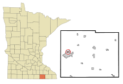
Mower County Minnesota Incorporated and Unincorporated areas Mapleview Highlighted.svg
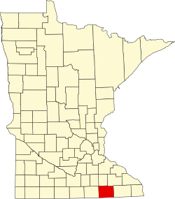
Location in Mower County and the state of Minnesota
Coordinates: 43°41′24″N92°58′26″W / 43.69000°N 92.97389°W / 43.69000; -92.97389
Country United States
State Minnesota
County Mower
Area
[1]
  Total0.18 sq mi (0.48 km2)
  Land0.18 sq mi (0.48 km2)
  Water0.00 sq mi (0.00 km2)
Elevation
[2]
1,198 ft (365 m)
Population
 (2020) [3]
  Total144
  Density778.38/sq mi (300.06/km2)
Time zone UTC-6 (Central (CST))
  Summer (DST) UTC-5 (CDT)
ZIP Code
55912
Area code 507
FIPS code 27-40346 [4]
GNIS feature ID2395845 [2]

Mapleview is a city in Lansing Township, Mower County, Minnesota, United States. It is a suburb of Austin, the county seat. The population was 144 at the 2020 census, [3] down from 176 in 2010. [5] It was named for a row of maple trees that once stood on the west side of town.[ citation needed ]

Contents

History

The village of Mapleview was incorporated in 1945 to provide facilities for approximately 100 families. In 1948, a plot of land north of town was purchased, where the liquor store, fire station, water tower, pump house and equipment garages were eventually built. In 1954, the city bought 4 acres (1.6 ha) along Murphy Creek, and this became Hillside Park. The fire house was built in 1958 and is currently[ when? ] running two fire trucks and 13 volunteer fire fighters, with Michael Langstaff as the Fire Chief of the Mapleview Fire Department. Natural gas was made available to residents in 1962. Until its disbanding in 2013, Mapleview and the city of Lyle shared a police department, with police commission of a commissioner and two city council members from each city.

Geography

Mapleview is in western Mower County and is bordered to the south, east, and west, by the city of Austin. Oakwood Cemetery is directly south of the Mapleview/Austin border, while Austin's Wildwood Park is to the southeast. The Cedar River passes through the easternmost part of Mapleview, and its tributary Murphy Creek crosses the western part of the city.

According to the U.S. Census Bureau, Mapleview has a total area of 0.18 square miles (0.47 km2), all of it recorded as land. [1] Via the Cedar River, Mapleview is part of the Iowa River watershed.

County 45 serves as a main route in the community. Interstate Highway 90 passes half a mile south of the city limits, and U.S. Highway 218 is less than a mile to the west.

Demographics

Historical population
CensusPop.Note
1950 435
1960 381−12.4%
1970 328−13.9%
1980 253−22.9%
1990 206−18.6%
2000 189−8.3%
2010 176−6.9%
2020 144−18.2%
U.S. Decennial Census [6]

2010 census

As of the census [7] of 2010, there were 176 people, 83 households, and 44 families residing in the city. The population density was 977.8 inhabitants per square mile (377.5/km2). There were 93 housing units at an average density of 516.7 per square mile (199.5/km2). The racial makeup of the city was 90.3% White, 1.7% Asian, 5.7% from other races, and 2.3% from two or more races. Hispanic or Latino of any race were 14.2% of the population.

There were 83 households, of which 22.9% had children under the age of 18 living with them, 33.7% were married couples living together, 9.6% had a female householder with no husband present, 9.6% had a male householder with no wife present, and 47.0% were non-families. 34.9% of all households were made up of individuals, and 7.2% had someone living alone who was 65 years of age or older. The average household size was 2.12 and the average family size was 2.64.

The median age in the city was 46.5 years. 15.9% of residents were under the age of 18; 12.5% were between the ages of 18 and 24; 19.8% were from 25 to 44; 36.5% were from 45 to 64; and 15.3% were 65 years of age or older. The gender makeup of the city was 54.5% male and 45.5% female.

2000 census

As of the census [4] of 2000, there were 189 people, 88 households, and 51 families residing in the city. The population density was 1,010.9 inhabitants per square mile (390.3/km2). There were 96 housing units at an average density of 513.5 per square mile (198.3/km2). The racial makeup of the city was 92.59% White, 3.17% Asian, 2.12% from other races, and 2.12% from two or more races. Hispanic or Latino of any race were 6.35% of the population.

There were 88 households, out of which 22.7% had children under the age of 18 living with them, 40.9% were married couples living together, 8.0% had a female householder with no husband present, and 42.0% were non-families. 35.2% of all households were made up of individuals, and 11.4% had someone living alone who was 65 years of age or older. The average household size was 2.15 and the average family size was 2.63.

In the city, the population was spread out, with 20.6% under the age of 18, 7.4% from 18 to 24, 30.2% from 25 to 44, 25.4% from 45 to 64, and 16.4% who were 65 years of age or older. The median age was 40 years. For every 100 females, there were 110.0 males. For every 100 females age 18 and over, there were 114.3 males.

The median income for a household in the city was $30,909, and the median income for a family was $30,625. Males had a median income of $29,000 versus $20,833 for females. The per capita income for the city was $16,884. About 4.5% of families and 12.8% of the population were below the poverty line, including none of those under the age of eighteen and 20.7% of those 65 or over.
Related Research Articles

<span class="mw-page-title-main">Mower County, Minnesota</span> County in Minnesota, United States

Mower County is a county in the U.S. state of Minnesota. As of the 2020 census, the population was 40,029. The county seat is Austin. Mower County comprises the Austin Micropolitan Statistical Area and is included in the Rochester-Austin Combined Statistical Area. Lake Louise State Park is in southeastern Mower County, near Le Roy.

<span class="mw-page-title-main">Kelliher, Minnesota</span> Town in Minnesota, United States

Kelliher is a city in Beltrami County, Minnesota, United States. The population was 258 at the 2020 census. Minnesota State Highway 72 is the primary route through Kelliher.

<span class="mw-page-title-main">Pillager, Minnesota</span> City in Minnesota, United States

Pillager is a city in Cass County, Minnesota, United States. Its population was 469 at the 2010 census. It is part of the Brainerd Micropolitan Statistical Area.

<span class="mw-page-title-main">Adams, Minnesota</span> City in Minnesota, United States

Adams is a city in Adams Township, Mower County, Minnesota, United States. The population was 683 at the 2020 census, down from 787 in 2010.

Austin Township is a township in Mower County, Minnesota, United States. The population was 1,396 at the 2000 census. The largest city partially in the township is Austin with a population of 24,718 people. The northern parts of the city of Austin are in Lansing Township. All other population centers are unincorporated areas.

<span class="mw-page-title-main">Brownsdale, Minnesota</span> City in Minnesota, United States

Brownsdale is a city in Mower County, Minnesota, United States. The population was 633 at the 2020 census.

<span class="mw-page-title-main">Dexter, Minnesota</span> City in Minnesota, United States

Dexter is a city Mower County, Minnesota, United States. The population was 324 at the 2020 census.

<span class="mw-page-title-main">Grand Meadow, Minnesota</span> City in Minnesota, United States

Grand Meadow is a city in Mower County, Minnesota, United States. The city is on the boundary between Grand Meadow Township and Frankford Township, and it is politically independent of both townships. The population was 1,127 at the 2020 census.

Lansing Township is a township in Mower County, Minnesota, United States. The population was 1,292 at the 2000 census. The largest city contained partially within the township is Austin with 23,314 people. The southern part of Austin is in Austin Township. Lansing Township also contains the town of Mapleview and the unincorporated areas of Ramsey, Corning, and Lansing.

<span class="mw-page-title-main">Le Roy, Minnesota</span> City in Minnesota, United States

Le Roy is a city in Mower County, Minnesota, United States, surrounded by Le Roy Township. The population was 957 at the 2020 census. Lake Louise State Park is just outside the town.

<span class="mw-page-title-main">Lyle, Minnesota</span> City in Minnesota, United States

Lyle is a city in Mower County, Minnesota, United States. The city lies on the north side of the Iowa border. The population was 522 at the 2020 census.

<span class="mw-page-title-main">Racine, Minnesota</span> City in Minnesota, United States

Racine is a city in Mower County, Minnesota, United States. The population was 458 at the 2020 census.

<span class="mw-page-title-main">Rose Creek, Minnesota</span> City in Minnesota, United States

Rose Creek is a city in Mower County, Minnesota, United States. The population was 397 at the 2020 census.

<span class="mw-page-title-main">Sargeant, Minnesota</span> City in Minnesota, United States

Sargeant is a city in Mower County, Minnesota, United States. The population was 63 at the 2020 census.

<span class="mw-page-title-main">Taopi, Minnesota</span> City in Minnesota, United States

Taopi is a city in Mower County, Minnesota, United States. The population was 61 at the 2020 census. It is located near the source of the Wapsipinicon River.

<span class="mw-page-title-main">Waltham, Minnesota</span> City in Minnesota, United States

Waltham is a city in Mower County, Minnesota, United States. The population was 164 at the 2020 census.

<span class="mw-page-title-main">Urbank, Minnesota</span> City in Minnesota, United States

Urbank is a city in Otter Tail County, Minnesota, United States. The population was 52 at the 2020 census.

<span class="mw-page-title-main">McKinley, St. Louis County, Minnesota</span> City in Minnesota, United States

McKinley is a city in Saint Louis County, Minnesota, United States; located within the Iron Range region of Minnesota. The population was 103 at the 2020 census.

<span class="mw-page-title-main">Winton, Minnesota</span> City in Minnesota, United States

Winton is a city in Saint Louis County, Minnesota, United States. The population was 172 at the 2010 census. The city is home to a small hydroelectric dam on the edge of Garden Lake, one of 11 stations owned by Minnesota Power.

<span class="mw-page-title-main">Elkton, Minnesota</span> City in Minnesota, United States

Elkton is a city in Marshall Township, Mower County, Minnesota, United States. The population was 130 at the 2020 census.

References

  1. 1 2 "2023 U.S. Gazetteer Files: Minnesota". United States Census Bureau. Retrieved February 12, 2024.
  2. 1 2 U.S. Geological Survey Geographic Names Information System: Mapleview, Minnesota
  3. 1 2 "P1. Race – Mapleview city, Minnesota: 2020 DEC Redistricting Data (PL 94-171)". U.S. Census Bureau. Retrieved February 12, 2024.
  4. 1 2 "U.S. Census website". United States Census Bureau . Retrieved January 31, 2008.
  5. "2010 Census Redistricting Data (Public Law 94-171) Summary File". American FactFinder. United States Census Bureau . Retrieved April 27, 2011.[ dead link ]
  6. "Census of Population and Housing". Census.gov. Retrieved June 4, 2015.
  7. "U.S. Census website". United States Census Bureau . Retrieved November 13, 2012.

Further reading

43°41′20″N92°58′46″W / 43.68889°N 92.97944°W / 43.68889; -92.97944