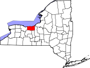
Marion (CDP), New York

Last updated

Marion, New York
Hamlet and CDP
USA New York location map.svg
Red pog.svg
Marion, New York
Location within the state of New York
Coordinates: 43°08′31″N77°11′38″W / 43.14194°N 77.19389°W / 43.14194; -77.19389 Coordinates: 43°08′31″N77°11′38″W / 43.14194°N 77.19389°W / 43.14194; -77.19389
CountryUnited States
State New York
County Wayne
Town Marion
Area
[1]
  Total3.06 sq mi (7.92 km2)
  Land3.05 sq mi (7.91 km2)
  Water0.01 sq mi (0.02 km2)
Elevation
479 ft (146 m)
Population
 (2020)
  Total1,432
  Density469.05/sq mi (181.11/km2)
Time zone UTC-5 (Eastern (EST))
  Summer (DST) UTC-4 (EDT)
ZIP Code
14505
Area code(s) 315 and 680
FIPS code 36-45634 [2]
GNIS feature ID2631642 [3]

Marion is a hamlet (and census-designated place) located in the Town of Marion, Wayne County, New York, United States. The population was 1,511 at the 2010 census. Government offices for the Town of Marion are located in the hamlet.

Contents

Marion is home to Seneca Foods, a food processing and distribution company.

Geography

Marion is located at 43°08′31″N77°11′38″W / 43.142005°N 77.193999°W / 43.142005; -77.193999 . [4]

According to the United States Census Bureau, the CDP has a total area of 3.1 square miles (8.0 km2), all land.

Marion is located off N.Y. Route 21. The primary intersection in the hamlet is at Main Street (CR 216) and Buffalo Street (CR 207).

Demographics

Historical population
CensusPop.
2020 1,432
U.S. Decennial Census [5]

As of the census [2] of 2010, there were 1,511 people, 604 households, and 389 families residing in the CDP. The population density was 487.4 people per square mile (188.9/km2). The racial makeup of the CDP was 95.4% White, 0.9% Black or African American, 0.6% Native American, 0.5% Asian, 0.0% Pacific Islander, 1.1% from other races, and 1.6% from two or more races. Hispanic or Latino of any race were 3.4% of the population.

There were 604 households, out of which 32.6% had children under the age of 18 living with them, 46.5% were married couples living together, 12.4% had a female householder with no husband present, and 35.6% were non-families. 28.6% of all households were made up of individuals, and 12.9% had someone living alone who was 65 years of age or older. The average household size was 2.49 and the average family size was 3.08.

In the CDP, the population was spread out, with 29.1% under the age of 20, 5.8% from 20 to 24, 25.6% from 25 to 44, 26.7% from 45 to 64, and 13.0% who were 65 years of age or older. The median age was 37.8 years. For every 100 females, there were 92.2 males. For every 100 females age 18 and over, there were 92.4 males.

The median income for a household in the CDP was $44,444, and the median income for a family was $68,229. Males had a median income of $55,694 versus $32,200 for females. The per capita income for the CDP was $23,438. About 12.8% of families and 10.8% of the population were below the poverty line, including 9.9% of those under age 18 and 16.6% of those age 65 or over.

Housing

There were 643 housing units at an average density of 207.4 per square mile (80.4/km2). 6.1% of housing units were vacant.

There were 604 occupied housing units in the CDP. 387 were owner-occupied units (64.1%), while 217 were renter-occupied (35.9%). The homeowner vacancy rate was 1.5% of total units. The rental unit vacancy rate was 5.2%. [2]

Related Research Articles

<span class="mw-page-title-main">Desert View Highlands, California</span> Census designated place in California, United States

Desert View Highlands is a census-designated place (CDP) in Los Angeles County, California, United States. The population was 2,360 at the 2010 census, up from 2,337 at the 2000 census. It is surrounded by the City of Palmdale.
<span class="mw-page-title-main">Mayflower Village, California</span> Census-designated place in California, United States

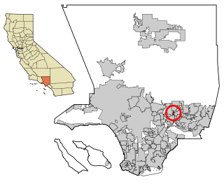
Mayflower Village is a census-designated place (CDP) in the San Gabriel Valley, in Los Angeles County, California, United States. The population was 5,515 at the 2010 census, up from 5,081 at the 2000 census. The ZIP Codes serving the community are 91006, which is served by Arcadia and 91016, which is served by Monrovia.
<span class="mw-page-title-main">North El Monte, California</span> Census-designated place in California, United States

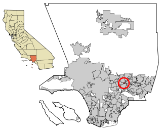
North El Monte is a census-designated place (CDP) in the San Gabriel Valley, in Los Angeles County, California, United States. The population was 3,723 at the 2010 census, up from 3,703 at the 2000 census.

<span class="mw-page-title-main">Tamalpais-Homestead Valley, California</span> Census-designated place in California, United States

Tamalpais-Homestead Valley is a census-designated place (CDP) in Marin County, California, United States. The population was 11,492 at the 2020 census.

<span class="mw-page-title-main">Mountain View Acres, California</span> Census-designated place in California, United States

Mountain View Acres is a census-designated place (CDP) in the Victor Valley of the Mojave Desert, within San Bernardino County, California.

<span class="mw-page-title-main">Garden Acres, California</span> Census-designated place in California, United States

Garden Acres is a census-designated place (CDP) in San Joaquin County, California, United States. The population was 10,648 at the 2010 census, up from 9,747 at the 2000 census. It is the most populous CDP in San Joaquin County.

<span class="mw-page-title-main">Aptos Hills-Larkin Valley, California</span> Census-designated place in California, United States

Aptos Hills-Larkin Valley is an unincorporated community in Santa Cruz County, California, United States. It is identified as one of several small communities with a combined population of 24,402 forming the unincorporated town of Aptos by the local Chamber of Commerce along with:

<span class="mw-page-title-main">Traver, California</span> Census-designated place in California, United States

Traver is a census-designated place (CDP) in Tulare County, California, United States. The population was 713 at the 2010 census, down from 732 at the 2000 census.

<span class="mw-page-title-main">Mākaha Valley, Hawaii</span> Census-designated place in Hawaii, United States

Mākaha Valley is a census-designated place (CDP) in Honolulu County, Hawaiʻi, United States. The population was 198 at the 2020 census.
<span class="mw-page-title-main">China Lake Acres, California</span> Census-designated place in California, United States

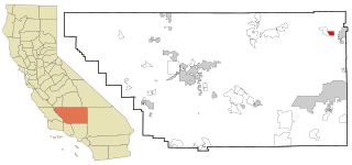
China Lake Acres is a census-designated place (CDP) in Kern County, California, United States. The population was 1,876 at the 2010 census, up from 1,761 at the 2000 census.

<span class="mw-page-title-main">Crown Heights, New York</span> Census-designated place in New York, United States

Crown Heights is a hamlet and census-designated place (CDP) in Dutchess County, New York, United States. The population was 2,840 at the 2010 census. It is part of the Poughkeepsie–Newburgh–Middletown, NY Metropolitan Statistical Area as well as the larger New York–Newark–Bridgeport, NY-NJ-CT-PA Combined Statistical Area.

<span class="mw-page-title-main">Nedrow, New York</span> Census-designated place in New York, United States

Nedrow is a hamlet located in the town of Onondaga in Onondaga County, New York, United States. The population was 2,244 at the 2010 census. It is a suburb of Syracuse, whose southern border it adjoins.
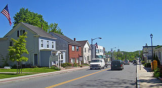
<span class="mw-page-title-main">Carmel (hamlet), New York</span> Hamlet and Census-designated place in New York, United States

Carmel Hamlet, commonly known simply as Carmel, is a hamlet and census-designated place (CDP) located in the Town of Carmel in Putnam County, New York, United States. As of the 2010 census, the population was 6,817.

<span class="mw-page-title-main">North Lindenhurst, New York</span> Hamlet and census-designated place in New York, United States

North Lindenhurst is a hamlet in Suffolk County, New York, United States. The population was 11,652 at the 2010 census. It is a community in the Town of Babylon. Most of North Lindenhurst is served by the Lindenhurst Post Office and School District, so it is usually considered a part of the Lindenhurst community.

<span class="mw-page-title-main">Marion, New York</span> Town in New York, United States

Marion is a town in Wayne County, New York, United States. The population was 4,746 as of the 2010 census. It is named after Revolutionary War hero Francis Marion. It is an interior town near the center of the county, approximately 20 miles east of Rochester, New York and 50 miles west of Syracuse.
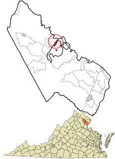
<span class="mw-page-title-main">Loch Lomond, Virginia</span> Census-designated place in Virginia, United States

Loch Lomond is a census-designated place (CDP) in Prince William County, Virginia, United States. The population was 3,701 at the 2010 census. It is named after a loch in northern Scotland, Loch Lomond.

North Rose is a hamlet located in the Town of Rose, Wayne County, New York, United States. The population was 636 at the time of the 2010 census. Government offices for the Town of Rose are located in the hamlet.

Savannah is a hamlet located in the Town of Savannah, Wayne County, New York, United States. The population was 558 at the 2010 census. Savannah was incorporated as a village in 1867, but dissolved in 1979. Government offices for the Town of Savannah are located in the hamlet.

Williamson is a hamlet located in the Town of Williamson, Wayne County, New York, United States. The population was 2,495 at the 2010 census. Government offices for the Town of Williamson are located in the hamlet.

Romulus is a hamlet located in the Town of Romulus, Seneca County, New York, United States on the border with the Town of Varick. The population was 409 at the 2010 census.

References

  1. "ArcGIS REST Services Directory". United States Census Bureau. Retrieved September 20, 2022.
  2. 1 2 3 "U.S. Census website". United States Census Bureau . Retrieved January 19, 2015.
  3. "US Board on Geographic Names". United States Geological Survey. August 30, 2010. Retrieved January 19, 2015.
  4. "US Gazetteer files: 2014". United States Census Bureau. February 12, 2014. Retrieved January 19, 2015.
  5. "Census of Population and Housing". Census.gov. Retrieved June 4, 2016.