Marmora and Lake

Last updated

Marmora and Lake
Municipality of Marmora and Lake
Marmora ON 2.JPG
Municipal office in Marmora
Canada Southern Ontario location map 2.png
Red pog.svg
Marmora and Lake
Location in southern Ontario
Coordinates: 44°38′33″N77°44′14″W / 44.64250°N 77.73722°W / 44.64250; -77.73722 [1]
Country Canada
Province Ontario
County Hastings
Settled1821 (1821)
IncorporatedJanuary 1, 2001
Government
  TypeMunicipality (low-tier)
  MayorJan O'Neill
  Federal riding Prince Edward—Hastings
  Prov. riding Prince Edward—Hastings
Area
[2]
  Land557.08 km2 (215.09 sq mi)
Elevation
[3]
274 m (899 ft)
Population
 (2021) [2]
  Total4,267
  Density7.9/km2 (20/sq mi)
Time zone UTC-5 (EST)
  Summer (DST) UTC-4 (EDT)
Postal Code
Area code(s) 613 and 343
Website www.marmoraandlake.ca
Ontario Highway 7 through Marmora Marmora ON 1.JPG
Ontario Highway 7 through Marmora

Marmora and Lake is a municipality along the banks of Crowe River and Beaver Creek, about midway between Toronto and Ottawa on provincial Highway 7 in Hastings County in Central Ontario, Canada. [1] It is home to over 4,000 full time and seasonal residents, many of whom enjoy outdoor recreation and relaxation on Crowe Lake.

Contents

Communities

History

The original township of Marmora was named in 1820 for the Latin word for marble, while the adjoining Township of Lake was named for Viscount Gerard Lake. The two townships were joined to form the single municipality of Marmora and Lake in 2001. [4] The village of Marmora separated from the township and was incorporated as a separate municipality in 1901.

Mining played an important role in the development of the area. Iron mining was particularly important in the area. Other minerals extracted from township mines include copper, lead, silver, gold and lithographic limestone. Today, talc and dolomite are processed in the municipality at the site of the former Bethlehem Steel Corporation iron ore open pit mine.

In 1998, the township expanded through an amalgamation of the Village of Deloro.

The current municipality was formed in 2001 through an amalgamation of the Village of Marmora and the existing Township of Marmora and Lake.

Demographics

In the 2021 Census of Population conducted by Statistics Canada, Marmora and Lake had a population of 4,267 living in 1,887 of its 2,578 total private dwellings, a change of 7.9% from its 2016 population of 3,953. With a land area of 538.24 km2 (207.82 sq mi), it had a population density of 7.9/km2 (20.5/sq mi) in 2021. [5]

Canada census – Marmora and Lake community profile
2021 2016 2011
Population4,267 (+7.9% from 2016)3,953 (-3.0% from 2011)4,074 (+4.1% from 2006)
Land area538.24 km2 (207.82 sq mi)557.08 km2 (215.09 sq mi)556.19 km2 (214.75 sq mi)
Population density7.9/km2 (20/sq mi)7.1/km2 (18/sq mi)7.3/km2 (19/sq mi)
Median age56.0 (M: 54.4, F: 56.8)54.6 (M: 53.8, F: 55.4)50.9 (M: 50.2, F: 51.6)
Private dwellings2,578 (total)  1,887 (occupied)2,521 (total) 2,503 (total) 
Median household income$62,800$50,586
References: 2021 [6] 2016 [7] 2011 [8] earlier [9] [10]

According to the 2006 Census, mother tongue of its population is: [9]

Historical population
YearPop.±%
1996 3,874    
2001 3,985+2.9%
2006 3,912−1.8%
2011 4,074+4.1%
2016 3,953−3.0%
2021 4,267+7.9%
[11] [12] [2]

Government

Marmora and Lake Council As of 2023:

Provincial and federal representation:

Tourist attractions

Notable residents

See also

Related Research Articles

<span class="mw-page-title-main">Kawartha Lakes</span> City in Ontario, Canada

The City of Kawartha Lakes is a unitary municipality in Central Ontario, Canada. It is a municipality legally structured as a single-tier city; however, Kawartha Lakes is the size of a typical Ontario county and is mostly rural. It is the second largest single-tier municipality in Ontario by land area.

<span class="mw-page-title-main">Hastings County</span> County in Ontario, Canada

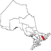
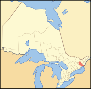
Hastings County is located in the province of Ontario, Canada. Geographically, it is located on the border of Eastern Ontario and Central Ontario. Hastings County is the second-largest county in Ontario, after Renfrew County, and its county seat is Belleville, which is independent of Hastings County. Hastings County has trademarked the moniker "Cheese Capital of Canada".

<span class="mw-page-title-main">Addington Highlands</span> Township in Ontario, Canada

Addington Highlands is a township in central eastern Ontario, Canada, in the County of Lennox and Addington. Bon Echo Provincial Park is located primarily in Addington Highlands.

<span class="mw-page-title-main">Havelock-Belmont-Methuen</span> Township in Ontario, Canada

Havelock-Belmont-Methuen is a township in central-eastern Ontario, Canada, in Peterborough County. On January 1, 1998, Belmont and Methuen Township amalgamated with the Village of Havelock to form what is now Havelock-Belmont-Methuen.

<span class="mw-page-title-main">Frontenac County</span> County in Ontario, Canada

Frontenac County is a county and census division of the Canadian province of Ontario. It is located in the eastern portion of Southern Ontario. The city of Kingston is in the Frontenac census division, but is separated from the County of Frontenac.

<span class="mw-page-title-main">Lennox and Addington County</span> County in Ontario, Canada

Lennox and Addington County is a county and census division of the Canadian province of Ontario. The county seat is Greater Napanee. It is located in the subregion of Southern Ontario named Eastern Ontario.

<span class="mw-page-title-main">Moira River</span> River in Ontario, Canada

The Moira River is a river in Hastings County in eastern Ontario, Canada. It travels from its source in the centre of the county to the Bay of Quinte at the county seat Belleville.

<span class="mw-page-title-main">Trent Hills</span> Township in Ontario, Canada

The Municipality of Trent Hills is a township municipality in Northumberland County in Central Ontario, Canada. It is on the Trent River and was created in 2001 through the amalgamation of the municipalities of Campbellford/Seymour, Percy Township and Hastings. Thereafter it was known in brief as Campbellford/Seymour, Percy, Hastings.

<span class="mw-page-title-main">Crowe River</span> River in Ontario, Canada

The Crowe River is a river in the counties of Haliburton, Hastings, Northumberland and Peterborough in southern Ontario, Canada. It is in the Lake Ontario drainage basin and is a tributary of the Trent River.

<span class="mw-page-title-main">Marmora, Ontario</span>

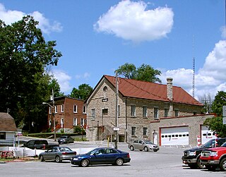
Marmora is the largest community in the Municipality of Marmora and Lake in Hastings County, Ontario, Canada. It is located on the Crowe River and along Highway 7 between Havelock to the west and Madoc to the east, about the halfway point between Ottawa and Toronto.

<span class="mw-page-title-main">Alnwick/Haldimand</span> Township in Ontario, Canada

The Township of Alnwick/Haldimand is a township in central Ontario, Canada, in Northumberland County, situated between Lake Ontario and Rice Lake. It was formed in 2001 by the merger of Alnwick Township in the north and Haldimand Township in the south. Alderville First Nation is an autonomously governed First Nation contained within the township boundaries, in two non-contiguous sections along County Roads 45 and 18.

<span class="mw-page-title-main">Armour, Ontario</span> Township municipality in Ontario, Canada

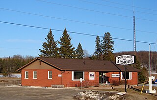
Armour is a township municipality in the Canadian province of Ontario.

<span class="mw-page-title-main">Hastings Highlands</span> Municipality in Ontario, Canada

Hastings Highlands is a township in the Canadian province of Ontario.

<span class="mw-page-title-main">Fauquier-Strickland</span> Township in Ontario, Canada

Fauquier-Strickland is a township municipality in Cochrane District in Northeastern Ontario, Canada. The three main communities in the township are Fauquier, Strickland, and Gregoires Mill. All are located along Ontario Highway 11 between the community of Departure Lake to the east and the municipality of Moonbeam to the west.

<span class="mw-page-title-main">Killaloe, Hagarty and Richards</span> Township in Ontario, Canada

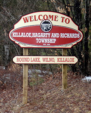
Killaloe, Hagarty and Richards is an incorporated township in Renfrew County in eastern Ontario, Canada, created on July 1, 2000, as a result of an amalgamation of the Township of Hagarty and Richards with the Village of Killaloe.

<span class="mw-page-title-main">North Frontenac</span> Township in Ontario, Canada

North Frontenac is a township in Frontenac County in eastern Ontario, Canada.

<span class="mw-page-title-main">Stone Mills</span> Township in Ontario, Canada

Stone Mills is a lower-tier township north of Greater Napanee in Lennox and Addington County, Ontario, Canada. According to the 2016 census, the township has a population of 7,702.

<span class="mw-page-title-main">James, Ontario</span> Township in Ontario, Canada

James is an incorporated township in the Canadian province of Ontario, located in Timiskaming District. The primary community within the township is Elk Lake, which is located at the junction of Ontario Highway 65 and Ontario Highway 560.

<span class="mw-page-title-main">Wollaston, Ontario</span> Township in Ontario, Canada

Wollaston is an incorporated township in Hastings County, Ontario, Canada. The township had a population of 670 in the Canada 2016 Census.

Deloro is a community in geographic Marmora Township in the Municipality of Marmora and Lake, Hastings County in Central Ontario, Canada. Deloro is about 200 kilometres (120 mi) southwest of Ottawa and 65 kilometres (40 mi) east of Peterborough. The Deloro Mine site sits along the banks of the Moira River, along the east side of the community. During the gold rush days, after striking gold in Eldorado in 1866, prospectors built at least 25 shafts on the area now known as the Deloro Mine Site.

References

  1. 1 2 "Marmora and Lake". Geographical Names Data Base . Natural Resources Canada . Retrieved 2014-06-08.
  2. 1 2 3 "Census Profile, 2016 Census: Marmora and Lake, Municipality". Statistics Canada. 8 February 2017. Retrieved June 15, 2019.
  3. Taken from Google Earth at geographic coordinates, accessed 2014-06-08.
  4. "MUNICIPAL RESTRUCTURING ACTIVITY SUMMARY TABLE". www.mah.gov.on.ca. Archived from the original on 16 March 2021. Retrieved 16 March 2021.
  5. "Population and dwelling counts: Canada, provinces and territories, census divisions and census subdivisions (municipalities), Ontario". Statistics Canada. February 9, 2022. Retrieved March 31, 2022.
  6. "2021 Community Profiles". 2021 Canadian Census . Statistics Canada. February 4, 2022. Retrieved 2023-10-19.
  7. "2016 Community Profiles". 2016 Canadian Census . Statistics Canada. August 12, 2021. Retrieved 2019-06-15.
  8. "2011 Community Profiles". 2011 Canadian Census . Statistics Canada. March 21, 2019. Retrieved 2014-06-08.
  9. 1 2 "2006 Community Profiles". 2006 Canadian Census . Statistics Canada. August 20, 2019.
  10. "2001 Community Profiles". 2001 Canadian Census . Statistics Canada. July 18, 2021.
  11. Statistics Canada: 1996, 2001, 2006 census
  12. "Marmora and Lake census profile". 2011 Census of Population . Statistics Canada. Retrieved 2012-03-02.
  13. Ebden, Theresa (August 25, 2000). "An actor in search of character detail". The Globe and Mail .

Other map sources: