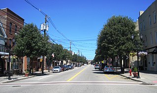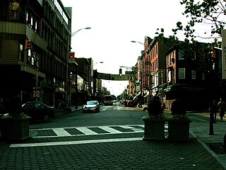
Perth Amboy is a city in Middlesex County, New Jersey, United States. The City of Perth Amboy is part of the New York metropolitan area. As of the 2020 United States Census, the city's population was 55,436. Perth Amboy has a Hispanic majority population. In the 2010 census, the Hispanic population made up 78.1% of the population, the second-highest in the state, behind Union City at 84.7%. Perth Amboy is known as the "City by the Bay", referring to its location adjoining Raritan Bay.

South Amboy is a suburban city in Middlesex County, New Jersey, on the Raritan Bay. As of the 2020 United States Census, the city's population was 9,411.

A flagship is a vessel used by the commanding officer of a group of naval ships, characteristically a flag officer entitled by custom to fly a distinguishing flag. Used more loosely, it is the lead ship in a fleet of vessels, typically the first, largest, fastest, most heavily armed, or best known.

Bethlehem Steel Corporation Shipbuilding Division was created in 1905 when the Bethlehem Steel Corporation of Bethlehem, Pennsylvania, acquired the San Francisco shipyard Union Iron Works. In 1917 it was incorporated as Bethlehem Shipbuilding Corporation, Limited.
Keasbey is an unincorporated community located within Woodbridge Township in Middlesex County, New Jersey, United States. It is located on the western outskirts of Perth Amboy. Through its proximity to Perth Amboy, and through natural outflow, attraction, and migration, Keasbey is also home to many Hispanic or Latino families.
![South River (Raritan River tributary) Tributary of the Raritan River in [[central New Jersey]] in the United States](https://upload.wikimedia.org/wikipedia/commons/thumb/b/bb/South_River%2C_Old_Bridge-Sayreville%2C_NJ.jpg/320px-South_River%2C_Old_Bridge-Sayreville%2C_NJ.jpg)
The South River is a tributary of the Raritan River in central New Jersey in the United States.
Joseph Vas is an American Democratic Party politician, who has served in the New Jersey General Assembly from 2004 to 2010, where he represented the 19th Legislative District. He did not seek re-election to the assembly in 2009. He also served as Mayor of Perth Amboy, New Jersey from 1990 to 2008. He was defeated for re-election to a 5th full term by local bank vice president Wilda Diaz in 2008 by a 58% to 42% margin. He was elected Perth Amboy Democratic Chairman in 2008, succeeding his longtime campaign chairman Ray Geneske. Vas resigned as the party chairman in 2009. He was convicted of state corruption charges in 2010 and federal corruption charges in 2011.
Hopelawn is an unincorporated community located within Woodbridge Township in Middlesex County, New Jersey, United States.

Military Ocean Terminal at Bayonne (MOTBY) was a U.S. military ocean terminal located in the Port of New York and New Jersey which operated from 1967 to 1999. From 1942 to 1967 the site was the Bayonne Naval Drydock. The site is on Upper New York Bay south of Port Jersey on the eastern side of Bayonne, New Jersey. Since its closure, it has undergone maritime, residential, commercial, and recreational mixed-use development. Part of the Hudson River Waterfront Walkway runs along its perimeter.

Media (AK-83) was a World War II US navy ship that was never commissioned and thus never bore the USS designation.

The fifth US Coast Guard cutter named Mohawk (WPG-78) was built by Pusey & Jones Corp., Wilmington, Delaware, and launched 1 October 1934. She was commissioned on 19 January 1935.
Communipaw is a neighborhood in Jersey City in Hudson County, New Jersey, United States. It is located west of Liberty State Park and east of Bergen Hill, and the site of one of the earliest European settlements in North America. It gives its name to the historic avenue which runs from its eastern end near Liberty State Park Station through the neighborhoods of Bergen-Lafayette and the West Side that then becomes the Lincoln Highway. Communipaw Junction, or simply The Junction, is an intersection where Communipaw, Summit Avenue, Garfield Avenue, and Grand Street meet, and where the toll house for the Bergen Point Plank Road was situated. Communipaw Cove at Upper New York Bay, is part of the 36-acre (150,000 m2) state nature preserve in the park and one of the few remaining tidal salt marshes in the Hudson River estuary.

Harsimus is a neighborhood within Downtown Jersey City, Hudson County, New Jersey, United States. The neighborhood stretches from the Harsimus Stem Embankment on the north to Christopher Columbus Drive on the south between Coles Street and Grove Street or more broadly, to Marin Boulevard. It borders the neighborhoods of Hamilton Park to the north, Van Vorst Park to the south, the Village to the west, and the Powerhouse Arts District to the east. Newark Avenue has traditionally been its main street. The name is from the Lenape, used by the Hackensack Indians who inhabited the region and could be translated as Crow’s Marsh. From many years, the neighborhood was part of the "Horseshoe", a political delineation created by its position between the converging rail lines and political gerrymandering.
Craig John Coughlin is an American Democratic Party politician, who has represented the 19th Legislative District in the New Jersey General Assembly since 2010. He has served as the Speaker of the New Jersey General Assembly since 2018.
Perth Amboy, New Jersey is located at the mouth of the Raritan River and the Arthur Kill at the Raritan Bay, and is part of the region known as the Raritan Bayshore.
The Current Mayor of Perth Amboy is Helmin Caba, who was elected on December 15, 2020 after defeating Wilda Diaz and was sworn in on January 1, 2021. Perth Amboy, New Jersey is governed under the Mayor-Council system of municipal government under the Faulkner Act. Members of the City Council are elected at-large on a non-partisan basis to four-year terms of office on a staggered basis, with two or three seats coming up for election in even years. The mayor also serves a four-year term of office, which is up for election the same year that two council seats are up for vote. In October 2010, the City Council voted to shift the city's non-partisan elections from May to November, with the first balloting held in conjunction with the General Election in November 2012. Terms run from January 1 to December 31. A royal charter was issued on August 4, 1718. Perth Amboy was incorporated as a city on December 21, 1784.

Harbortown is a planned community neighborhood in Perth Amboy in Middlesex County, New Jersey, United States. It is situated south of the Outerbridge Crossing along the Arthur Kill, between the city's traditional waterfront and the Kinder Morgan terminal The 135-acre area was the Lehigh Valley Railroad's (LVRR) Easton and Amboy Railroad's marshaling yards where coal was loaded onto barges until the LVRR's bankruptcy in 1976.
Port Reading Junction is a major rail junction (MANS) in Manville, New Jersey serving rail freight travelling between the Port of New York and New Jersey in northeastern New Jersey and points to the south and west. It is the site of Manville Yard.


![South River (Raritan River tributary) Tributary of the Raritan River in [[central New Jersey]] in the United States](https://upload.wikimedia.org/wikipedia/commons/thumb/b/bb/South_River%2C_Old_Bridge-Sayreville%2C_NJ.jpg/320px-South_River%2C_Old_Bridge-Sayreville%2C_NJ.jpg)


