Maxwell, New Mexico

Last updated

Maxwell, New Mexico
Colfax County New Mexico Incorporated and Unincorporated areas Maxwell Highlighted.svg
Location of Maxwell, New Mexico
Usa edcp location map.svg
Red pog.svg
Maxwell, New Mexico
Location in the United States
Coordinates: 36°32′22″N104°32′33″W / 36.53944°N 104.54250°W / 36.53944; -104.54250
Country United States
State New Mexico
County Colfax
Area
[1]
  Total0.47 sq mi (1.23 km2)
  Land0.47 sq mi (1.23 km2)
  Water0.00 sq mi (0.00 km2)
Elevation
5,925 ft (1,806 m)
Population
 (2020) [2]
  Total224
  Density472.57/sq mi (182.29/km2)
Time zone UTC-7 (Mountain (MST))
  Summer (DST) UTC-6 (MDT)
ZIP code
87728
Area code 575
FIPS code 35-47080
GNIS feature ID0891692

Maxwell is a village in Colfax County, New Mexico, United States. The population was 254 at the 2010 census, [3] down from 274 in 2000. Maxwell was established in 1879 as a railroad town on the Atchison, Topeka and Santa Fe Railway. It was named in honor of Lucien Maxwell, who provided the land for the original townsite from his Maxwell Land Grant.[ citation needed ]

Contents

Geography

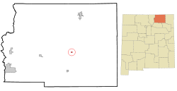
Maxwell is located near the center of Colfax County at 36°32′22″N104°32′33″W / 36.53944°N 104.54250°W / 36.53944; -104.54250 (36.539487, -104.542630), [4] in the valley of the Canadian River. Interstate 25 passes through the east side of the village, with access from Exit 426. I-25 leads north 26 miles (42 km) to Raton, the Colfax County seat, and southwest 81 miles (130 km) to Las Vegas.

According to the United States Census Bureau, the village has a total area of 0.47 square miles (1.23 km2), all land. [3]

The United States Fish and Wildlife Service manages the Maxwell National Wildlife Refuge, located 2 miles (3 km) northwest of the village. The refuge offers excellent birding opportunities during the spring and fall migrations. It consists of several lakes, fields and woodlots managed for birds and the areas other wildlife.

Demographics

Historical population
CensusPop.Note
1920 384
1930 43914.3%
1940 48310.0%
1950 404−16.4%
1960 392−3.0%
1970 3930.3%
1980 316−19.6%
1990 247−21.8%
2000 27410.9%
2010 254−7.3%
2020 224−11.8%
U.S. Decennial Census [5] [2]

As of the census [6] of 2000, there were 274 people, 117 households, and 76 families residing in the village. The population density was 577.5 inhabitants per square mile (223.0/km2). There were 148 housing units at an average density of 311.9 per square mile (120.4/km2). The racial makeup of the village was 86.50% White, 4.01% Native American, 7.30% from other races, and 2.19% from two or more races. Hispanic or Latino of any race were 55.47% of the population.

There were 117 households, out of which 29.9% had children under the age of 18 living with them, 51.3% were married couples living together, 11.1% had a female householder with no husband present, and 34.2% were non-families. 29.9% of all households were made up of individuals, and 14.5% had someone living alone who was 65 years of age or older. The average household size was 2.34 and the average family size was 2.91.

In the village, the population was spread out, with 25.2% under the age of 18, 6.9% from 18 to 24, 24.5% from 25 to 44, 23.7% from 45 to 64, and 19.7% who were 65 years of age or older. The median age was 41 years. For every 100 females, there were 101.5 males. For every 100 females age 18 and over, there were 86.4 males.

The median income for a household in the village was $23,750, and the median income for a family was $28,750. Males had a median income of $22,083 versus $20,625 for females. The per capita income for the village was $11,231. About 22.0% of families and 21.9% of the population were below the poverty line, including 24.6% of those under the age of eighteen and 8.0% of those 65 or over.

1964 tornado

On May 29, 1964, an F3 tornado struck Maxwell and claimed one life, causing eight injuries. A total of 50 homes were destroyed. [7] It was one of only four F3 tornadoes in New Mexico history. [8]

Related Research Articles

<span class="mw-page-title-main">Colfax County, New Mexico</span> County in New Mexico, United States

Colfax County is a county in the U.S. state of New Mexico. As of the 2020 census, the population was 12,387. Its county seat is Raton. It is south from the Colorado state line. This county was named for Schuyler Colfax (1823–1885), seventeenth Vice President of the United States under U.S. President Ulysses S. Grant.

<span class="mw-page-title-main">Union, Illinois</span> Village in Illinois, United States

Union is a village in McHenry County, Illinois, United States. The population was 551 at the 2020 census.

<span class="mw-page-title-main">Loch Lynn Heights, Maryland</span> Town in Maryland, United States

Loch Lynn Heights is a town in Garrett County, Maryland, United States. The population was 493 at the 2020 census.

<span class="mw-page-title-main">Colfax Township, Benzie County, Michigan</span> Civil township in Michigan, United States

Colfax Township is a civil township of Benzie County in the U.S. state of Michigan. The population was 504 at the 2020 census. Colfax Township contains half of the village of Thompsonville, and the entire community of Nessen City

Maxwell Township is a township in Lac qui Parle County, Minnesota, United States. The population was 206 at the 2000 census.

<span class="mw-page-title-main">Howells, Nebraska</span> Village in Nebraska, United States

Howells is a village in Colfax County, Nebraska, United States. The population was 561 at the 2010 census.

<span class="mw-page-title-main">Leigh, Nebraska</span> Village in Nebraska, United States

Leigh is a village in Colfax County, Nebraska, United States. The population was 405 at the 2010 census.

<span class="mw-page-title-main">Richland, Nebraska</span> Village in Nebraska, United States

Richland is a village in Colfax County, Nebraska, United States. The population was 73 at the 2010 census.

<span class="mw-page-title-main">Rogers, Nebraska</span> Village in Nebraska, United States

Rogers is a village in Colfax County, Nebraska, United States. The population was 95 at the 2010 census.

<span class="mw-page-title-main">Maxwell, Nebraska</span> Village in Lincoln County, Nebraska, United States

Maxwell is a village in Lincoln County, Nebraska, United States. It is part of the North Platte Micropolitan Statistical Area. The population was 312 at the 2010 census.

<span class="mw-page-title-main">Angel Fire, New Mexico</span> Village in New Mexico, United States

Angel Fire is a village in Colfax County, New Mexico, United States. The population was 1,216 at the 2010 census. It is a popular ski resort destination, with over 500 acres (2.0 km2) of slopes. Angel Fire and nearby communities experience cold winter temperatures and mild temperatures in the summer.

<span class="mw-page-title-main">Cimarron, New Mexico</span> Village in New Mexico, United States

Cimarron is a village in Colfax County, New Mexico, United States, which sits on the eastern slopes of the Sangre de Cristo Mountains. The population was 792 at the 2020 census, making it the fourth most populous municipality in Colfax County.

<span class="mw-page-title-main">Springer, New Mexico</span> Town in New Mexico, United States

Springer is a town in Colfax County, New Mexico, United States. Its population was 1,047 at the 2010 census.

<span class="mw-page-title-main">Wagon Mound, New Mexico</span> Village in New Mexico, United States

Wagon Mound is a village in Mora County, New Mexico, United States. It is named after and located at the foot of a butte called Wagon Mound, which was a landmark for covered wagon trains and traders going up and down the Santa Fe Trail and is now Wagon Mound National Historic Landmark. It was previously an isolated ranch that housed four families that served as local traders. The shape of the mound is said to resemble a Conestoga wagon. As of the 2010 census, the village population was 314. It was also called Santa Clara for many years. The village, with brightly painted houses and several stores and shops, is located on the plains of northeastern New Mexico. Interstate 25, which skirts the western side of town, gives a view of the majority of the town. Wagon Mound is not growing rapidly, but it has seen new construction along I-25, with new buildings on the northeast side of town as well.

<span class="mw-page-title-main">Ephratah, New York</span> Town in New York, United States

Ephratah is a town in Fulton County, New York, United States. The population was 1,682 at the 2010 census. It is named after Ephrath, a biblical town in what is now Israel.

<span class="mw-page-title-main">Andover, Ohio</span> Village in Ohio, United States

Andover is a village located in the south-east of Ashtabula County, Ohio, United States. The population was 972 at the time of the 2020 census.

<span class="mw-page-title-main">Moscow, Ohio</span> Village in Ohio, United States

Moscow is a village in Clermont County, Ohio. The population was 155 at the time of the 2020 census. The William H. Zimmer Power Station, a coal-fired power plant that was converted from a planned nuclear power plant during construction, is partially located within village limits. It is located near the Ulysses S. Grant Birthplace.

<span class="mw-page-title-main">Samburg, Tennessee</span> Town in Tennessee, United States

Samburg is a town in Obion County, Tennessee, United States. The population was 210 at the 2020 census. Samburg is located on the eastern shores of Reelfoot Lake.

Colfax is a town in Dunn County, Wisconsin, United States. The population was 909 at the 2000 census.

<span class="mw-page-title-main">Colfax, Wisconsin</span> Village in Wisconsin, United States

Colfax is a village in Dunn County, Wisconsin, United States. The population was 1,158 at the 2010 census. The village is surrounded by the Town of Colfax.

References

  1. "ArcGIS REST Services Directory". United States Census Bureau. Retrieved October 12, 2022.
  2. 1 2 "Census Population API". United States Census Bureau. Retrieved October 12, 2022.
  3. 1 2 "Geographic Identifiers: 2010 Demographic Profile Data (G001): Maxwell village, New Mexico". U.S. Census Bureau, American Factfinder. Archived from the original on February 12, 2020. Retrieved October 23, 2014.
  4. "US Gazetteer files: 2010, 2000, and 1990". United States Census Bureau. February 12, 2011. Retrieved April 23, 2011.
  5. "Census of Population and Housing". Census.gov. Retrieved June 4, 2015.
  6. "U.S. Census website". United States Census Bureau . Retrieved January 31, 2008.
  7. "The Most 'Important' US Tornadoes by State". Archived from the original on March 4, 2016. Retrieved May 22, 2009.
  8. "Tornado History Project: Maps and Statistics". Archived from the original on January 17, 2018. Retrieved July 13, 2022.