
Blackheath is an area of South East London, England, straddling the border of the Royal Borough of Greenwich and the London Borough of Lewisham. It is located 1 mile north east of Lewisham, 1.5 miles south of Greenwich and 6.4 miles south east of Charing Cross, the traditional centre of London.

The Royal Borough of Greenwich is a London borough in southeast Greater London. The London Borough of Greenwich was formed in 1965 by the London Government Act 1963. The new borough covered the former area of the Metropolitan Borough of Greenwich and part of the Metropolitan Borough of Woolwich to the east. The local council is Greenwich London Borough Council which meets in Woolwich Town Hall. The council's offices are also based in Woolwich, the main urban centre in the borough.

Greenwich is a town in south-east London, England, located in the historic county of Kent and the ceremonial county of Greater London. It is situated 5.5 miles (8.9 km) east-southeast of Charing Cross.

Lewisham is an area of south east London, England, 5.9 miles (9.5 km) south of Charing Cross. It is the principal area of the London Borough of Lewisham, and is also within the historic county of Kent. It is identified in the London Plan as one of 35 major centres in Greater London, with a large shopping centre and street market.

Westcombe Park station is in Greenwich, London, and is situated on the Greenwich Line connecting suburbs along the south side of the River Thames with central London stations.

Greenwich Park is a former hunting park in Greenwich and one of the largest single green spaces in south-east London. One of the Royal Parks of London, and the first to be enclosed, it covers 74 hectares, and is part of the Greenwich World Heritage Site. It commands fine views over the River Thames, the Isle of Dogs and the City of London.

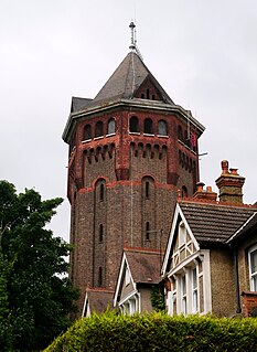
Westcombe Park is a largely residential area in Blackheath in the Royal Borough of Greenwich, south-east London, England. It is bounded by the main London-Dartford railway line to the north, the Blackwall Tunnel southern approach to the east, the Blackheath common to the south and a road, Vanbrugh Hill, to the west.

Charlton is an area of southeast London, England, within the Royal Borough of Greenwich. It is east of Greenwich and west of Woolwich. It is 7.2 miles (11.6 km) east-southeast of Charing Cross. 'Charlton next Woolwich' was an ancient parish in the county of Kent, which became part of the metropolitan area of London in 1855. It is home to Charlton Athletic and to Charlton House.
Shooter's Hill is a district in South East London within the Royal Borough of Greenwich. It borders the London Borough of Bexley. It lies north of Eltham and south of Woolwich. With a height of 132 metres (433 ft), it is the highest point in the Borough of Greenwich and one of the highest points in Greater London. Shooter's Hill also gives its name to the A road which passes through east to west and is part of the A207 road, the A2 road, and also Watling Street.
Eltham is a district of southeast London, England, within the Royal Borough of Greenwich. It is 8.7 miles (14.0 km) east-southeast of Charing Cross, and is identified in the London Plan as one of 35 major centres in Greater London. The three wards of Eltham North, South and West have a total population of 35,459.

Greenwich and Woolwich is a constituency represented in the House of Commons of the UK Parliament since 2015 by Matthew Pennycook of the Labour Party.

The John Roan School is a co-educational secondary school and sixth form located in Greenwich, south-east London, England.

Woodlands House is a Grade II* listed Georgian villa, next door to Mycenae House, Mycenae Road, in the Westcombe Park area of the Royal Borough of Greenwich. From 1972 to 2003 the building served as a library and art museum, known as the Woodlands Art Gallery.

East Greenwich Pleasaunce is a public park in East Greenwich, in south-east London. It is situated to the north side of the railway line between Maze Hill and Westcombe Park railway stations and south of the A206 Woolwich Road.

Vanbrugh Castle is a house designed and built by John Vanbrugh for his own family, located on Maze Hill on the eastern edge of Greenwich Park in London, to the north of Blackheath, with views to the west past the Old Royal Naval College at Greenwich down to the Thames reaching as far as the Houses of Parliament.

John Rocque's Map of London, 1746 can refer to two different maps, the better known of which is formally titled A plan of the cities of London and Westminster, and borough of Southwark, and is a map of Georgian London to a scale of 26 inches to a mile, surveyed by John Rocque, engraved by John Pine, and published in 1746. This map consists of 24 sheets and measures 3.84 by 2.01 metres. Taking nearly ten years to survey, engrave and publish, it has been described as "a magnificent example of cartography ... one of the greatest and most handsome plans of any city".

Neil Biron Rhind is an English journalist, writer and an authority on the social and historical development of Blackheath and surrounding areas of south east London.
