McBaine, Missouri

Last updated

McBlaine, Missouri
Village of McBaine
Boone County Missouri Incorporated and Unincorporated areas McBaine Highlighted.svg
Location of McBaine, Missouri
Coordinates: 38°53′01″N92°27′20″W / 38.88361°N 92.45556°W / 38.88361; -92.45556
Country United States
State Missouri
County Boone
Area
[1]
  Total0.20 sq mi (0.51 km2)
  Land0.19 sq mi (0.50 km2)
  Water0.01 sq mi (0.02 km2)
Elevation
[2]
577 ft (176 m)
Population
 (2020)
  Total17
  Density89.01/sq mi (34.28/km2)
Time zone UTC-6 (Central (CST))
  Summer (DST) UTC-5 (CDT)
ZIP code
65203
Area code 573
FIPS code 29-44768 [3]
GNIS feature ID2396743 [2]

McBaine is a village in Boone County, Missouri, United States. It is part of the Columbia, Missouri Metropolitan Statistical Area. The population was 10 at the 2010 census. McBaine is located just north of Eagle Bluffs Conservation Area and within sight of The Big Tree.

Contents

History

McBaine was laid out in 1899, and named after Turner McBaine, the original owner of the site. [4] A post office called McBaine was established in 1894, and remained in operation until 1958. [5]

Geography

According to the United States Census Bureau, the village has a total area of 0.22 square miles (0.57 km2), all land. [6]

Demographics

Historical population
CensusPop.Note
1930 125
1940 1314.8%
1950 75−42.7%
2000 17
2010 10−41.2%
2020 1770.0%
U.S. Decennial Census [7]

2010 census

As of the census [8] of 2010, there were 10 people, 6 households, and 1 families living in the village. The population density was 45.5 inhabitants per square mile (17.6/km2). There were 7 housing units at an average density of 31.8 per square mile (12.3/km2). The racial makeup of the village was 100.0% White.

There were 6 households, of which 16.7% were married couples living together and 83.3% were non-families. 50.0% of all households were made up of individuals. The average household size was 1.67 and the average family size was 3.00.

The median age in the village was 54 years. 0.0% of residents were under the age of 18; 10% were between the ages of 18 and 24; 30% were from 25 to 44; 30% were from 45 to 64; and 30% were 65 years of age or older. The gender makeup of the village was 70.0% male and 30.0% female.

2000 census

As of the census [3] of 2000, there were 17 people, 9 households, and 2 families living in the village. The population density was 73.2 inhabitants per square mile (28.3/km2). There were 12 housing units at an average density of 51.7 per square mile (20.0/km2). The racial makeup of the village was 100.00% White.

There were 9 households, out of which 33.3% had children under the age of 18 living with them, none were married couples living together, 33.3% had a female householder with no husband present, and 66.7% were non-families. 44.4% of all households were made up of individuals, and none had someone living alone who was 65 years of age or older. The average household size was 1.89 and the average family size was 2.67.

In the village, the population was spread out, with 29.4% under the age of 18, 17.6% from 18 to 24, 41.2% from 25 to 44, 11.8% from 45 to 64. The median age was 30 years. For every 100 females, there were 70.0 males. For every 100 females age 18 and over, there were 71.4 males.

The median income for a household in the village was $21,875, and the median income for a family was $20,625. Males had a median income of $0 versus $20,625 for females. The per capita income for the village was $10,112. About 33.3% of families and 35.3% of the population were below the poverty line, including 40.0% of under eighteens and none of those over 64.

Education

Its school district is Columbia 93 School District. [9]

Related Research Articles

<span class="mw-page-title-main">Ashland, Missouri</span> City in Missouri, United States

Ashland is a city in Boone County, Missouri, United States. Ashland is part of the Columbia, Missouri Metropolitan Statistical Area. The population was 4,747 at the 2020 census.

<span class="mw-page-title-main">Harrisburg, Missouri</span> Village in Missouri, United States

Harrisburg is a village in western Boone County, Missouri, United States. It is part of the Columbia, Missouri Metropolitan Statistical Area. The population was 266 at the 2010 census.

<span class="mw-page-title-main">Hartsburg, Missouri</span> Village in Missouri, United States

Hartsburg is a village in southern Boone County, Missouri, United States. It is part of the Columbia, Missouri Metropolitan Statistical Area. The population was 133 per the 2020 census.

<span class="mw-page-title-main">Kingdom City, Missouri</span> Village in Missouri, US

Kingdom City is a village in Callaway County, Missouri, United States. It is part of the Jefferson City Metropolitan Statistical Area. The population was 128 at the 2010 census. The village lies north of the intersection of Interstate 70 and U.S. Route 54.

<span class="mw-page-title-main">West Line, Missouri</span> Village in Missouri, United States

West Line is a village in Cass County, Missouri. The population was 97 at the 2010 census. It is part of the Kansas City metropolitan area.

<span class="mw-page-title-main">Wooldridge, Missouri</span> Village in Missouri, United States

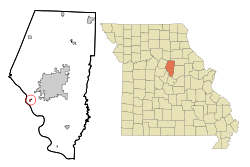
Wooldridge is a village in northeastern Cooper County, Missouri, United States. The population was 61 at the 2010 census.

<span class="mw-page-title-main">Louisburg, Missouri</span> Village in Missouri, United States

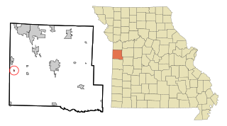
Louisburg is a village in Dallas County, Missouri, United States. The population was 122 at the 2010 census. It is part of the Springfield, Missouri Metropolitan Statistical Area.

<span class="mw-page-title-main">Weatherby, Missouri</span> Village in Missouri, United States

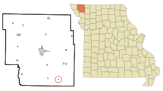
Weatherby is a village in eastern DeKalb County, Missouri, United States. The population was 80 at the 2020 census. It is part of the St. Joseph, MO–KS Metropolitan Statistical Area.

<span class="mw-page-title-main">Chilhowee, Missouri</span> Village in Missouri, United States

Chilhowee is a village in south central Johnson County, Missouri, United States. It is situated along Missouri Route 2. The population was 325 at the 2010 census.

<span class="mw-page-title-main">Anniston, Missouri</span> City in Missouri, United States

Anniston is a city in Mississippi County, Missouri, United States. The population was 180 at the 2020 census, down from 232 in 2010.

<span class="mw-page-title-main">Guilford, Missouri</span> Village in Missouri, United States

Guilford is a village in Nodaway County, Missouri, United States, near the Platte River. The population was 85 at the 2010 census.

<span class="mw-page-title-main">Frankford, Missouri</span> City in Missouri, United States

Frankford is a city in Pike County, Missouri, United States. The population was 323 at the 2010 census.

<span class="mw-page-title-main">Clifton Hill, Missouri</span> City in Missouri, United States

Clifton Hill is a city in Randolph County, Missouri, United States. The population was 114 at the 2010 census.

<span class="mw-page-title-main">Coney Island, Missouri</span> Village in Missouri, United States

Coney Island is a village in Stone County, Missouri, United States. The population was 47 at the 2020 census. It is part of the Branson, Missouri Micropolitan Statistical Area.

<span class="mw-page-title-main">Johnstown, Nebraska</span> Village in Brown County, Nebraska, United States

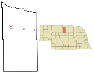
Johnstown is a village in Brown County, Nebraska, United States. The population was 64 at the 2010 census.

<span class="mw-page-title-main">Moorefield, Nebraska</span> Village in Frontier County, Nebraska, United States

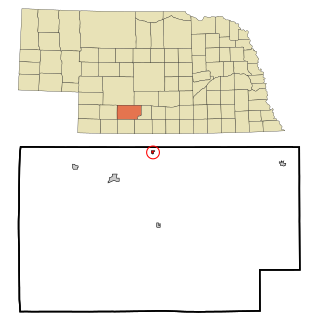
Moorefield is a village in Frontier County, Nebraska, United States. The population was 32 at the 2010 census.

<span class="mw-page-title-main">McGrew, Nebraska</span> Village in Scotts Bluff County, Nebraska, United States

McGrew is a village in Scotts Bluff County, Nebraska, United States. It is part of the Scottsbluff, Nebraska Micropolitan Statistical Area. The population was 105 at the 2010 census.

<span class="mw-page-title-main">Champ, Missouri</span> Village in Missouri, United States

Champ is a village in St. Louis County, Missouri, United States. The population was 10 at the 2020 census.

<span class="mw-page-title-main">Bell Center, Wisconsin</span> Village in Wisconsin, United States

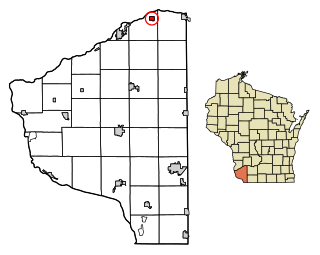
Bell Center is a village in Crawford County, Wisconsin, United States. The population was 117 at the 2010 census.

<span class="mw-page-title-main">Blue River, Wisconsin</span> Village in Wisconsin, United States

Blue River is a village in Grant County, Wisconsin, United States. The population was 434 at the 2010 census.

References

  1. "ArcGIS REST Services Directory". United States Census Bureau. Retrieved August 28, 2022.
  2. 1 2 U.S. Geological Survey Geographic Names Information System: McBaine, Missouri
  3. 1 2 "U.S. Census website". United States Census Bureau . Retrieved January 31, 2008.
  4. "Boone County Place Names, 1928–1945 (archived)". The State Historical Society of Missouri. Archived from the original on June 24, 2016. Retrieved September 4, 2016.{{cite web}}: CS1 maint: bot: original URL status unknown (link)
  5. "Post Offices". Jim Forte Postal History. Retrieved September 4, 2016.
  6. "US Gazetteer files 2010". United States Census Bureau. Archived from the original on January 12, 2012. Retrieved July 8, 2012.
  7. "Census of Population and Housing". Census.gov. Retrieved June 4, 2015.
  8. "U.S. Census website". United States Census Bureau . Retrieved July 8, 2012.
  9. "2020 CENSUS - SCHOOL DISTRICT REFERENCE MAP: Boone County, MO" (PDF). U.S. Census Bureau . Retrieved July 19, 2023.