McClellanville, South Carolina

Last updated

McClellanville, South Carolina
McClellanville, South Carolina Jeremy Creek.jpg
Jeremy Creek at McClellanville; looking upstream
SCMap-doton-McClellanville.PNG
Location of McClellanville in South Carolina
Coordinates: 33°5′20.23″N79°28′2.23″W / 33.0889528°N 79.4672861°W / 33.0889528; -79.4672861
Country United States
State South Carolina
County Charleston
Government
   Mayor Rutledge B. Leland III
Area
[1]
  Total2.34 sq mi (6.07 km2)
  Land2.23 sq mi (5.77 km2)
  Water0.12 sq mi (0.31 km2)
Elevation
8 ft (2 m)
Population
 (2020) [2]
  Total605
  Density271.67/sq mi (104.87/km2)
Time zone UTC-5 (EST)
  Summer (DST) UTC-4 (EDT)
ZIP code
29458
Area code(s) 843, 854
FIPS code 45-43585 [3]
GNIS feature ID1252622 [4]
Website www.mcclellanvillesc.org

McClellanville is a small fishing town in rural Charleston County, South Carolina, United States. The population was 605 at the 2020 census. It is situated on the Atlantic coast, on land surrounded by Francis Marion National Forest, and has traditionally derived its livelihood from the Atlantic Ocean and coastal marshes by fishing, shrimping and oystering. McClellanville is part of the Charleston-North Charleston-Summerville metropolitan area and the Charleston-North Charleston Urbanized Area.

Contents

History

McClellanville village began in the late 1860s when local plantation owners A.J. McClellan and R.T. Morrison sold lots in the vicinity of Jeremy Creek to planters of the Santee Delta, who sought relief from summer fevers. The first store opened soon after the Civil War, and the village became the social and economic center for a wide area that produced timber, rice, cotton, naval stores, and seafoods. Incorporated in 1926, McClellanville became, and remains, best known for its shrimping fleet and seafood industries.[ citation needed ]

In 1989 the town was devastated by the full brunt of Hurricane Hugo which destroyed homes, downed century-old oaks, deposited shrimp boats in front yards, and otherwise altered much of the picturesque character of this historic fishing village. The stronger north side of the eyewall passed directly over the village while a Category 4 hurricane. Residents taking refuge in the local high school, a designated storm shelter, were surprised by a storm surge which threatened to drown the refugees. Helping one another in complete darkness, they managed to crawl into a space above the false ceilings of the building and none were lost. [5] [6]

The Bethel African Methodist Episcopal Church, Cape Romain Lighthouses, Fairfield Plantation, Hampton Plantation, Harrietta Plantation, McClellanville Historic District, Wedge Plantation, and Old Georgetown Road are listed on the National Register of Historic Places. [7]

Geography

McClellanville is located in northeastern Charleston County at 33°5′20.23″N79°28′2.23″W / 33.0889528°N 79.4672861°W / 33.0889528; -79.4672861 (33.088953,-79.467287). [8] U.S. Route 17 passes along the northwestern edge of the town, leading northeast 23 miles (37 km) to Georgetown and southwest 38 miles (61 km) to Charleston.

According to the United States Census Bureau, McClellanville has a total area of 2.4 square miles (6.1 km2), of which 2.2 square miles (5.8 km2) is land and 0.1 square miles (0.3 km2), or 5.02%, is water. [9] Jeremy Creek, a tidal inlet, runs through the center of the town, and the town limits extend south to the Intracoastal Waterway, adjacent to Cape Romain National Wildlife Refuge.

Demographics

Historical population
CensusPop.Note
1930 502
1940 431−14.1%
1950 417−3.2%
1960 354−15.1%
1970 304−14.1%
1980 43643.4%
1990 333−23.6%
2000 45937.8%
2010 4998.7%
2020 60521.2%
U.S. Decennial Census [10] [2]

2020 census

McClellanville racial composition [11]
RaceNum.Perc.
White (non-Hispanic)56092.56%
Black or African American (non-Hispanic)182.98%
Native American 20.33%
Other/Mixed 193.14%
Hispanic or Latino 60.99%

As of the 2020 United States census, there were 605 people, 222 households, and 149 families residing in the town.

2000 census

As of the census [3] of 2000, there were 459 people, 206 households, and 138 families residing in the town. The population density was 220.9 inhabitants per square mile (85.3/km2). There were 254 housing units at an average density of 122.2 per square mile (47.2/km2). The racial makeup of the town was 92% White and 7.14% African American. Hispanic or Latino of any race were 2.18% of the population.

There were 206 households, out of which 20.4% had children under the age of 18 living with them, 58.7% were married couples living together, 5.8% had a female householder with no husband present, and 33.0% were non-families. 29.6% of all households were made up of individuals, and 12.1% had someone living alone who was 65 years of age or older. The average household size was 2.23 and the average family size was 2.75.

In the town, the population was spread out, with 16.3% under the age of 18, 7.0% from 18 to 24, 20.9% from 25 to 44, 36.4% from 45 to 64, and 19.4% who were 65 years of age or older. The median age was 48 years. For every 100 females, there were 96.2 males. For every 100 females age 18 and over, there were 92.0 males.

The median income for a household in the town was $42,500, and the median income for a family was $50,000. Males had a median income of $36,750 versus $25,781 for females. The per capita income for the town was $22,425. About 8.3% of families and 11.8% of the population were below the poverty line, including 21.8% of those under age 18 and 8.6% of those age 65 or over.

Government

The city is run by an elected mayor–council government system.

Mayor

Rutledge B. Leland III

Council members

Aaron Baldwin, Robert J. Gannon, Chris B Bates, James E. Scott IV.

Education

Charleston County School District operates district public schools serving McClellanville.

St. James-Santee Elementary School is in McClellanville. [12]

Lincoln High School was in McClellanville but closed in 2015. In 2016 school district staff stated that they were considering having a new Lincoln High constructed in Awendaw. [13]

Cape Romain Environmental Education Charter School (CREECS) is a charter school in McClellanville. [14]

Notable people

Related Research Articles

<span class="mw-page-title-main">Georgetown County, South Carolina</span> County in South Carolina, United States

Georgetown County is a county located in the U.S. state of South Carolina. As of the 2020 census, the population was 63,404. Its county seat is Georgetown. The county was founded in 1769. It is named for George III of the United Kingdom.

<span class="mw-page-title-main">Charleston County, South Carolina</span> County in South Carolina, United States

Charleston County is located in the U.S. state of South Carolina along the Atlantic coast. As of the 2020 census, the population was 408,235, making it the third-most populous county in South Carolina. Its county seat is Charleston. It is also the largest county in the state by total area, although Horry County has a larger land area. The county was created in 1800 by an act of the South Carolina State Legislature.

<span class="mw-page-title-main">Berkeley County, South Carolina</span> County in South Carolina, United States

Berkeley County is a county in the U.S. state of South Carolina. As of the 2020 census, its population was 229,861. Its county seat is Moncks Corner, and the largest community is Goose Creek. After two previous incarnations of Berkeley County, the current county was created in 1882. Berkeley County is included in the Charleston-North Charleston, SC Metropolitan Statistical Area.

<span class="mw-page-title-main">Penobscot County, Maine</span> County in Maine, United States

Penobscot County is a county in the U.S. state of Maine, named for the Penobscot people in Wabanakik. As of the 2020 census, the population was 152,199, making it the third-most-populous county in Maine. Its county seat is Bangor. The county was established on February 15, 1816, from part of Hancock County when the area was still part of Massachusetts. Penobscot County is home to the University of Maine.

<span class="mw-page-title-main">Fort Myers Beach, Florida</span> Town in Florida, United States of America

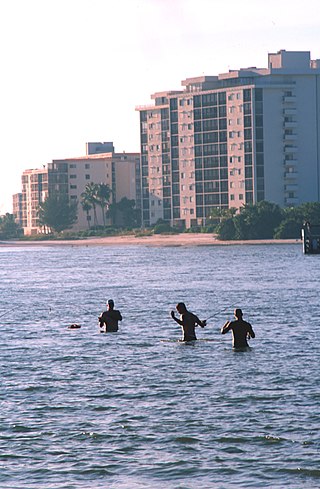
Fort Myers Beach is a town located on the North end of Estero Island in Lee County, Florida, United States. The town is on the Gulf of Mexico and is accessed from the mainland by a bridge over Estero Bay. It is part of the Cape Coral-Fort Myers, Florida Metropolitan Statistical Area. It was officially incorporated on December 31, 1995. The population was 5,582 at the 2020 census.

<span class="mw-page-title-main">Charleston, Maine</span> Town in the state of Maine, United States

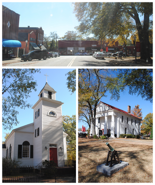
Charleston is a town in Penobscot County, Maine, United States. It is part of the Bangor Metropolitan Statistical Area. The population was 1,558 at the 2020 census. Charleston includes the village of West Charleston and is home to the Higgins Classical Institute, a Christian school.

<span class="mw-page-title-main">Pendleton, South Carolina</span> Town in South Carolina, United States

Pendleton is a town in Anderson County, South Carolina, United States. The population was 3,489 at the 2020 census. It is a sister city of Stornoway in the Outer Hebrides of Scotland.

<span class="mw-page-title-main">Jamestown, South Carolina</span> Town in South Carolina, United States

Jamestown is a town in Berkeley County, South Carolina, United States. The population was 72 at the 2010 census.

<span class="mw-page-title-main">Moncks Corner, South Carolina</span> Town in South Carolina, United States

Moncks Corner is a town in and the county seat of Berkeley County, South Carolina, United States. The population was 7,885 at the 2010 census. As defined by the U.S. Census Bureau, Moncks Corner is included within the Charleston-North Charleston, SC Metropolitan Statistical Area.

<span class="mw-page-title-main">St. Stephen, South Carolina</span> Town in South Carolina, United States

St. Stephen is a town in Berkeley County, South Carolina, United States. The population was 1,697 at the 2010 census.

<span class="mw-page-title-main">Awendaw, South Carolina</span> Town in South Carolina, United States

Awendaw is a small fishing town in Charleston County, South Carolina, United States. The population was 1,294 at the 2010 census. Awendaw is part of the Charleston, South Carolina metropolitan area.

<span class="mw-page-title-main">Mount Pleasant, South Carolina</span> Town in South Carolina, United States

Mount Pleasant is a large suburban town in Charleston County, South Carolina, United States. In the Lowcountry, it is the fourth-most populous municipality in South Carolina, and for several years was one of the state's fastest-growing areas, doubling in population between 1990 and 2000. The population was 90,801 at the 2020 census. It is part of the Charleston metropolitan area.

<span class="mw-page-title-main">Summerton, South Carolina</span> Town in South Carolina, United States

Summerton is a town in Clarendon County, South Carolina, United States. Per the 2020 census, the population was 814.

<span class="mw-page-title-main">Georgetown, South Carolina</span> City in South Carolina, United States

Georgetown is the third oldest city in the U.S. state of South Carolina and the county seat of Georgetown County, in the Lowcountry. As of the 2010 census it had a population of 9,163. Located on Winyah Bay at the confluence of the Black, Great Pee Dee, Waccamaw, and Sampit rivers, Georgetown is the second largest seaport in South Carolina, handling over 960,000 tons of materials a year, while Charleston is the largest.

<span class="mw-page-title-main">Pawleys Island, South Carolina</span> Town in South Carolina, United States

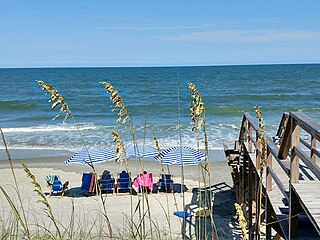
Pawleys Island is a town in Georgetown County, South Carolina, United States, and the Atlantic coast barrier island on which the town is located.

<span class="mw-page-title-main">Santee, South Carolina</span> Town in South Carolina, United States

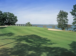
Santee is a town in Orangeburg County along the Santee River Valley in central South Carolina, United States. It has become a resort town of note located centrally north-south along the Atlantic Seaboard of South Carolina. The region has been rural, with a primarily agricultural economy typical of Orangeburg County, but is now known primarily for its several golf courses in proximity to Lake Marion, Santee State Park and other Lake Marion attractions. Interstate 95 connects its attractions easily with tourists traveling by automobile. I-95 crosses a narrow arm of the lake into the town lands, along a causeway. Lake Marion is a man-made hydroelectric reservoir, which at 110,000 acres is one of the fifty largest lakes in the country.

<span class="mw-page-title-main">Pinewood, South Carolina</span> Town in South Carolina, United States

Pinewood is a town located on South Carolina Highway 261 at the southern entrance to the High Hills of Santee in Sumter County, South Carolina, United States. The population was 538 at the 2010 census. It is included in the Sumter, South Carolina Metropolitan Statistical Area.

Stateburg is a census-designated place (CDP) in the High Hills of Santee in Sumter County, South Carolina, United States. The population was 1,380 at the 2010 census. It is included in the Sumter, South Carolina Metropolitan Statistical Area. Stateburg is located within the larger Stateburg Historic District.

<span class="mw-page-title-main">Lane, South Carolina</span> Town in South Carolina, United States

Lane is a town in Williamsburg County, South Carolina, United States. The population was 480 at the 2020 census.

<span class="mw-page-title-main">Hurricane, West Virginia</span> City in West Virginia, United States

Hurricane is a city in Putnam County, West Virginia, United States. The population was 6,977 at the 2020 census. Located roughly equidistant from Charleston and Huntington, it is part of the Huntington–Ashland metropolitan area.

References

  1. "ArcGIS REST Services Directory". United States Census Bureau. Retrieved October 15, 2022.
  2. 1 2 "Census Population API". United States Census Bureau. Retrieved October 15, 2022.
  3. 1 2 "U.S. Census website". United States Census Bureau . Retrieved January 31, 2008.
  4. "US Board on Geographic Names". United States Geological Survey. October 25, 2007. Retrieved January 31, 2008.
  5. "Hurricane Hugo – An Eyewitness Account By George Metts" (PDF). Aoml.noaa.gov. Retrieved October 26, 2017.
  6. Service, US Department of Commerce, NOAA, National Weather. "Hurricane Hugo". Weather.gov. Retrieved October 26, 2017.{{cite web}}: CS1 maint: multiple names: authors list (link)
  7. "National Register Information System". National Register of Historic Places . National Park Service. July 9, 2010.
  8. "US Gazetteer files: 2010, 2000, and 1990". United States Census Bureau. February 12, 2011. Retrieved April 23, 2011.
  9. "Geographic Identifiers: 2010 Census Summary File 1 (G001): McClellanville town, South Carolina". U.S. Census Bureau, American Factfinder. Archived from the original on February 13, 2020. Retrieved June 29, 2015.
  10. "Census of Population and Housing". Census.gov. Retrieved June 4, 2015.
  11. "Explore Census Data". data.census.gov. Retrieved December 15, 2021.
  12. Home. St. James-Santee Elementary School. Retrieved on December 11, 2016.
  13. Bowers, Paul (June 2, 2016). "Replacement site in Awendaw considered". The Post and Courier . Retrieved December 11, 2016.
  14. Home. Cape Romain Environmental Education Charter School. Retrieved on December 11, 2016.
  15. "Herman Lindsay "Duff" Holbrook Obituary". The Post and Courier . July 18, 2015. Retrieved August 12, 2015.