
Tallahatchie County is a county in the U.S. state of Mississippi. At the 2020 census, the population was 12,715. Its county seats are Charleston and Sumner.
Sunflower County is a county located in the U.S. state of Mississippi. As of the 2020 census, the population was 25,971. Its largest city and county seat is Indianola.

Leflore County is a county located in the U.S. state of Mississippi. As of the 2020 census, the population was 28,339. The county seat is Greenwood. The county is named for Choctaw leader Greenwood LeFlore, who signed a treaty to cede his people's land to the United States in exchange for land in Indian Territory. LeFlore stayed in Mississippi, settling on land reserved for him in Tallahatchie County.

Columbia County is a county located in the east central portion of the U.S. state of Georgia. As of the 2020 census, the population was 156,010. The legal county seat is Appling, but the de facto seat of county government is Evans.

Itta Bena is a city in Leflore County, Mississippi, United States. The population was 2,049 at the 2010 census. The town's name is derived from the Choctaw phrase iti bina, meaning "forest camp". Itta Bena is part of the Greenwood, Mississippi micropolitan area. It developed as a trading center of an area of cotton plantations.
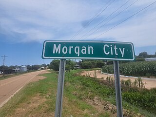
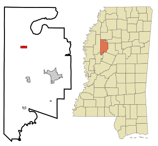
Morgan City, Mississippi is a town in Leflore County along Mississippi Highway 7. The population was 255 at the 2010 census, down from 305 at the 2000 census. It is part of the Greenwood, Mississippi micropolitan area.
Schlater is a town in Leflore County, Mississippi, United States. The population was 310 at the 2010 census, down from 388 at the 2000 census. It is part of the Greenwood, Mississippi micropolitan area.

Yazoo City is the county seat of Yazoo County, Mississippi, United States. It was named after the Yazoo River, which, in turn was named by the French explorer Robert La Salle in 1682 as "Rivière des Yazous" in reference to the Yazoo tribe living near the river's mouth. Yazoo City is the principal city of the Yazoo City Micropolitan Statistical Area, which is part of the larger Jackson–Yazoo City Combined Statistical Area. According to the 2010 census, the population was 11,403. The most important industry in 2021 is a group of federal prisons.

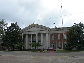
Greenwood is a city in and the county seat of Leflore County, Mississippi, United States, located at the eastern edge of the Mississippi Delta region, approximately 96 miles north of the state capital, Jackson, and 130 miles south of the riverport of Memphis, Tennessee. It was a center of cotton planter culture in the 19th century.

Minter City is an unincorporated community in Leflore County and Tallahatchie County, Mississippi. It is part of the Greenwood, Mississippi micropolitan area, and is within the Mississippi Delta.

Alexander Gallatin McNutt was a Mississippi attorney and politician who served as Governor from 1838 to 1842.

The Appomattox Court House National Historical Park is the preserved 19th-century village named Appomattox Court House in Appomattox County, Virginia. The village was named for the presence nearby of what is now preserved as the Old Appomattox Court House. The village is the site of the Battle of Appomattox Court House, and contains the McLean House, where the surrender of the Army of Northern Virginia under Robert E. Lee to Union commander Ulysses S. Grant took place on April 9, 1865, an event widely symbolic of the end of the American Civil War. The village itself began as the community of Clover Hill, which was made the county seat of Appomattox County in the 1840s. The village of Appomattox Court House entered a stage of decline after it was bypassed by a railroad in 1854. In 1930, the United States War Department was authorized to erect a monument at the site, and in 1933 the War Department's holdings there was transferred to the National Park Service. The site was greatly enlarged in 1935, and a restoration of the McLean House was planned but was delayed by World War II. In 1949, the restored McLean House was reopened to the public. Several restored buildings, as well as a number of original 19th-century structures are situated at the site.

Money is an unincorporated community near Greenwood in Leflore County, Mississippi, United States, in the Mississippi Delta. It has fewer than 100 residents, down from 400 in the early 1950s when a cotton mill operated there. Money is located on a railroad line along the Tallahatchie River, a tributary of the Yazoo River in the eastern part of the Mississippi Delta. The community has ZIP code 38945 in the Greenwood, Mississippi micropolitan area.
Benton is a census-designated place and unincorporated community in Yazoo County, Mississippi. It was first named as a CDP in the 2020 Census which listed a population of 415.
Mississippi Delta Community College is a public community college serving the Mississippi Delta region with its main campus in Moorhead, Mississippi. It also offers courses at locations in Greenville, Greenwood, and Indianola. Its mascot is the Trojan warrior. It has an enrollment of 3,491 students.

U.S. Route 49E is an 89.6-mile-long (144.2 km) U.S. Highway in the Delta region of Mississippi. It travels through Yazoo, Holmes, Leflore, and Tallahatchie counties.
A Mississippi Landmark is a building officially nominated by the Mississippi Department of Archives and History and approved by each county's chancery clerk. The Mississippi Landmark designation is the highest form of recognition bestowed on properties by the state of Mississippi, and designated properties are protected from changes that may alter the property's historic character. Currently there are 890 designated landmarks in the state. Mississippi Landmarks are spread out between eighty-one of Mississippi's eighty-two counties; only Issaquena County has no such landmarks.

Berclair is an unincorporated community located in Leflore County, Mississippi, United States. Berclair is approximately 3 miles (4.8 km) west of Itta Bena. It is part of the Greenwood, Mississippi micropolitan area.

Shellmound is an unincorporated community located in Leflore County, Mississippi, United States, located approximately 6 miles (9.7 km) north of Greenwood and approximately 6 miles (9.7 km) southeast of Schlater near U.S. Highway 49E.
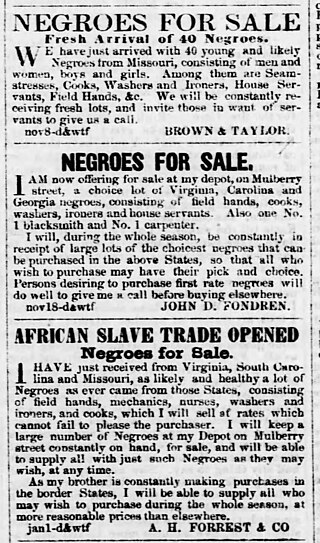
Aaron H. Forrest was one of the six Forrest brothers who engaged in the interregional slave trade in the United States prior to the American Civil War. He may have also owned or managed cotton plantations in Mississippi. He led a Confederate cavalry unit composed of volunteers from the Yazoo River region of Mississippi during the American Civil War. He died in 1864, apparently from illness.


