Schlater, Mississippi

Last updated

Schlater, Mississippi
Leflore County Mississippi Incorporated and Unincorporated areas Schlater Highlighted.svg
Location of Schlater, Mississippi
Usa edcp location map.svg
Red pog.svg
Schlater, Mississippi
Location in the United States
Coordinates: 33°38′25″N90°20′50″W / 33.64028°N 90.34722°W / 33.64028; -90.34722
Country United States
State Mississippi
County Leflore
Government
  TypeMayor and board of aldermen
Area
[1]
  Total1.15 sq mi (2.99 km2)
  Land1.15 sq mi (2.99 km2)
  Water0.00 sq mi (0.00 km2)
Elevation
128 ft (139 m)
Population
 (2020)
  Total236
  Density204.51/sq mi (78.95/km2)
Time zone UTC-6 (Central (CST))
  Summer (DST) UTC-5 (CDT)
ZIP code
38952
Area code 662
FIPS code 28-66080
GNIS feature ID0677454

Schlater is a town in Leflore County, Mississippi, United States. The population was 310 at the 2010 census, [2] down from 388 at the 2000 census. It is part of the Greenwood, Mississippi micropolitan area.

Contents

Geography

Schlater is located in northwestern Leflore County at 33°38′25″N90°20′50″W / 33.64028°N 90.34722°W / 33.64028; -90.34722 (33.640156, -90.347246). [3] Mississippi Highway 442 passes through the town, leading east 3 miles (5 km) to U.S. Route 49E and west 10 miles (16 km) to Doddsville and U.S. Route 49W. Via US-49E Schlater is 17 miles (27 km) northwest of Greenwood, the Leflore county seat.

According to the United States Census Bureau, the town has a total area of 1.2 square miles (3.0 km2), all of it recorded as land. [4] McNutt Lake is a narrow waterway that passes through the town, connecting Ashland Brake to the east with the Quiver River to the west, part of the Yazoo River watershed.

Demographics

Historical population
CensusPop.Note
1970 398
1980 4297.8%
1990 404−5.8%
2000 388−4.0%
2010 310−20.1%
2020 236−23.9%
U.S. Decennial Census [5]

As of the 2010 United States Census, there were 310 people living in the town. The racial makeup of the town was 68.7% Black, 29.0% White and 1.0% from two or more races. 1.3% were Hispanic or Latino of any race.

As of the census [6] of 2000, there were 388 people, 141 households, and 105 families living in the town. The population density was 332.8 inhabitants per square mile (128.5/km2). There were 150 housing units at an average density of 128.7 per square mile (49.7/km2). The racial makeup of the town was 60.57% African American, 38.92% White and 0.52% Asian.

There were 141 households, out of which 29.8% had children under the age of 18 living with them, 44.7% were married couples living together, 22.7% had a female householder with no husband present, and 25.5% were non-families. 24.8% of all households were made up of individuals, and 11.3% had someone living alone who was 65 years of age or older. The average household size was 2.75 and the average family size was 3.29.

In the town, the population was spread out, with 32.2% under the age of 18, 9.3% from 18 to 24, 25.5% from 25 to 44, 20.1% from 45 to 64, and 12.9% who were 65 years of age or older. The median age was 34 years. For every 100 females, there were 86.5 males. For every 100 females age 18 and over, there were 81.4 males.

The median income for a household in the town was $23,816, and the median income for a family was $25,000. Males had a median income of $21,667 versus $13,571 for females. The per capita income for the town was $10,022. About 34.9% of families and 44.3% of the population were below the poverty line, including 65.0% of those under age 18 and 14.3% of those age 65 or over.

Education

It is in the Greenwood-Leflore School District. Its high school is Amanda Elzy High School. [7]

The town was served by the Leflore County School District. [8] Effective July 1, 2019, this district consolidated into the Greenwood-Leflore School District. [9]

Notable people

Related Research Articles

<span class="mw-page-title-main">Washington County, Mississippi</span> County in Mississippi, United States

Washington County is a county located in the U.S. state of Mississippi. As of the 2020 census, the population was 44,922. Its county seat is Greenville. The county is named in honor of the first president of the United States, George Washington. It is located to the Arkansas border.

<span class="mw-page-title-main">Tallahatchie County, Mississippi</span> County in Mississippi, United States

Tallahatchie County is a county in the U.S. state of Mississippi. At the 2020 census, the population was 12,715. Its county seats are Charleston and Sumner.

<span class="mw-page-title-main">Sunflower County, Mississippi</span> County in Mississippi, United States

Sunflower County is a county located in the U.S. state of Mississippi. As of the 2020 census, the population was 25,971. Its largest city and county seat is Indianola.

<span class="mw-page-title-main">Leflore County, Mississippi</span> County in Mississippi, United States

Leflore County is a county located in the U.S. state of Mississippi. As of the 2020 census, the population was 28,339. The county seat is Greenwood. The county is named for Choctaw leader Greenwood LeFlore, who signed a treaty to cede his people's land to the United States in exchange for land in Indian Territory. LeFlore stayed in Mississippi, settling on land reserved for him in Tallahatchie County.

<span class="mw-page-title-main">Carroll County, Mississippi</span> County in Mississippi, United States

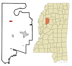
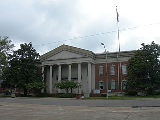
Carroll County is a county in the U.S. state of Mississippi. As of the 2020 census, the population was 9,998. Its county seats are Carrollton and Vaiden. The county is named for Charles Carroll of Carrollton, the last surviving signatory of the Declaration of Independence.

<span class="mw-page-title-main">Buffalo, Iowa</span> Town in Iowa, United States

Buffalo is a town in Scott County, Iowa, United States. The population was 1,176 at the 2020 census. Buffalo is located on the Mississippi River. The town is a part of the Quad Cities Metropolitan Area.

<span class="mw-page-title-main">Milford Mill, Maryland</span> Census-designated place in Maryland, United States

Milford Mill is an unincorporated community and census-designated place in Baltimore County, Maryland, United States. Per the 2020 census, the population was 30,622.

<span class="mw-page-title-main">Benoit, Mississippi</span> Town in Mississippi, United States

Benoit is a town in Bolivar County, Mississippi, United States. Per the 2020 Census, the population was 365.

<span class="mw-page-title-main">Pace, Mississippi</span> Town in Mississippi, United States

Pace is a town in Bolivar County, Mississippi, United States. Per the 2020 census, the population was 183.

<span class="mw-page-title-main">Carrollton, Mississippi</span> Town in Mississippi, United States

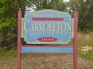
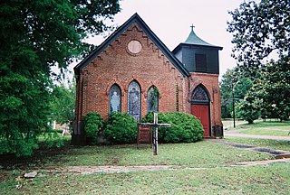
Carrollton is a town in and the second county seat of Carroll County, Mississippi, United States, which is within the Mississippi Delta. The population was 190 at the 2010 census, down from 408 in 2000. Centrally located in the county, the town is part of the Greenwood, Mississippi micropolitan area. The first county seat, Vaiden, was founded in the eastern part of the county during its early settlement.

<span class="mw-page-title-main">Vaiden, Mississippi</span> Town in Mississippi, United States

Vaiden is a town in Carroll County, Mississippi, United States and its first county seat. The population was 734 at the 2010 census. It is part of the Greenwood, Mississippi micropolitan area.

<span class="mw-page-title-main">Coahoma, Mississippi</span> Town in Mississippi, United States

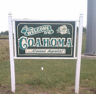
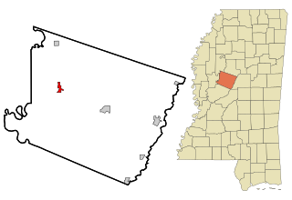
Coahoma is a town in Coahoma County, Mississippi, United States. Per the 2020 census, the population was 229.

<span class="mw-page-title-main">Cruger, Mississippi</span> Town in Mississippi, United States

Cruger is a town in Holmes County, Mississippi, United States. Per the 2020 census, the population was 268.

<span class="mw-page-title-main">Tchula, Mississippi</span> Town in Mississippi, United States

Tchula is a town in Holmes County, Mississippi, United States. The population was 1,650 at the 2020 census, down from 2,332 in 2000.

<span class="mw-page-title-main">Itta Bena, Mississippi</span> City in Mississippi, United States

Itta Bena is a city in Leflore County, Mississippi, United States. The population was 2,049 at the 2010 census. The town's name is derived from the Choctaw phrase iti bina, meaning "forest camp". Itta Bena is part of the Greenwood, Mississippi micropolitan area. It developed as a trading center of an area of cotton plantations.

<span class="mw-page-title-main">Morgan City, Mississippi</span> Town in Mississippi, United States

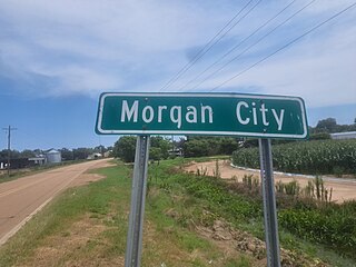
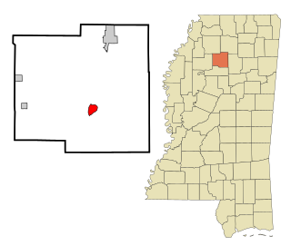
Morgan City, Mississippi is a town in Leflore County along Mississippi Highway 7. The population was 255 at the 2010 census, down from 305 at the 2000 census. It is part of the Greenwood, Mississippi micropolitan area.

<span class="mw-page-title-main">Sidon, Mississippi</span> Town in Mississippi, United States

Sidon is a town in Leflore County, Mississippi, United States. The population was 509 at the 2010 census. It is part of the Greenwood, Mississippi micropolitan area.

<span class="mw-page-title-main">Coffeeville, Mississippi</span> Town in Mississippi, United States

Coffeeville is a town in and one of two county seats of Yalobusha County, Mississippi, United States. The population was 905 at the 2010 census. It is named after John Coffee (1772–1833), a planter and military leader. The minor American Civil War Battle of Coffeeville took place near here in December 1862.

<span class="mw-page-title-main">Lena, Mississippi</span> Town in Mississippi, United States

Lena is a town in Leake County, Mississippi, United States. The population was 148 at the 2010 census. The center of population of Mississippi is located in Lena.

<span class="mw-page-title-main">Greenwood, Mississippi micropolitan area</span> Micropolitan Statistical Area in Mississippi, United States

The Greenwood Micropolitan Statistical Area is a micropolitan area in the northwestern Delta region of Mississippi that covers two counties - Leflore and Carroll. As of the 2000 census, the USA had a population of 48,716.

References

  1. "2020 U.S. Gazetteer Files". United States Census Bureau. Retrieved July 24, 2022.
  2. "Total Population: 2010 Census DEC Summary File 1 (P1), Schlater town, Mississippi". data.census.gov. U.S. Census Bureau. Retrieved April 7, 2020.
  3. "US Gazetteer files: 2010, 2000, and 1990". United States Census Bureau. February 12, 2011. Retrieved April 23, 2011.
  4. "U.S. Gazetteer Files: 2019: Places: Mississippi". U.S. Census Bureau Geography Division. Retrieved April 7, 2020.
  5. "Census of Population and Housing". Census.gov. Retrieved June 4, 2015.
  6. "U.S. Census website". United States Census Bureau . Retrieved January 31, 2008.
  7. "School Profile". Greenwood-Leflore Consolidated School District. Archived from the original on August 8, 2020. Retrieved May 18, 2021. from the rural areas of Greenwood including the towns of [...] Slaughter[...] - The page states "Schlater" as being "Slaughter".
  8. "SCHOOL DISTRICT REFERENCE MAP (2010 CENSUS): Leflore County, MS" (PDF). U.S. Census Bureau. Archived (PDF) from the original on May 13, 2021. Retrieved May 12, 2021.
  9. "School District Consolidation in Mississippi Archived 2017-07-02 at the Wayback Machine ." Mississippi Professional Educators. December 2016. Retrieved on July 2, 2017. Page 2 (PDF p. 3/6).