The New Jersey Turnpike (NJTP) is a system of controlled-access toll roads in the U.S. state of New Jersey. The turnpike is maintained by the New Jersey Turnpike Authority (NJTA). The 117.20-mile (188.62 km) mainline's southern terminus is at Interstate 295 (I-295) and U.S. Route 40 (US 40) in Pennsville Township in Salem County, near the Delaware Memorial Bridge. Its northern terminus is at the approach to the George Washington Bridge in Fort Lee in Bergen County; originally it was at an interchange with I-80 and US 46 in Ridgefield Park. Construction of the mainline from concept to completion took 22 months, from 1950 to 1951. It was opened to traffic on November 5, 1951, between its southern terminus and exit 10.

The Pennsylvania Turnpike is a controlled-access toll road that is operated by the Pennsylvania Turnpike Commission (PTC) in the Commonwealth of Pennsylvania in the United States. It runs for 360 miles (580 km) across the state, connecting Pittsburgh in Western Pennsylvania with Philadelphia in eastern Pennsylvania, and passes through four tunnels as it crosses the Appalachian Mountains in central Pennsylvania.
Interstate 66 (I-66) is a 76.32 mile east–west Interstate Highway in the eastern United States. The highway runs from an interchange with I-81 near Middletown, Virginia, on its western end to an interchange with U.S. Route 29 (US 29) in Washington, D.C., at the eastern terminus. Much of the route parallels US 29 or State Route 55 (SR 55) in Virginia. I-66 has no physical or historical connection to US 66, which was located in a different region of the United States.
Interstate 77 (I-77) is a north–south Interstate Highway in the Eastern United States. It traverses diverse terrain, from the mountainous state of West Virginia to the rolling farmlands of North Carolina and Ohio. It largely supplants the old U.S. Route 21 (US 21) between Cleveland, Ohio, and Columbia, South Carolina, as an important north–south corridor through the middle Appalachian Mountains. The southern terminus of I-77 is in Cayce, South Carolina, in Lexington County at the junction with I-26. The northern terminus is in Cleveland at the junction with I-90. Other major cities that I-77 connects to include Columbia, South Carolina; Charlotte, North Carolina; Charleston, West Virginia; and Akron, Ohio. The East River Mountain Tunnel, connecting Virginia and West Virginia, is one of only two instances in the U.S. where a mountain road tunnel crosses a state line. The other is the Cumberland Gap Tunnel, connecting Tennessee and Kentucky. I-77 is a snowbird route to the Southern U.S. for those traveling from the Great Lakes region.

The Atlantic City Expressway, officially numbered, but unsigned, as Route 446 and abbreviated A.C. Expressway, ACE, or ACX, and known locally as the Expressway, is a 44.19-mile (71.12 km) controlled-access toll road in the U.S. state of New Jersey, managed and operated by the South Jersey Transportation Authority (SJTA). It serves as an extension of the freeway part of Route 42 from Turnersville southeast to Atlantic City. The Atlantic City Expressway is signed as east-west, though the mileage and exits decrease as if one is travelling north-south. It connects Philadelphia and the surrounding Delaware Valley metropolitan area with Atlantic City and other Jersey Shore resorts, and also serves other South Jersey communities, including Hammonton and Mays Landing. The expressway intersects many major roads, including Route 73 in Winslow Township, Route 54 in Hammonton, Route 50 in Hamilton Township, the Garden State Parkway in Egg Harbor Township, U.S. Route 9 (US 9) in Pleasantville, and the Atlantic City–Brigantine Connector near the eastern terminus in Atlantic City.
E-ZPass is an electronic toll collection system used on toll roads, toll bridges, and toll tunnels in the Eastern United States, Midwestern United States, and Southern United States. The E-ZPass Interagency Group (IAG) consists of member agencies in several states, which use the same technology and allow travelers to use the same transponder on toll roads throughout the network.

The Capital Beltway is a 64-mile (103 km) auxiliary Interstate Highway in the Washington metropolitan area that surrounds Washington, D.C., the capital of the United States, and its inner suburbs in adjacent Maryland and Virginia. It is the basis of the phrase "inside the Beltway", used when referring to issues dealing with US federal government and politics. The highway is signed as Interstate 495 (I-495) for its entire length, and its southern and eastern half runs concurrently with I-95.
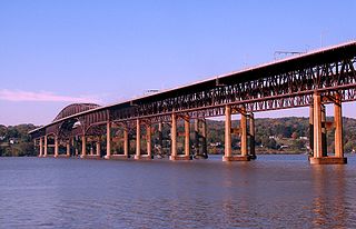
The Hamilton Fish Newburgh–Beacon Bridge is a continuous truss toll bridge that spans the Hudson River in New York State. The bridge carries Interstate 84 (I-84) and New York State Route 52 (NY 52) between Newburgh and Beacon and consists of two separate spans. The original northern span, which now carries westbound traffic, was opened on November 2, 1963, as a two-lane bridge. A second span, completed in 1980, now carries all eastbound traffic. Still often referred to by its original name, the Newburgh–Beacon Bridge, in 1997 the bridge was rededicated in honor of Hamilton Fish III, a 12-term member of the U.S. House of Representatives, and his son and namesake Hamilton Fish IV, a 13-term member of the House.

State Route 32 (SR 32), also known as the James A. Rhodes Appalachian Highway, is a major east–west highway across the southern portion of the U.S. state of Ohio. It is the eighth longest state route in Ohio, spanning southern Ohio from Cincinnati to Belpre, across the Ohio River from Parkersburg, West Virginia. Except in Belpre, leading up to the bridge into West Virginia, the entire route outside Cincinnati's beltway is a high-speed four-lane divided highway, forming the Ohio portion of Corridor D of the Appalachian Development Highway System.
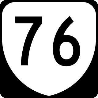
State Route 76 is a controlled-access toll road in the U.S. state of Virginia. Known as the Powhite Parkway, the state highway runs 13.04 miles (20.99 km) from SR 652 near Midlothian north to Interstate 195 (I-195) in Richmond. SR 76 connects SR 288, U.S. Route 60, and SR 150 in Chesterfield County with I-195 and SR 195 west of Downtown Richmond. The highway includes a pair of mainline barrier toll plazas and ramp toll plazas at most interchanges, all of which accept E-ZPass. SR 76 is maintained by the Virginia Department of Transportation (VDOT) in Chesterfield County and the Richmond Metropolitan Authority in the city of Richmond. The Richmond section of the freeway was constructed in the early 1970s; the highway was extended to its current terminus in Chesterfield County in the late 1980s.
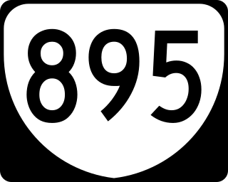
State Route 895, also known as the Pocahontas Parkway and Pocahontas 895, is a controlled-access toll road in the U.S. state of Virginia. It connects the junction of Interstate 95 and State Route 150 in Chesterfield County with Interstate 295 near Richmond International Airport in Henrico County, forming part of a southeastern bypass of Richmond. Due to a quirk in the evolution of the road, the long-planned designation of Interstate 895 could not be used.

The Delaware River Joint Toll Bridge Commission (DRJTBC) is a bistate, public agency that maintains and operates river crossings connecting the U.S. states of Pennsylvania and New Jersey. The agency's jurisdiction stretches roughly 140 miles (230 km) along the Delaware River from Philadelphia and Bucks County in southeast Pennsylvania and then north through the Lehigh Valley and to Pennsylvania-New York state border.
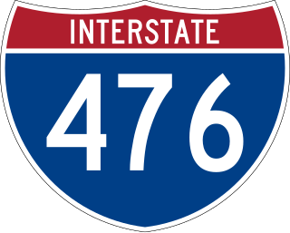
Interstate 476 (I-476) is a 132.1-mile (212.6 km) auxiliary Interstate Highway of I-76 in the U.S. state of Pennsylvania. The highway runs from I-95 near Chester north to I-81 near Scranton, serving as the primary north–south Interstate corridor through eastern Pennsylvania. It consists of both the 20-mile (32 km) Mid-County Expressway, locally referred to as the "Blue Route", through Delaware and Montgomery counties in the suburban Philadelphia area, and the tolled, 110.6-mile (178.0 km) Northeast Extension of the Pennsylvania Turnpike, which connects the Delaware Valley with the Lehigh Valley, the Pocono Mountains, and the Wyoming Valley to the north.
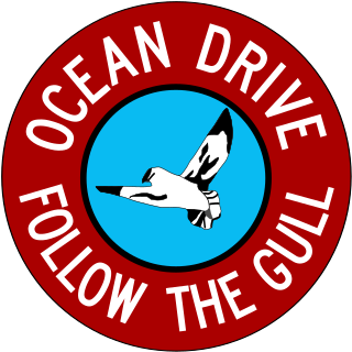
Ocean Drive is a series of local toll roads in southern New Jersey, connecting Atlantic City to Cape May along barrier islands on the Atlantic Ocean. It consists of several roads and includes all five drawbridges owned by the Cape May County Bridge Commission.
The Moundsville Bridge is a four-lane through arch bridge that connects Mead Township, Ohio and Moundsville, West Virginia across the Ohio River. The approach routes to the bridge carries Ohio State Route 872 on the Ohio side and the unsigned West Virginia Route 2 Spur on the West Virginia side. The bridge is also officially known as the Arch A. Moore Bridge, named after the former West Virginia governor Arch A. Moore, Jr.

Interstate 77 (I-77) in the US state of West Virginia is a major north–south Interstate Highway. It extends for 187.21 miles (301.29 km) between Bluefield at the Virginia state line and Williamstown at the Ohio state line.

The Easton–Phillipsburg Toll Bridge is a modified Pennsylvania (Petit) through truss bridge that carries U.S. Route 22 over the Delaware River. The bridge is located between Easton, Pennsylvania and Phillipsburg, New Jersey in the Lehigh Valley.

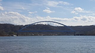
The Hi Carpenter Memorial Bridge is a cantilever bridge over the Ohio River between Newport, Ohio and St. Marys, West Virginia. It carries Ohio State Route 807 and West Virginia Route 807 and serves to connect WV 2 with OH 7.
Virginia HOT lanes refers to six separate projects in the U.S. state of Virginia. The first project, completed in November 2012, added high-occupancy/toll (HO/T) lanes to the Capital Beltway (I-495) in Fairfax County. The second project, opened to the public in December 2014, involved converting and extending the existing reversible high-occupancy vehicle (HOV) lanes on I-95 and a portion of I-395 to HO/T lanes from Stafford to near Alexandria. The third project converted all lanes on I-66 inside the Beltway to peak-direction HO/T lanes, opening on December 4, 2017. The fourth project reconstructed approximately 21 miles (34 km) of I-66 outside the Beltway, making it a 10-lane corridor. The fifth project, which was completed in November 2019, essentially extended the aforementioned I-95/I-395 project several miles to the north, converting the existing reversible HOV lanes on I-395 to HO/T lanes from near Alexandria to Washington, DC. The sixth project will convert the existing reversible HOV lanes to HO/T Lanes on Interstate 64 from Interstate 564 in Norfolk to Interstate 264 in Virginia Beach, and also propose to expand the I-64 express lanes before and after the HO/T Lanes. The seventh project, which is be completed by Spring 2024, extended I-95's HO/T lanes from VA 610 in Garrisonville to its northernmost interchange with US 17 and US 17 business in Falmouth. The eighth project, which is expected to be completed by 2026, will extend the Capital Beltway's (I-495) HO/T lanes two miles north from VA 267 in Tysons to the American Legion Memorial Bridge.

The Market Street Bridge is a suspension bridge connecting Market Street in Steubenville, Ohio and West Virginia Route 2 in Follansbee, West Virginia over the Ohio River. As a project of the Steubenville Bridge Company, it was constructed in 1905 by the Ohio Steel Erection Company, the framework was created by the Penn Bridge Company, and the original steel was done by Jones and Laughlin Steel Company and Bethlehem Steel. The bridge spans a length of 1,794 feet (547 m) with a width of 20.7 feet (6.3 m). As of 2002, the average daily traffic was estimated around 15,000 vehicles. It was listed on the National Register of Historic Places in 2019.