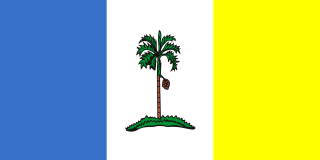
Penang is a Malaysian state located on the northwest coast of Peninsular Malaysia, by the Malacca Strait. It has two parts: Penang Island, where the capital city, George Town, is located, and Seberang Perai on the Malay Peninsula. These two halves are physically connected by the Penang Bridge and the Second Penang Bridge. The state shares borders with Kedah to the north and east, and Perak to the south.

Butterworth is the city centre of Seberang Perai in the Malaysian state of Penang. It lies about 3 km (1.9 mi) east of George Town, the capital city of Penang, across the Penang Strait. As of 2020, Butterworth had a total population of 80,378 residents.

Seberang Perai is a city in the Malaysian state of Penang. Located on the Malay Peninsula and separated from Penang Island by the Penang Strait, it shares borders with Kedah to the north and east, and Perak to the south. The city spans an area of 748 km2 (289 sq mi) and had a population of 946,092 as of 2020, making it the third largest city in Malaysia.

Bukit Mertajam is a suburb of Seberang Perai in the Malaysian state of Penang. It also serves as the seat of the Central Seberang Perai District. As of 2010, Bukit Mertajam (core) contains a total of 13,097 residents.

Nibong Tebal is a suburb of Seberang Perai in the Malaysian state of Penang. Located at the northern bank of the Kerian River within the Southern Seberang Perai District, it is the southernmost populated place of Penang. Nibong Tebal contained a population of 2,045 as of 2010.

Perai is a suburb of Seberang Perai in the Malaysian state of Penang. It lies at the southern bank of the Perai River and borders Butterworth to the north.

Teluk Bahang is a suburb of George Town within the Malaysian state of Penang. It is located 13.6 km (8.5 mi) west of the city centre near the northwestern tip of Penang Island. Established as a fishing village, Teluk Bahang has evolved into a tourist destination, with a number of attractions built within the vicinity of the town.

The Bandar Baharu District is a town, district and state assembly constituency at the southernmost end of Kedah, Malaysia. Bandar Baharu is located along the Kedah-Penang–Perak border tripoint, 37 km (23 mi) southeast of George Town, Penang's capital city.

Seberang Jaya is a township within the city of Seberang Perai in the Malaysian state of Penang. Located at the southern bank of the Perai River and east of Perai proper, the area was developed in the 1970s. Since then, Seberang Jaya has evolved into a booming area, with various commercial and retail developments.

Batu Kawan is an island and suburb of Seberang Perai in the Malaysian state of Penang. It is geographically separated from the rest of Seberang Perai by the Jawi and Tengah rivers. As of 2010, Batu Kawan contained a population of 5,537.

Ayer Itam is a suburb of George Town in the Malaysian state of Penang. Nested within the central valleys of Penang Island, it is located approximately 6 km (3.7 mi) southwest of the city centre. The suburb is home to Kek Lok Si, touted as the largest Buddhist temple in the country.

Gelugor is a suburb of George Town in the Malaysian state of Penang. Named after a plant species, Gelugor lies along the eastern seaboard of Penang Island, between Jelutong and Sungai Dua, and nearly 5 km (3.1 mi) south of the city centre.

The Penang Strait is an 11 kilometre-wide strait that separates Penang Island from mainland Malay Peninsula. Penang Island is to the west of the channel, while Seberang Perai, the mainland half of the State of Penang, is to the east. The northern and southern ends of the channel join the Strait of Malacca, one of the world's busiest maritime routes.

The State of Penang in Malaysia, home to the country's third largest city as well as part of Malaysia's second most populous conurbation, has a relatively well-developed transport infrastructure. The city-state is well-connected by land, air and sea; the Penang International Airport is one of Malaysia's busiest, while the Port of Penang is the main harbour and transshipment hub within northern Malaysia. The North–South Expressway, the main highway along western Peninsular Malaysia, runs through Penang, while the two geographically separate halves of the state are now linked by two bridges and a ferry service.

The North-East District is a district within the Malaysian state of Penang. The district covers the northeastern half of Penang Island, including the centre of George Town, Penang's capital city. It has an area of 122.79 km2 (47.41 sq mi) and a population of 510,996 as of 2010. The district borders the South-West District to the south-west.

The Seberang Perai City Council is the city council which administers Seberang Perai, the mainland half of the Malaysian state of Penang. This agency is under the purview of the Penang state government.

Mengkuang Titi is a village within the city of Seberang Perai in the Malaysian state of Penang. It is located not too far from the Mengkuang Dam. The village has a population of about 800, and still retains the rustic feel ideal for the development of agricultural and cottage industries.

The Greater Penang Conurbation, also known as the George Town Conurbation, is the built-up urban or metropolitan area within and around the Malaysian state of Penang. Encompassing all of Penang, and parts of the neighbouring states of Kedah and Perak, the conurbation was home to over 2.84 million people as of 2020, the second largest in the country after the Klang Valley.

Penangite Chinese are ethnic Chinese Malaysians of full or partial Chinese ancestry who either hail from or live within the State of Penang. As of 2020, 45% of Penang's population belonged to the Chinese ethnic group, making ethnic Chinese the largest ethnic community within the state.

The Port of Penang is a deepwater seaport within the Malaysian state of Penang. It consists of terminals along the Penang Strait, including five in Seberang Perai and one in George Town. The Port of Penang was the third busiest harbour in Malaysia in terms of cargo as of 2017, handling 1.52 million TEUs of cargo, as well as the busiest port-of-call within the country for cruise shipping.


