Related Research Articles

Maitland is a city in the Lower Hunter Valley of New South Wales, Australia and the seat of Maitland City Council, situated on the Hunter River approximately 166 kilometres (103 mi) by road north of Sydney and 35 km (22 mi) north-west of Newcastle. It is on the New England Highway about 17 km (11 mi) from its start at Hexham.

Branxton is a town in the Hunter Region of New South Wales, Australia. Branxton is 171 kilometres (106 mi) north of Sydney via the Sydney-Newcastle Freeway and New England Highway. Branxton is located mostly in the City of Cessnock, but part of it is in Singleton Shire. It had a population of 1,991 at the 2016 census.

Maitland railway station is located on the Main Northern line in New South Wales, Australia. It serves the city of Maitland opening on in 1880 as West Maitland being renamed on 1 April 1949. It is the junction station for the Main Northern and North Coast lines. It was added to the New South Wales State Heritage Register on 2 April 1999.

Waratah railway station is located on the Main Northern line in New South Wales, Australia. It serves the western Newcastle suburbs of Waratah and Mayfield.

Sandgate railway station is located on the Main Northern line in New South Wales, Australia. It serves the western Newcastle suburb of Sandgate, opening in 1881 as Grant's Creek.

Thornton railway station is located on the Main Northern line in New South Wales, Australia. It serves Thornton in the eastern suburbs of Maitland opening in 1913.

Metford railway station is located on the Main Northern line in New South Wales, Australia. It serves Metford in the eastern suburbs of Maitland, opening on 17 March 1995.

Victoria Street railway station is a heritage-listed railway station located on the Main Northern line in New South Wales, Australia. It serves the Victoria Street area of East Maitland. It was added to the New South Wales State Heritage Register on 2 April 1999.

East Maitland railway station is a heritage-listed railway station located on the Main Northern line in New South Wales, Australia serving East Maitland. It is the fourth site of the station known as East Maitland. It was added to the New South Wales State Heritage Register on 2 April 1999.

Kurri Kurri is a small town in the Hunter Region of New South Wales, Australia, in the Cessnock LGA. At the 2016 census, its population was 6,044. Kurri Kurri is the largest town in a group of towns and hamlets, including Stanford Merthyr, Pelaw Main, Weston, Abermain and Heddon Greta, called Kurri Kurri – Weston by the ABS. Its estimated population was 17,241 at 2016 census.

Greta is a small town in the Hunter Region of New South Wales, Australia. The Traditional Owners and Custodians of the Maitland area are the Wonnarua people. Greata started a small community around Anvil Creek in 1830s. Settled by Europeans from around 1822, when the town was surveyed in 1842 it was given the name Greta, possibly after a small river in Cumberland, England. Coal mining was established in the area in 1862 with the development of a railway station.. In 1864 keroscene shale was discovered.. By the 1870s, Greta had four hotels, four churches ,a school and schools of arts..Geologist Edgeworth David discovered coal seam in 1886. By 1907 ten collieries were in operation. In 1939 an army training camp was established. After WWII the town's population grew as it became a migrant camp for European refugees. The small town has a large European community with many people coming from, Polish, Ukrainian and German heritage. At the 2016 census the town had a population of 2,830. The Main Street of Greta, High street is a quiet stretch of road with the most popular social areas being Tattersalls Hotel Pub and the bowling club. These days it is largely a commuter town located midway between Cessnock, Singleton and Maitland. A convenient location for miners and their families to live. The town is also linked to nearby town, Branxton where you will find the nearest grocery store. Being in the Hunter Valley, Greta is close to many vineyards and wine cellars.
Thornton is a suburb in the City of Maitland, New South Wales, Australia. It is bisected by the New England Highway.

East Maitland is a suburb in the City of Maitland, New South Wales, Australia. It is on the New England Highway and it has two railway stations, Victoria Street and East Maitland. Both stations are served by NSW TrainLink's Hunter Line. Hunter Valley Buses provides bus service.
Telarah is a suburb in the City of Maitland, New South Wales, Australia. The suburb was formerly known as Homeville, however use of this name was abandoned in the 1950s. It is located on the New England Highway and is also the site of a major rail junction, where the North Coast line and the once extensive, privately owned South Maitland Railway system meet the Main North line. A station on the North Coast line opened in 1911 and is served by NSW TrainLink's Hunter Line, with services to Newcastle and Dungog. Telarah has its own fire brigade as well as bowling club, supermarket, pharmacy, takeaway shop and newsagents.

Tarro is a north-western suburb of the Newcastle City Council local government area in the Hunter Region of New South Wales, Australia. It, and parts of nearby Beresfield, was originally known as Upper Hexham, "lower" Hexham being an older settlement located about 5 kilometres (3 mi) to the east on the Hunter River. The name "Tarro" reportedly means "stone" in an Aboriginal language.
Wickham is an inner suburb of Newcastle, New South Wales, Australia, located 3 kilometres (1.9 mi) from Newcastle's central business district.

The Newcastle railway line is a branch railway line in the city of Newcastle, New South Wales, Australia. The line branches off the Main North line at Broadmeadow and travels in an easterly direction through the inner suburbs to Newcastle Interchange, with one intermediate station at Hamilton. Until its curtailment in December 2014, it extended to Newcastle station. NSW TrainLink operates electric passenger train services over this line as part of its Central & Newcastle line service, and diesel railcars to Maitland and beyond as part of the Hunter Line.
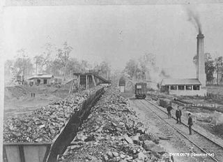
The South Maitland Railway was once an extensive network of privately owned colliery and passenger railway lines which served the South Maitland coalfields in the Hunter Region of New South Wales, Australia and were the second last system in Australia to use steam haulage, having used steam locomotives until 1983.
Gillieston Heights is a suburb of the City of Maitland local government area in the Hunter Region of New South Wales, Australia, approximately 5.1 km (3.2 mi) from the Maitland CBD. Prior to 1967, the village was named East Greta however this was changed to honour former Maitland mayor and member of the New South Wales Legislative Assembly John Gillies following a poll of residents. At the 2016 census, Gillieston Heights had a population of over 3,000.
Newcastle Interchange is a transport interchange situated in the Australian city of Newcastle, New South Wales. It serves as the termini for NSW TrainLink's Central Coast & Newcastle Line and Hunter Line train services, Newcastle Light Rail services and Newcastle Transport bus routes.
References
- ↑ Australian Bureau of Statistics (27 June 2017). "Metford". 2016 Census QuickStats. Retrieved 8 December 2017.

- ↑ "Main North Line". www.nswrail.net. Retrieved 22 November 2006.
- ↑ Brian Langton MLA, "Questions and Answers - 491: Railway Station Openings" Archived 2014-06-24 at the Wayback Machine : New South Wales Legislative Assembly, Hansard, 16 April 1996, p. 1006. Accessed January 7, 2008.
- ↑ "Metford Public School". NSW Department of Education. Retrieved 9 September 2020.
- ↑ "home". Maitland Christian School. Retrieved 9 September 2020.
| This City of Maitland geography article is a stub. You can help Wikipedia by expanding it. |