Miccosukee, like other unincorporated areas in northern Leon County, is an area of rolling hills dotted with ponds and lakes. The large, swampyLake Miccosukee borders the eastern edge of the community. It is located at the junction of County Roads 59 and 151.
History
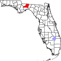
Settlement of Miccosukee, Leon County, Florida
The town of Miccosukee or Mikasuki was settled by members of the Miccosukee tribe, a group of Creek origin who had settled in Florida and became identified with the developing Seminole nation. It was mapped by the British in 1778 and originally called Mikasuki with 60 homes, 28 families, and a town square. It was the capital of the short-lived State of Muskogee.
At the time of the 1818 American invasion of Spanish Florida, during the First Seminole War, "Andrew Jackson and his men were stunned by the sheer size of the Miccosukee town. Having been occupied since before the American Revolution, it was a town of long-standing permanence." Jackson burned over 300 homes before departing on April 5, 1818.[4]:91–92 Whites estimated there were up to 500 warriors, and "the town was the largest in Florida at the time".[5]:183
After the Civil War, the area reverted to farms and by 1887, the Florida Central Railroad served Miccosukee. During the 1890s, wealthy industrialists bought large tracts of land for quail hunting plantations or estates removing thousands of acres of land from agricultural production. Miccosukee thrived until the boll weevil infestation of 1918. The Great Depression (1929-1935) destroyed Leon County's agriculture[citation needed] and the railroad pulled out in the mid-1940s.
As of the 2020 United States census, there were 383 people, 120 households, and 70 families residing in the CDP.
Historical places
Concord School (Miccosukee) was built in 1894 in the town of Miccosukee for grades 1-6. It was closed in 1985. The building is still used for Miccosukee's Head Start program.
Concord School - Served as a Leon County elementary school until it closed in 1985.[9] The school yard now serves as a county park.[10]
The Miccosukee Community Center is administered by the Tallahassee-Leon County Parks and Recreation Department. The center is used for a variety of activities including monthly "Senior Outreach" days.[11]
Reeves Landing is a public boat launching facility on Lake Miccosukee just east of the village.
Miccosukee Volunteer Fire & Rescue was established in 1978 with the merger of Miccosukee Land Cooperative and Miccosukee in 1979. The department has 3 fire stations: Cromartie Road Station, Co-op Station and Heatherwood Station, each with a pumper truck.[13] The Tallahassee Fire Department also provides support.
↑Note: the US Census treats Hispanic/Latino as an ethnic category. This table excludes Latinos from the racial categories and assigns them to a separate category. Hispanics/Latinos can be of any race.[7][8]
Paisley, Clifton; From Cotton To Quail, University of Florida Press, c1968.
This page is based on this Wikipedia article Text is available under the CC BY-SA 4.0 license; additional terms may apply. Images, videos and audio are available under their respective licenses.


