Woodville, Florida

Last updated

Woodville, Florida
CDP
Leon County Florida Incorporated and Unincorporated areas Woodville Highlighted.svg
Location in Leon County and the state of Florida
Coordinates: 30°18′27″N84°15′8″W / 30.30750°N 84.25222°W / 30.30750; -84.25222
Country Flag of the United States.svg  United States
State Flag of Florida.svg  Florida
County   Leon
Area
[1]
  Total8.46 sq mi (21.91 km2)
  Land8.45 sq mi (21.87 km2)
  Water0.01 sq mi (0.03 km2)
Elevation
[2]
36 ft (11 m)
Population
 (2020)
  Total4,097
  Density485.08/sq mi (187.30/km2)
Time zone UTC-5 (Eastern (EST))
  Summer (DST) UTC-4 (EDT)
ZIP code
32305
Area code 850
FIPS code 12-78700 [3]
GNIS feature ID0306616 [2]

Woodville is a census-designated place in Leon County, Florida, United States, just south of Tallahassee, Florida. The population was 4,097 at the 2020 census, up from 2,978 at the 2010 census. It is part of the Tallahassee, Florida Metropolitan Statistical Area. The American Civil War Battle of Natural Bridge, in March 1865, occurred in what is now Woodville, at the Natural Bridge (approximately six miles from Woodville proper). This is where the St. Marks River drops into a sinkhole, the Natural Bridge Sink and flows underground, reemerging .25 miles (0.40 km) later. [4]

Contents

Geography

Woodville is located at 30°18′27″N84°15′8″W / 30.30750°N 84.25222°W / 30.30750; -84.25222 (30.307453, -84.252215). [5]

According to the United States Census Bureau, the CDP has a total area of 6.4 square miles (17 km2), all land.

Demographics

Historical population
CensusPop.Note
1990 2,760
2000 3,0068.9%
2010 2,978−0.9%
2020 4,09737.6%
U.S. Decennial Census [6]

2020 census

Woodville racial composition [7]
(NH = Non-Hispanic) [lower-alpha 1]
RaceNumberPercentage
White (NH)2,51361.34%
Black or African American (NH)1,09826.8%
Native American or Alaska Native (NH)190.46%
Asian (NH)90.22%
Pacific Islander (NH)70.17%
Some Other Race (NH)200.49%
Mixed/Multi-Racial (NH)2365.76%
Hispanic or Latino 1954.76%
Total4,097

As of the 2020 United States census, there were 4,097 people, 1,475 households, and 1,106 families residing in the CDP.

2000 census

As of the census [3] of 2000, there were 3,006 people, 1,182 households, and 855 families residing in the CDP. The population density was 427.8 inhabitants per square mile (165.2/km2). There were 1,278 housing units at an average density of 198.9 per square mile (76.8/km2). The racial makeup of the CDP was 79.34% White, 18.30% African American, 0.70% Native American, 0.13% Asian, 0.27% from other races, and 1.26% from two or more races. Hispanic or Latino of any race were 2.00% of the population.

There were 1,182 households, out of which 32.0% had children under the age of 18 living with them, 50.7% were married couples living together, 15.4% had a female householder with no husband present, and 27.6% were non-families. 21.7% of all households were made up of individuals, and 7.0% had someone living alone who was 65 years of age or older. The average household size was 2.54 and the average family size was 2.92.

In the CDP, the population was spread out, with 25.1% under the age of 18, 8.8% from 18 to 24, 29.2% from 25 to 44, 26.3% from 45 to 64, and 10.6% who were 65 years of age or older. The median age was 37 years. For every 100 females, there were 95.6 males. For every 100 females age 18 and over, there were 92.0 males.

The median income for a household in the CDP was $38,946, and the median income for a family was $42,026. Males had a median income of $26,495 versus $27,237 for females. The per capita income for the CDP was $19,915. About 6.2% of families and 10.7% of the population were below the poverty line, including 19.0% of those under age 18 and 2.8% of those age 65 or over.

Climate

The climate in this area is characterized by hot, humid summers and generally mild to cool winters. According to the Köppen Climate Classification system, Woodville has a humid subtropical climate, abbreviated "Cfa" on climate maps. [10]

Related Research Articles

<span class="mw-page-title-main">San Antonio Heights, California</span> Census-designated place in California, United States

San Antonio Heights is a census-designated place (CDP) in the San Bernardino County, California. It is in the northern Pomona Valley and the foothills of the San Gabriel Mountains. The population was 3,371 at the 2010 census, up from 3,122 at the 2000 census.

<span class="mw-page-title-main">Fanning Springs, Florida</span> City in Florida, United States

Fanning Springs is a city in Gilchrist and Levy counties in the U.S. state of Florida. It is part of the Gainesville, Florida Metropolitan Statistical Area. The population was 1,182 at the 2020 census, up from 764 at the 2010 census.

<span class="mw-page-title-main">Charleston Park, Florida</span> Census-designated place in Florida, United States

Charleston Park is an unincorporated community and census-designated place (CDP) in Lee County, Florida, United States. The population was 235 at the 2020 census, up from 218 at the 2010 census. It is part of the Cape Coral-Fort Myers, Florida Metropolitan Statistical Area.

<span class="mw-page-title-main">North Fort Myers, Florida</span> Census-designated place in Florida, United States

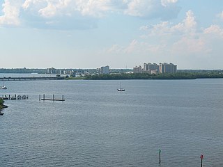
North Fort Myers is an unincorporated area and census-designated place (CDP) in Lee County, Florida, United States. The population was 42,719 at the 2020 census, up from 39,407 at the 2010 census. It is part of the Cape Coral-Fort Myers, Florida Metropolitan Statistical Area.

<span class="mw-page-title-main">Suncoast Estates, Florida</span> Census-designated place in Florida, United States

Suncoast Estates is a census-designated place (CDP) in Lee County, Florida, United States. The population was 4,097 at the 2020 census, down from 4,384 at the 2010 census. It is part of the Cape Coral-Fort Myers, Florida Metropolitan Statistical Area.

<span class="mw-page-title-main">Coral Terrace, Florida</span> Census-designated place in Florida

Coral Terrace is a suburban unincorporated community and census-designated place (CDP) in Miami-Dade County, Florida, United States. It is part of the Miami metropolitan area of South Florida. The population was 23,142 at the 2020 census, down from 24,376 in 2010.

<span class="mw-page-title-main">Glenvar Heights, Florida</span> Census-designated place in Florida

Glenvar Heights is a census-designated place (CDP) and neighborhood in Miami-Dade County, Florida, United States. It is part of the Miami metropolitan area of South Florida. The population was 20,786 at the 2020 US census, up from 16,898 in 2010 US census.

<span class="mw-page-title-main">Homestead Base, Florida</span> Census-designated place in Florida

Homestead Base is a census-designated place (CDP) in Miami-Dade County, Florida, United States. The CDP comprises the extent of Homestead Air Reserve Base plus some surrounding land. It is part of the Miami metropolitan area of South Florida. The population was 999 at the 2020 census.

<span class="mw-page-title-main">Kendall West, Florida</span> Census-designated place in Florida

Kendall West is a census-designated place and unincorporated community in Miami-Dade County, Florida, west of the Florida Turnpike. It is located in the Miami metropolitan area of South Florida. The population was 36,536 at the 2020 census.

<span class="mw-page-title-main">Leisure City, Florida</span> Census-designated place in Florida

Leisure City is an unincorporated community and census-designated place (CDP) in Miami-Dade County, Florida, United States, that includes the smaller, older community of Modello in its northwestern section. The CDP is most notable for the Coral Castle Museum, located in the Modello area. It is located in the Miami metropolitan area of South Florida. The population was 26,324 at the 2020 census, up from 22,655 in 2010.

<span class="mw-page-title-main">Westview, Florida</span> Census-designated place in Florida

Westview is a census-designated place (CDP) in Miami-Dade County, Florida, United States. It is part of the Miami metropolitan area of South Florida. The population was 9,923 at the 2020 census.

<span class="mw-page-title-main">South Apopka, Florida</span> Census-designated place in Florida, United States

South Apopka is a census-designated place and an unincorporated area in Orange County, Florida, United States. Per the 2020 census, the population was 6,803. It is part of the Orlando–Kissimmee Metropolitan Statistical Area.

<span class="mw-page-title-main">Babson Park, Florida</span> Census-designated place in Florida, US

Babson Park is a census-designated place (CDP) in Polk County, Florida, United States. The population was 1,182 at the 2000 census. It is also the home of Webber International University.

<span class="mw-page-title-main">Experiment, Georgia</span> Place in Georgia, United States

Experiment is an unincorporated community and census-designated place (CDP) in Spalding County, Georgia, United States. The population was 3,233 at the 2000 census.

<span class="mw-page-title-main">Housatonic, Massachusetts</span> Census-designated place in Massachusetts, United States

Housatonic is a census-designated place (CDP) in the town of Great Barrington in Berkshire County, Massachusetts, United States. It is part of the Pittsfield, Massachusetts Metropolitan Statistical Area. The population was 1,109 at the 2010 census. It was named after the Housatonic River.

<span class="mw-page-title-main">Sand Ridge, New York</span> CDP in New York, United States

Sand Ridge is a hamlet in Oswego County, New York, United States. The population was 849 at the 2010 census.

<span class="mw-page-title-main">Lipscomb, Texas</span> Census-designated place in Texas, United States

Lipscomb is an unincorporated community and census-designated place (CDP) in Lipscomb County, Texas, United States. It is the Lipscomb county seat. The population was 37 at the 2010 census.

<span class="mw-page-title-main">Deweyville, Texas</span> CDP in Texas, United States

Deweyville is a census-designated place (CDP) in Newton County, on the central eastern border of Texas, United States. The population was 571 at the 2020 census, down from 1,023 at the 2010 census.

<span class="mw-page-title-main">Woodville, Texas</span> Town in Texas, United States

Woodville is a town and county seat of Tyler County, Texas, United States. The town is intersected by three U.S. highways: U.S. Highway 69, U.S. Highway 190, and U.S. Highway 287. The population was 2,403 at the 2020 census. It is the county seat of Tyler County. The town was named after George Tyler Wood, governor of Texas from 1847 to 1849.

<span class="mw-page-title-main">Fort Kent (CDP), Maine</span> Census-designated place in Maine, United States

Fort Kent is a census-designated place (CDP) that comprises the main village in the town of Fort Kent in Aroostook County, Maine, United States. In 2010, Fort Kent's population was 2,488 of 4,097 for the entire town.

References

  1. "2020 U.S. Gazetteer Files". United States Census Bureau. Retrieved December 2, 2021.
  2. 1 2 U.S. Geological Survey Geographic Names Information System: Woodville, Florida
  3. 1 2 "U.S. Census website". United States Census Bureau . Retrieved January 31, 2008.
  4. "Natural Bridge Battlefield Historic State Park". StateParks.Com. Retrieved August 27, 2016.
  5. "US Gazetteer files: 2010, 2000, and 1990". United States Census Bureau. February 12, 2011. Retrieved April 23, 2011.
  6. "Census of Population and Housing". Census.gov. Retrieved June 4, 2016.
  7. "Explore Census Data". data.census.gov. Retrieved May 18, 2022.
  8. https://www.census.gov/ [ not specific enough to verify ]
  9. "About the Hispanic Population and its Origin". www.census.gov. Retrieved May 18, 2022.
  10. Climate Summary for Woodville, Florida
  1. Note: the US Census treats Hispanic/Latino as an ethnic category. This table excludes Latinos from the racial categories and assigns them to a separate category. Hispanics/Latinos can be of any race. [8] [9]