Mid-Continental Canadian forests

Last updated
Mid-Continental Canadian Forests
Waskesiu Lake in Prince Albert National Park Saskatchewan, Canada.jpg
Mid-Continental Canadian forests map.svg
Ecology
Realm Nearctic
Biome Boreal forests/taiga
Borders
Bird species183 [1]
Mammal species55 [1]
Geography
Area367,778 km2 (142,000 sq mi)
Country Canada
Provinces
Conservation
Conservation status Vulnerable [2]
Habitat loss0.4% [1]
Protected15.5% [1]

The Mid-Continental Canadian forests are a taiga ecoregion of Western Canada, as defined by the World Wildlife Fund (WWF) categorization system. [2]

Contents

Setting

This ecoregion extends from south of the Great Slave Lake in the Northwest Territories through most of northeastern Alberta, central Saskatchewan and parts of west-central Manitoba and consists of three main areas: the Slave River basin in northeastern Alberta, the lowlands of the northern Manitoba plain, and the uplands south of the Canadian Shield from north-central Alberta to southwestern Manitoba. This is a mixed area of lowlands and mountains up to 800m high, including areas of wetland and peat bog and mountain lakes and ponds. The area has a subhumid mid-boreal ecoclimate with short summers (average temperature 14°C) and long, cold winters (ave. -15°C) and patches of permafrost in the lowlands. [2]

Flora

These forests, like so much of Canada at this latitude, are a mixture of conifers and deciduous trees including quaking aspen ( Populus tremuloides ), balsam poplar ( Populus balsamifera ), white spruce ( Picea glauca ), paper birch ( Betula papyrifera ), black spruce ( Picea mariana ), white spruce ( Picea glauca ), jack pine ( Pinus banksiana ) and balsam fir ( Abies balsamea ).

Fauna

Wildlife of the area includes moose ( Alces alces ), American black bear ( Ursus americanus ), wolf ( Canis lupus ), Canada lynx ( Lynx canadensis ), white-tailed deer ( Odocoileus virginianus ), elk ( Cervus canadensis ), North American beaver ( Castor canadensis ), muskrat ( Ondatra zibethicus ), snowshoe hare ( Lepus americanus ). The plain to the south of the lake is home to moose, coyote ( Canis latrans ), and eastern cottontail ( Sylvilagus floridanus ) as well. Wood Buffalo National Park on the Slave River is the largest national park in Canada and home to the world's largest herd of American bison ( Bison bison ).

Birds include ducks, geese, American white pelican ( Pelecanus erythrorhynchos ), sandhill crane ( Grus canadensis ), ruffed grouse ( Bonasa umbellus ) and common loon ( Gavia immer ) The wetlands of the region, such as Cumberland Lake, are an important refuge for migratory birds and include the most important breeding populations of the endangered whooping crane in North America.

Threats and preservation

Half of the natural forest remains intact, the other half having been removed by extensive logging, oil and gas exploration and mining. Blocks of intact forest include Wood Buffalo Park, the areas around Cold Lake/Primrose Lake and Doré Lake, Prince Albert National Park, to the north of Cumberland Lake, Riding Mountain National Park, Porcupine Hills, Duck Mountain Provincial Park (Manitoba), Duck Mountain Provincial Park (Saskatchewan) (near the town of Kamsack) and the Peace–Athabasca Delta on the Slave River. Other protected areas include Clearwater River (Saskatchewan), Meadow Lake Provincial Park (near Goodsoil, Saskatchewan) and Narrow Hills Provincial Park.

See also

Related Research Articles

<span class="mw-page-title-main">Aspen parkland</span> Temperate grasslands, savannas, and shrublands ecoregion of Canada and the United States

Aspen parkland refers to a very large area of transitional biome between prairie and boreal forest in two sections, namely the Peace River Country of northwestern Alberta crossing the border into British Columbia, and a much larger area stretching from central Alberta, all across central Saskatchewan to south central Manitoba and continuing into small parts of the US states of Minnesota and North Dakota. Aspen parkland consists of groves of aspen, poplar and spruce, interspersed with areas of prairie grasslands, also intersected by large stream and river valleys lined with aspen-spruce forests and dense shrubbery. This is the largest boreal-grassland transition zone in the world and is a zone of constant competition and tension as prairie and woodlands struggle to overtake each other within the parkland.

<span class="mw-page-title-main">British Columbia mainland coastal forests</span> Temperate coniferous forest ecoregion in British Columbia, Canada and Washington, United States

British Columbia mainland coastal forests is a temperate coniferous forest ecoregion the Pacific coast of North America, as defined by the World Wildlife Fund (WWF) categorization system.

<span class="mw-page-title-main">New England–Acadian forests</span> Temperate broadleaf and mixed forest ecoregion of Canada and the United States

The New England-Acadian forests are a temperate broadleaf and mixed forest ecoregion in North America that includes a variety of habitats on the hills, mountains and plateaus of New England and New York State in the Northeastern United States, and Quebec and the Maritime Provinces of Eastern Canada.

<span class="mw-page-title-main">Cascade Mountains leeward forests</span> Temperate coniferous forest ecoregion in British Columbia, Canada and Washington, United States

The Cascade Mountains leeward forests are a temperate coniferous forest ecoregion of North America, as defined by the World Wildlife Fund (WWF) categorization system.

<span class="mw-page-title-main">Eastern forest–boreal transition</span> Temperate broadleaf and mixed forest ecoregion in Canada and the United States

The eastern forest–boreal transition is a temperate broadleaf and mixed forests ecoregion of North America, mostly in eastern Canada. It is a transitional zone or region between the predominantly coniferous Boreal Forest and the mostly deciduous broadleaf forest region further south.

<span class="mw-page-title-main">Gulf of St. Lawrence lowland forests</span> Temperate broadleaf and mixed forest ecoregion of Canada and the United States

The Gulf of St. Lawrence lowland forests are a temperate broadleaf and mixed forest ecoregion of Eastern Canada, as defined by the World Wildlife Fund (WWF) categorization system.

<span class="mw-page-title-main">Alberta Mountain forests</span> Temperate coniferous forests ecoregion of Alberta and British Columbia, Canada

The Alberta Mountain forests are a temperate coniferous forests ecoregion of Western Canada, as defined by the World Wildlife Fund (WWF) categorization system.

<span class="mw-page-title-main">Alberta–British Columbia foothills forests</span> Temperate coniferous forests ecoregion of Alberta and British Columbia, Canada

The Alberta–British Columbia foothills forests are a temperate coniferous forests ecoregion of Western Canada, as defined by the World Wildlife Fund (WWF) categorization system. This ecoregion borders Canada's taiga and contains a mix of subarctic forest and temperate forest species as a result. This makes the region an ecotone region, or a region that acts as a buffer between two other biomes.

<span class="mw-page-title-main">Eastern Canadian forests</span> Taiga ecoregion of eastern Canada

The Eastern Canadian forests is a taiga ecoregion in Eastern Canada, as defined by the World Wildlife Fund (WWF) categorization system.

<span class="mw-page-title-main">Eastern Canadian Shield taiga</span> Taiga ecoregion of Labrador and Quebec, Canada

The Eastern Canadian Shield taiga is an ecoregion of Canada as defined by the World Wildlife Fund (WWF) categorization system.

<span class="mw-page-title-main">Yukon Interior dry forests</span> Taiga ecoregion of British Columbia and Yukon, Canada

The Yukon Interior dry forests is a taiga ecoregion of Canada.

<span class="mw-page-title-main">Muskwa–Slave Lake forests</span> Taiga ecoregion of northwestern Canada

The Muskwa-Slave Lake forests ecoregion covers Canadian taiga in northwestern Alberta, northeastern British Columbia and a large portion of the southwestern Northwest Territories around the Mackenzie River valley and the Great Slave Lake.

<span class="mw-page-title-main">South Central Rockies forests</span> Temperate coniferous forests ecoregion of the United States

The South Central Rockies forests is a temperate coniferous forest ecoregion of the United States located mainly in Wyoming, Idaho, and Montana. It has a considerably drier climate than the North Central Rockies forest.

<span class="mw-page-title-main">North Central Rockies forests</span> Temperate coniferous forest ecoregion in Canada and the United States

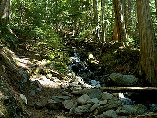
The North Central Rockies forests is a temperate coniferous forest ecoregion of Canada and the United States. This region overlaps in large part with the North American inland temperate rainforest and gets more rain on average than the South Central Rockies forests and is notable for containing the only inland populations of many species from the Pacific coast.

<span class="mw-page-title-main">Midwestern Canadian Shield forests</span> Taiga ecoregion of Canada

The Midwestern Canadian Shield forests ecoregion, in the Taiga and Boreal forests Biome, are of northern Canada.

<span class="mw-page-title-main">Central Canadian Shield forests</span> Taiga ecoregion of Ontario and Quebec, Canada

The Central Canadian Shield forests are a taiga ecoregion of Eastern Canada, as defined by the World Wildlife Fund (WWF) categorization system.

<span class="mw-page-title-main">Western Great Lakes forests</span> Temperate broadleaf and mixed forest ecoregion in Canada and the United States

The Western Great Lakes forests is a terrestrial ecoregion as defined by the World Wildlife Fund. It is within the temperate broadleaf and mixed forests biome of North America. It is found in northern areas of the United States' states of Michigan, Wisconsin and Minnesota, and in southern areas of the Canadian province of Manitoba and northwestern areas of the province of Ontario.

<span class="mw-page-title-main">Northern Canadian Shield taiga</span> Taiga ecoregion in Canada

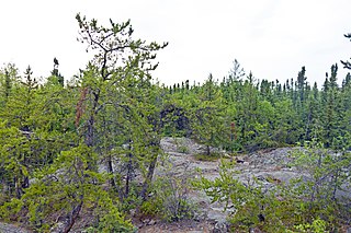
Northern Canadian Shield taiga is a taiga ecoregion located in northern Canada, stretching from Great Bear Lake in the Northwest Territories to Hudson Bay in eastern Nunavut. The region supports conifer forests to its northern edge, where the territory grades into tundra. The open forest in this transition zone is characterized by widely scattered, stunted stands of black spruce and tamarack, with some white spruce. The ecoregion lies over the northwestern extent of the Canadian Shield.

<span class="mw-page-title-main">Northwest Territories taiga</span> Taiga ecoregion located in the Northwest Territories and Yukon provinces of Canada

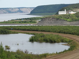
The Northwest Territories taiga ecoregion (WWF:NA0614) is located in the Northwest Territories and Yukon provinces of Canada. It covers forest and tundra along the Mackenzie River Valley and the surrounding highlands in the southern portion of the valley.

<span class="mw-page-title-main">Interior Yukon–Alaska alpine tundra</span>

The Interior Yukon-Alaska alpine tundra ecoregion covers alpine, sub-alpine, and boreal forest areas along the cordillera of Interior Alaska and south-central Yukon Territory. Geologically, they are the disjunct uplands of the Yukon-Tanana Terrane plus a southern extension of the Brooks Range. The cover is extensive 'dark taiga' of closed spruce forest, open forest of other species, and alpine vegetation at higher altitudes. The region is mostly wilderness and relatively untouched by human development.

References

  1. 1 2 3 4 "The Atlas of Global Conservation". The Nature Conservancy. Archived from the original on 2012-03-05. Retrieved 2020-08-18.
  2. 1 2 3 "Mid-Continental Canadian forests". Terrestrial Ecoregions. World Wildlife Fund.