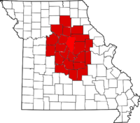
Columbia is a city in the U.S. state of Missouri. It is the county seat of Boone County and home to the University of Missouri. Founded in 1821, it is the principal city of the three-county Columbia metropolitan area. It is Missouri's fourth most populous with an estimated 128,555 residents in 2022.

Jefferson City, informally Jeff City, is the capital of the U.S. state of Missouri. It had a population of 43,228 at the 2020 census, ranking as the 16th most populous city in the state. It is also the county seat of Cole County and the principal city of the Jefferson City Metropolitan Statistical Area, the second-most-populous metropolitan area in Mid-Missouri and the fifth-largest in the state. Most of the city is in Cole County, with a small northern section extending into Callaway County. Jefferson City is named for Thomas Jefferson, the third President of the United States.

Miller County is a county located in the northern Ozarks region of the U.S. state of Missouri. As of the 2020 United States census, the population was 24,722. Its county seat is Tuscumbia. The county was organized February 6, 1837, and named for John Miller, former U.S. Representative and Governor of Missouri.

Scouting in Missouri has a long history, from the 1910s to the present day.

Mexico, formerly known as New Mexico, is a city in and the county seat of Audrain County, Missouri, United States. It is home to the Missouri Military Academy and annually hosts the Miss Missouri Pageant. The city's population was 11,469 at the 2020 census. The micropolitan statistical area consists of Audrain County. It is a part of the Columbia, Missouri metropolitan area.

Sedalia is a city located approximately 30 miles south of the Missouri River and, as the county seat of Pettis County, Missouri, United States, it is the principal city of the Sedalia Micropolitan Statistical Area. As of the 2020 census, the city had a total population of 21,725. Sedalia is also the location of the Missouri State Fair and the Scott Joplin International Ragtime Festival. U.S. Routes 50 and 65 intersect in the city.

Lake Ozark is a city in Camden and Miller counties in the U.S. state of Missouri, near its namesake, the Lake of the Ozarks. The population was 2,077 at the 2020 census.

Osage Beach is a city in Camden and Miller counties in the U.S. state of Missouri, near the Lake of the Ozarks. Most of the city is in Camden County, while a small eastern sliver is in Miller County. The population was 4,637 at the 2020 census.

Green Country, sometimes referred to as Northeast Oklahoma, is the northeastern portion of the U.S. state of Oklahoma, which lies west of the northern half of Arkansas, the southwestern corner the way of Missouri, and south of Kansas.

Lake of the Ozarks is a reservoir created by impounding the Osage River in the northern part of the Ozarks in central Missouri. Parts of three smaller tributaries to the Osage are included in the impoundment: the Niangua River, Grandglaize Creek, and Gravois Creek. The lake has a surface area of 54,000 acres (220 km2) and 1,150 miles (1,850 km) of shoreline. The main channel of the Osage Arm stretches 92 miles (148 km) from one end to the other. The total drainage area is over 14,000 square miles (36,000 km2). The lake's serpentine shape has earned it the nickname "the Missouri Dragon", which has, in turn, inspired the names of local institutions such as the Magic Dragon Street Meet.
KPLA refers to a Cumulus radio station in Columbia, Missouri. KPLA first started out as 101.7 KARO-FM, an "easy listening" station in February 1983. In 1986, it became known as K102. Then in 1994, it became KPLA and has consistently been a Top 3 radio station in the market, playing "soft rock." KPLA broadcasts from the highest tower in Columbia, Missouri, reaching 70 miles (110 km) within Mid-Missouri.

U.S. Route 50 (US 50) is a major east–west route in the state of Missouri. It is also known as the Rex M. Whitton Expressway in the capital of Missouri, Jefferson City.

The Valdosta metropolitan area, designated the Valdosta metropolitan statistical area by the U.S. Office of Management and Budget, is a metropolitan statistical area consisting of four counties—Brooks, Echols, Lanier, and Lowndes—centered on the city of Valdosta. Located in Southeast Georgia, the metropolitan area's population was 151,118 according to 2023 U.S. census estimates, up from 149,849 at the 2020 U.S. census.

KCMQ is a radio station broadcasting a classic rock format. Licensed to Columbia, Missouri, the station is currently owned by the Zimmer Radio Group.

KZWV is a radio station airing an adult contemporary format licensed to Eldon, Missouri. The station serves the areas of Osage Beach, Missouri and Jefferson City, Missouri. KZWV's studio is located on Osage Beach Road in Osage Beach, with transmitting facilities just south of Eldon off of U.S. Route 54.
The St. Louis Cardinals Radio Network is a United States radio network that broadcasts St. Louis Cardinals baseball games. The network consists of 146 stations1 and six FM translators in nine states. Its flagship station is KMOX in St. Louis. Due to an earlier deal with KTRS, it is still a partial owner of that station although Cardinals games no longer air on KTRS.

U.S. Route 63 is the portion of a north-south highway that runs through the U.S. state of Missouri from the Arkansas state line near Thayer to the Iowa state line near Lancaster.

KRMS-LD is a low-power television station licensed to Lake Ozark, Missouri, United States, serving the Lake of the Ozarks region as an affiliate of Cozi TV. It is owned by Viper Communications alongside radio stations KRMS and KRMS-FM (93.5). The stations share studios on Old US 54 in Osage Beach; KRMS-LD's transmitter is located on Osage Ridge Road, also in Osage Beach.