Location of Mid-State Regional Airport and Black Moshannon State Park
"Black Moshannon Airport" was built on land taken from Black Moshannon State Park and Moshannon State Forest just before the Second World War,[5] and was operational by 1942, hosting a Civil Air Patrol training exercise for nearly 300 planes on May 30, 1942.[6] It was renamed "Mid-State Airport" in 1962.[7]
The March 1951 diagram shows the 163/343 runway 3400 feet long and the 056/236 runway 3000 feet. In May 1962 both runways were 5000 feet; in September 1968 16/34 was 5710 feet.
In 2008 the name is "Mid-State Regional Airport" and it has been designated a Keystone Opportunity Zone (KOZ). The KOZ portion of the airport is on 484 acres (1.96km2) to encourage business growth and is designated a KOZ through December 31, 2010.[4] However, there are limitations in state law that prohibit any further development on park or forest lands.[8]
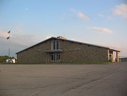
Facilities
Mid-State Airport covers 500 acres (2.0km2) and has two asphalt runways: 16/34 is 5,711 x 100ft (1,741 x 30 m) and 6/24 is 5,006 x 100ft (1,526 x 30 m). In the year ending June 30, 2007 the airport had 2,550 aircraft operations: 98% general aviation and 2% military. Two aircraft are based at the airport.[3]
Runway 16/34 is connected to the airport ramp by 69-foot (21m) wide taxiway A and 50-foot (15m) wide taxiways D and E. D and E connect to the east side of the runway, with D leading to the large hangar and E to the smaller T-hangar. Runway 6/24 is connected to the airport ramp by 96-foot (29m) wide taxiway B, and 50-foot (15m) wide taxiway C at the 24-end of the runway. All of the taxiways are asphalt except for E, which is turf for the last 240 feet (73m) before the runway.[2]
Other Users
Based at Mid-State Regional Airport is the Civil Air PatrolMid-State Composite Squadron 239. The Pennsylvania Bureau of Forestry bases a fire fighting aircraft at the airport during forest fire season.
The Central Pennsylvania Region Sports Car Club of America holds autocross races at the airport.[10] The airport remains active during the races; when an aircraft wishes to land, the race will be suspended, the aircraft will land, and racing will resume. This is possible due to the nature of autocross racing, where one car is on the course at a time.
↑ "290 Fliers in Rendezvous; Pennsylvania Civil Air Patrol Stages Training Operation". The New York Times. June 1, 1942. p.28.
↑ "Pennsylvania Aviation History". Pennsylvania Department of Transportation. Archived from the original on 2011-06-07. Retrieved 2008-04-03.Note: this reference incorrectly gives the opening year as 1946
This page is based on this Wikipedia article Text is available under the CC BY-SA 4.0 license; additional terms may apply. Images, videos and audio are available under their respective licenses.