| Milam | |
|---|---|
 Milam Location in India  Milam Milam (India) | |
| Type | Mountain glacier |
| Location | Pithoragarh district Kumaon Himalayas, Uttarakhand, India |
| Coordinates | 30°29′N80°6′E / 30.483°N 80.100°E |
 | |
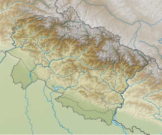
Milam Glacier is a major glacier of Himalaya in the Munsiyari tehsil of Pithoragarh district of Kumaon region in the Uttrakhand state of India. [1] The Milam village, near the snout of Milam Glacier, is the source of the Goriganga River which flows to Munsiyari through the Johar Valley inhabited by Shauka Tibeto-Burman ethnic people. Munsiari-Bugdiar-Milam Road (MBMR), the paved motorable road being constructed by the BRO as part of the India–China Border Roads (ICBRs) with expected completion date of March 2026, provides access to Milam village and glacier from the district sub-division headquarter Munsiyari. [2]
Contents
Munsiyari, further down the Goriganga valley, was the traditional base for the trek to the glacier before the construction of the road. [3] The suitable time to visit the glacier is from mid-March to May. Monsoon usually sets in during the month of June which herald the menace of landslides and roadblocks making the trek inadvisable. [3]