Millard, Omaha, Nebraska

Last updated
Millard
Neighborhood
Millard water tower, Omaha, Nebraska.jpg
Water tower
Coordinates: 41°12′34″N96°07′28″W / 41.209493°N 96.1245°W / 41.209493; -96.1245
Country United States
State Nebraska
County Douglas
City Omaha
Founded1870
Incorporated1885
Absorbed 1971
Founded byEzra Millard
Area
  Total32.72 sq mi (84.77 km2)
Population
 (2019)
  Total110,480
  Density3,400/sq mi (1,300/km2)
Time zone UTC−06:00 (CST)
  Summer (DST) UTC−05:00 (CDT)
Zip Codes
68135, 68137
Area Codes 402, 531

Millard is a former town and current neighborhood in southwest Omaha, Nebraska. The original downtown area of Millard (often referred to as 'Old Millard') is near the intersection of Millard Avenue and L Street.

Contents

History

Millard was laid out in 1870 by Ezra Millard, and named for him. [1] A post office was established in Millard in 1873, and remained in operation until it was discontinued in 1967. [2] The town was incorporated in 1885. [1] After lengthy legal fights, the town of Millard was annexed by the city of Omaha in 1971. [3] There also were attempts through both the state legislature and the court system to annex Millard’s schools into the Omaha Public Schools, but the Millard Public Schools remained independent. Recently, they have been included under the taxing authority of the Learning Community to extend Omaha's tax base.

Millard Public Schools

The Millard Public Schools system has 25 elementary schools, six middle schools, and four high schools. Similar to schools in Omaha Public Schools, many students that live outside the assigned attendance areas of Millard choose to attend Millard Public Schools. Aldrich Elementary and Black Elk Elementary are IB elementary schools, while North Middle and North High are also IB.

Demographics

As of 2019, the estimated population of Millard was 110,480. There were 39,979 households and 42,305 housing units. The average population density was 3,003.7 per square mile. The racial makeup of the area was 87% White, 2% Black, 1% Native American, 3% from two or more races, 4% Asian, 5% Hispanic, and 0% Other or Pacific Islander.

There were 40,000 households, of which 75% were married couples, 3% were male householders with no female present, 11% were female householder with no male present. 11% of households were made up of individuals. The average household size was 2.7.

The median per capita income was $42,622, versus the median household income of $92,552. 4.1% of the population was under the poverty line, including 4% being children under the age of 18 and 6% being seniors over the age of 65. [4]

Location

Millard is around 144th and L, with a water tower that says Millard on 144th and Q. It extends to around 204th on the west, 108th on the east, Blondo Street on the North, and Harrison Street on the South. [ citation needed ].

Related Research Articles

<span class="mw-page-title-main">Douglas County, Nebraska</span> County in Nebraska, United States

Douglas County is a county located in the U.S. state of Nebraska. As of the 2020 United States Census, the population is 584,526. It is the state's most populous county, home to well over one-fourth of Nebraska's residents. Its county seat is Omaha, the state's largest city. The county was established in 1854 and named after Stephen A. Douglas (1813–1861), who was then serving as Senator from Illinois.

<span class="mw-page-title-main">Dodge County, Nebraska</span> County in Nebraska, United States

Dodge County is a county in the U.S. state of Nebraska. As of the 2020 United States Census, the population was 37,167. Its county seat is Fremont. The county was formed in 1855 and named after Iowa Senator Augustus C. Dodge.

<span class="mw-page-title-main">Omaha, Arkansas</span> Town in Arkansas, United States

Omaha is a town in Boone County, Arkansas, United States. As of the 2020 census the population stood at 128. It is a rural community located approximately 10 miles from Branson, Missouri and 15 miles from Harrison. The town is part of the Harrison Micropolitan Statistical Area.

<span class="mw-page-title-main">Grand Mound, Iowa</span> City in Iowa, United States

Grand Mound is a city in Clinton County, Iowa, United States. The population was 615 at the time of the 2020 census.

<span class="mw-page-title-main">Carter Lake, Iowa</span> City in Iowa, United States

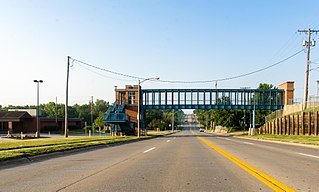
Carter Lake is a city in Pottawattamie County, Iowa, United States. A suburb of Omaha, Nebraska, it sits surrounding the south and west sides of the region's major airport, Eppley Airfield. It is separated from the rest of Iowa by the Missouri River, effectively making it an exclave. The population was 3,791 at the 2020 census.

<span class="mw-page-title-main">Ava, Missouri</span> City in Missouri, United States

Ava is the only incorporated city in Douglas County, Missouri, United States. The population was 2,894 at the 2020 census. Ava is the county seat of Douglas County. The city was founded in 1871. It was renamed Ava in 1881, the town's original name having been "Militia Springs."

<span class="mw-page-title-main">Alliance, Nebraska</span> City in Nebraska, United States

Alliance is a city and the county seat of Box Butte County, in the western part of the state of Nebraska, in the Great Plains region of the United States. Its population was 8,151 at the 2020 census.

<span class="mw-page-title-main">Bristow, Nebraska</span> Village in Nebraska, United States

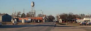
Bristow is a village in Boyd County, Nebraska, United States. The population was 70 at the 2020 census, up from 65 in 2010.

<span class="mw-page-title-main">Lyons, Nebraska</span> City in Nebraska, United States

Lyons is a city in Burt County, Nebraska, United States. The population was 851 in the 2010 census. The city is named after its founder.

<span class="mw-page-title-main">Ralston, Nebraska</span> City in Douglas County, Nebraska, United States

Ralston is a city in Douglas County, Nebraska, United States. The population was 6,494 at the 2020 census. A suburb of Omaha, Ralston is surrounded on three sides by the city of Omaha by 84th, 72nd, and L Streets, and by Sarpy County on the south side.

<span class="mw-page-title-main">Valley, Nebraska</span> City in Douglas County, Nebraska, United States

Valley is a city in Douglas County, Nebraska, United States. The population was 3,037 at the 2020 census.

<span class="mw-page-title-main">Talmage, Nebraska</span> Village in Nebraska, United States

Talmage is a village in Otoe County, Nebraska, United States. The population was 198 at the 2020 census.

<span class="mw-page-title-main">Osceola, Nebraska</span> City in Nebraska, United States

Osceola is a city and the county seat of Polk County, Nebraska, United States. The population was 880 as of the 2010 census.

<span class="mw-page-title-main">Bellevue, Nebraska</span> City in Sarpy County, Nebraska, United States

Bellevue is a suburban city in Sarpy County, Nebraska, United States. It is part of the Omaha–Council Bluffs metropolitan area, and had a population of 64,176 as of the 2020 census, making it the 3rd most populous city in Nebraska, behind Omaha and Lincoln, and the second largest city in the U.S. named "Bellevue," behind Bellevue, Washington.

<span class="mw-page-title-main">La Vista, Nebraska</span> City in Sarpy County, Nebraska, United States

La Vista is a city in Sarpy County, Nebraska, United States. The population was 16,746 at the 2020 census, making it the 12th most populous city in Nebraska. The city was incorporated on February 23, 1960.

<span class="mw-page-title-main">Ceresco, Nebraska</span> Village in Saunders County, Nebraska, United States

Ceresco is a farming village in Saunders County, Nebraska, United States. The population was 919 at the 2020 census. It is located near U.S. Highway 77, just north of Lincoln, just south of Wahoo, and a short distance southwest of Omaha.

<span class="mw-page-title-main">Yutan, Nebraska</span> City in Saunders County, Nebraska, United States

Yutan is a city in Saunders County, Nebraska, United States.

<span class="mw-page-title-main">Davenport, Nebraska</span> Village in Thayer County, Nebraska, United States

Davenport is a village in Thayer County, Nebraska, United States. The population was 321 at the 2020 census.

<span class="mw-page-title-main">Wayne, Nebraska</span> City in Wayne County, Nebraska, United States

Wayne is a city in Wayne County, Nebraska, United States. The population was 5,660 at the 2010 census. It is the county seat of Wayne County and the home of Wayne State College.

<span class="mw-page-title-main">Stone Ridge, New York</span> CDP in New York, United States

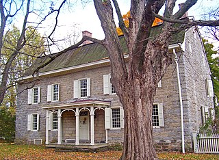
Stone Ridge is a hamlet in Ulster County, New York, United States. The population was 1,234 at the 2020 census.

References

  1. 1 2 Wakeley, Arthur Cooper (1917). Omaha: The Gate City, and Douglas County, Nebraska. S.J. Clarke Publishing Company. p.  419.
  2. "Douglas County". Jim Forte Postal History. Retrieved 25 August 2014.
  3. Larsen, Lawrence Harold (2007). Upstream Metropolis: An Urban Biography of Omaha and Council Bluffs. University of Nebraska Press. p. 327. ISBN   0-8032-0602-X.
  4. "Census profile: Millard Public Schools, NE". Census Reporter.

See also

41°12′34″N96°07′23″W / 41.209413°N 96.12299°W / 41.209413; -96.12299