Miller Township, Dallas County, Missouri

Last updated

Miller Township is an inactive township in Dallas County, in the U.S. state of Missouri. [1]

A civil township is a widely used unit of local government in the United States that is subordinate to a county. The term town is used in New England, New York, and Wisconsin to refer to the equivalent of the civil township in these states. Specific responsibilities and the degree of autonomy vary based on each state. Civil townships are distinct from survey townships, but in states that have both, the boundaries often coincide and may completely geographically subdivide a county. The U.S. Census Bureau classifies civil townships as minor civil divisions. Currently, there are 20 states with civil townships.

Dallas County, Missouri U.S. county in Missouri

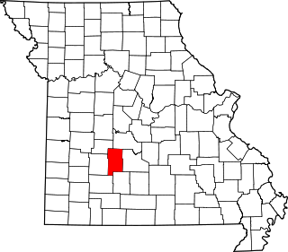
Dallas County is a county located in the U.S. state of Missouri. As of the 2010 census, the population was 16,777. Its county seat is Buffalo. The county was organized in 1842 as Niangua County and then renamed in 1844 for George M. Dallas, who served as Vice President under James K. Polk.

U.S. state constituent political entity of the United States

In the United States, a state is a constituent political entity, of which there are currently 50. Bound together in a political union, each state holds governmental jurisdiction over a separate and defined geographic territory and shares its sovereignty with the federal government. Due to this shared sovereignty, Americans are citizens both of the federal republic and of the state in which they reside. State citizenship and residency are flexible, and no government approval is required to move between states, except for persons restricted by certain types of court orders.

Miller Township was established in 1841, and has the name of John R. Miller, an early settler. [2]

It was a largely rural township and included the northeast corner of the county, close to the borders of both Camden and Laclede counties. It includes the communities of Easton (per US Census records from 1860) and Celt (per map at https://www.acrevalue.com/plat-map/MO/Dallas/)

Related Research Articles

Handley is an unincorporated community in Dallas County, in the U.S. state of Missouri.

Plad is an unincorporated community in Dallas County, in the U.S. state of Missouri.

Shady Grove is an unincorporated community in southeast Dallas County, in the U.S. state of Missouri. The community was located on Route M, approximately five miles west of Conway. The Shady Grove School was just south of Route M, near the headwaters of Goose Creek.

Thorpe is an unincorporated community in Dallas County, in the U.S. state of Missouri. The community lies just north of the Dallas-Webster county line, with Missouri Route W and the Niangua River passing about one mile to the east. The community lies approximately midway between Buffalo, eleven miles to the northwest and Marshfield, eleven miles to the southeast.

Tilden is an unincorporated community in Dallas County, in the U.S. state of Missouri.

Grant Township is an inactive township in Dallas County, in the U.S. state of Missouri.

Jackson Township is an inactive township in Dallas County, in the U.S. state of Missouri.

Jasper Township is an inactive township in Dallas County, in the U.S. state of Missouri.

Lincoln Township is an inactive township in Dallas County, in the U.S. state of Missouri.

North Benton Township is an inactive township in Dallas County, in the U.S. state of Missouri.

Sheridan Township is an inactive township in Dallas County, in the U.S. state of Missouri.

Sherman Township is an inactive township in Dallas County, in the U.S. state of Missouri.

South Benton Township is an inactive township in Dallas County, in the U.S. state of Missouri.

Washington Township is an inactive township in Dallas County, in the U.S. state of Missouri.

Wilson Township is an inactive township in Dallas County, in the U.S. state of Missouri.

Franklin Township is an inactive township in Laclede County, in the U.S. state of Missouri.

Franklin Township is an inactive township in Miller County, in the U.S. state of Missouri.

Saline Township is an inactive township in Miller County, in the U.S. state of Missouri.

Dallas Township is an inactive township in St. Clair County, in the U.S. state of Missouri.

Dallas Township is an inactive township in Webster County, in the U.S. state of Missouri.

References

  1. U.S. Geological Survey Geographic Names Information System: Miller Township, Dallas County, Missouri
  2. "Dallas County Place Names, 1928–1945 (archived)". The State Historical Society of Missouri. Archived from the original on 15 September 2016. Retrieved 26 September 2016.CS1 maint: BOT: original-url status unknown (link)

Coordinates: 37°49′54″N92°55′16″W / 37.8317°N 92.9212°W / 37.8317; -92.9212

Geographic coordinate system Coordinate system

A geographic coordinate system is a coordinate system that enables every location on Earth to be specified by a set of numbers, letters or symbols. The coordinates are often chosen such that one of the numbers represents a vertical position and two or three of the numbers represent a horizontal position; alternatively, a geographic position may be expressed in a combined three-dimensional Cartesian vector. A common choice of coordinates is latitude, longitude and elevation. To specify a location on a plane requires a map projection.