| Redtop, Missouri | |
|---|---|
| Unincorporated community | |
 Redtop  Redtop | |
| Coordinates: 37°30′13″N93°08′39″W / 37.50361°N 93.14417°W Coordinates: 37°30′13″N93°08′39″W / 37.50361°N 93.14417°W | |
| Country | United States |
| State | Missouri |
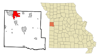
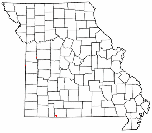
| County | Dallas |
| Township | Jasper |
| Elevation | 371 m (1,217 ft) |
| Time zone | Central (CST) (UTC-6) |
| • Summer (DST) | CDT (UTC-5) |
| GNIS feature ID | 737911 [1] |
Redtop is an unincorporated community in Dallas County, Missouri. [1] It is located west of U.S. Route 65 (on an older alignment of the highway) approximately 9 mi (14 km) south of Buffalo.

In law, an unincorporated area is a region of land that is not governed by a local municipal corporation; similarly an unincorporated community is a settlement that is not governed by its own local municipal corporation, but rather is administered as part of larger administrative divisions, such as a township, parish, borough, county, city, canton, state, province or country. Occasionally, municipalities dissolve or disincorporate, which may happen if they become fiscally insolvent, and services become the responsibility of a higher administration. Widespread unincorporated communities and areas are a distinguishing feature of the United States and Canada. In most other countries of the world, there are either no unincorporated areas at all, or these are very rare; typically remote, outlying, sparsely populated or uninhabited areas.
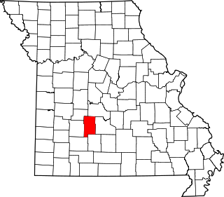
Dallas County is a county located in the U.S. state of Missouri. As of the 2010 census, the population was 16,777. Its county seat is Buffalo. The county was organized in 1842 as Niangua County and then renamed in 1844 for George M. Dallas, who served as Vice President under James K. Polk.
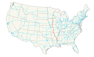
U.S. Route 65 is a north–south United States highway in the southern and midwestern United States. The southern terminus of the route is at U.S. Route 425 in Clayton, Louisiana. The northern terminus is at Interstate 35 just south of Interstate 90 in Albert Lea, Minnesota. Parts of its modern route in Iowa and historic route in Minnesota follow the old Jefferson Highway.
Redtop is part of the Springfield, Missouri Metropolitan Statistical Area.

Springfield is the third-largest city in the state of Missouri and the county seat of Greene County. As of the 2010 census, its population was 159,498. As of 2017, the Census Bureau estimated its population at 167,376. It is the principal city of the Springfield metropolitan area, which has a population of 462,369 and includes the counties of Christian, Dallas, Greene, Polk, Webster.