Millstadt, Illinois

Last updated
Millstadt
Millstadt-tower.jpg
Millstadt Water Tower, no longer used
St. Clair County Illinois Incorporated and Unincorporated areas Millstadt Highlighted.svg
Location of Millstadt in St. Clair County, Illinois.
Illinois in United States (US48).svg
Location of Illinois in the United States
Coordinates: 38°27′34″N90°5′39″W / 38.45944°N 90.09417°W / 38.45944; -90.09417
CountryUnited States
StateIllinois
County St. Clair
Government
  MayorMichael H. Todd
Area
[1]
  Total3.67 sq mi (9.50 km2)
  Land3.49 sq mi (9.04 km2)
  Water0.18 sq mi (0.46 km2)
Elevation
[2]
600 ft (200 m)
Population
 (2020)
  Total4,071
  Density1,166.14/sq mi (450.31/km2)
Time zone UTC-6 (CST)
  Summer (DST) UTC-5 (CDT)
ZIP Code(s)
62260/62220
Area code 618
FIPS code 17-49386
GNIS feature ID2399363 [2]
Wikimedia CommonsMillstadt, Illinois
Website www.villageofmillstadt.org

Millstadt is a village in St. Clair County, Illinois, United States, located at the crossing of Illinois Routes 163 (locally, "Jefferson Avenue") and 158 (locally, "Washington Avenue"). The village is known for its German heritage, with more than half its people of German descent. [3] [4] The population was 4,011 at the 2010 census, but a more recent study in July 2018 estimated the number at 3,885.

Contents

History

During a barn raising in 1836, it was proposed that a town be incorporated on land belonging to Henry Randleman. The name "Centerville" was proposed, as the site was equidistant from Belleville, Columbia, and Pittsburg Lake. The town was platted on March 13, 1837. In 1880, its name was changed to Millstadt, as the name Centreville was in use by another nearby town.[ citation needed ]

Another account (Millstadt School website): "The story of how Millstadt developed out of 'Centerville' goes something like this. The current Centreville and our Centerville each had a post offices through which a great deal of mail became confused and mis-delivered. Our town's forefathers, upon applying for formal organization through the state, supposedly decided on the name 'Mittlestadt' or 'Middlestadt,' which means literally 'center city'; somehow the state misread the writing and sent back the papers reading 'Millstadt.' As you can guess, the governing group decided to keep that name as we had several mills at that time and the name fit."[ citation needed ]

In 1874, a German immigrant farm family was killed in a farming hamlet known as Saxtown, just south of the town. It made national headlines and became the subject of the book The Ax Murders of Saxtown. [5]

Demographics

Historical population
CensusPop.Note
1880 1,229
1890 1,186−3.5%
1900 1,172−1.2%
1910 1,140−2.7%
1920 907−20.4%
1930 1,01411.8%
1940 1,29027.2%
1950 1,56621.4%
1960 1,83016.9%
1970 2,16818.5%
1980 2,73626.2%
1990 2,566−6.2%
2000 2,7948.9%
2010 4,01143.6%
2020 4,0711.5%
U.S. Decennial Census [6]

As of the census [7] of 2000, there were 2,794 people, 1,148 households, and 813 families residing in the village. The population density was 2,511.9 inhabitants per square mile (969.9/km2). There were 1,196 housing units at an average density of 1,075.2 per square mile (415.1/km2). The racial makeup of the village was 99% White, 0% Native American, 1% Asian, 0% from other races, and 0% from two or more races. Hispanic or Latino of any race were 0% of the population.

There were 1,148 households, out of which 31.8% had children under the age of 18 living with them, 59.1% were married couples living together, 8.9% had a female householder with no husband present, and 29.1% were non-families. 25.3% of all households were made up of individuals, and 12.5% had someone living alone who was 65 years of age or older. The average household size was 2.43 and the average family size was 2.92.

In the village, the population was spread out, with 23.7% under the age of 18, 7.6% from 18 to 24, 28.6% from 25 to 44, 22.9% from 45 to 64, and 17.3% who were 65 years of age or older. The median age was 39 years. For every 100 females there were 91.5 males. For every 100 females age 18 and over, there were 87.5 males.

The median income for a household in the village was $47,824, and the median income for a family was $56,378. Males had a median income of $40,893 versus $27,196 for females. The per capita income for the village was $21,914. About 3.2% of families and 4.0% of the population were below the poverty line, including 5.9% of those under age 18 and 5.1% of those age 65 or over.

Geography

Millstadt (Ill.) Commercial Club, Police Headquarters Millstadtcommercialclub.jpg
Millstadt (Ill.) Commercial Club, Police Headquarters
Millstadt Community Center and ambulance service Millstadt-centre.jpg
Millstadt Community Center and ambulance service
Mertz Motors and Ott's Tavern pictured above in downtown Millstadt. Downtownmillstadt.jpg
Mertz Motors and Ott's Tavern pictured above in downtown Millstadt.

According to the 2010 census, the village has a total area of 3.58 square miles (9.3 km2), of which 3.41 square miles (8.8 km2) (or 95.25%) is land and 0.17 square miles (0.44 km2) (or 4.75%) is water. [8]

The town center is formed by the intersection of two state highways. Illinois Route 158, or Washington Avenue, leads west to Columbia and east to Belleville. The other main street is Jefferson Avenue, the north part of which forms the southern end of Illinois Route 163, leading north to Centreville, where it intersects highways providing access to East St. Louis. The south end of Jefferson Avenue, as it leaves Millstadt, becomes Floraville Road.

Economy

A 25.5-kW solar array on a barn at Magill Farms came into service in 2021. [9]

Schools, churches, cemeteries

Centreville Cemetery, one of Millstadt's oldest graveyards Millstadt-centreville-cem.jpg
Centreville Cemetery, one of Millstadt's oldest graveyards

Notable people

Sister cities

See also

Related Research Articles

<span class="mw-page-title-main">St. Clair County, Illinois</span> County in Illinois, United States

St. Clair County is the ninth most populous county in Illinois. Located directly east of St. Louis, the county is part of the Metro East region of the Greater St. Louis metropolitan area in southern Illinois. As of the 2020 United States census, St. Clair County had a population of 257,400, making it the third most populous county in Illinois outside the Chicago metropolitan area. Belleville is the county’s seat and largest city.

<span class="mw-page-title-main">Ivesdale, Illinois</span> Village in Illinois, United States

Ivesdale is a village in Champaign County, Illinois, United States; a very small portion of the village extends into Piatt County, Illinois. The population was 265 at the 2020 census.

<span class="mw-page-title-main">Aviston, Illinois</span> Village in Illinois, United States

Aviston is a village in Clinton County, Illinois, United States. The population was 2,340 at the 2020 census, up from 1,945 at the 2010 census.

<span class="mw-page-title-main">Ridgway, Illinois</span> Village in Illinois, United States

Ridgway is a village in Gallatin County, Illinois, United States. As of the 2020 census, the population was 851. As of 2018, Rebecca Mitchell was the town mayor.

<span class="mw-page-title-main">Columbia, Illinois</span> City in Illinois, United States

Columbia is a city mainly in Monroe County with a small portion in St. Clair County in the U.S. state of Illinois, about 12 miles (19 km) south of St. Louis, Missouri. The population was 10,999 at the 2020 census.

<span class="mw-page-title-main">Hecker, Illinois</span> Village in Illinois, United States

Hecker is a village in Monroe County in the U.S state of Illinois. The population was 429 at the 2020 census, down from 481 in 2010.

<span class="mw-page-title-main">Belleville, Illinois</span> City in Illinois, United States

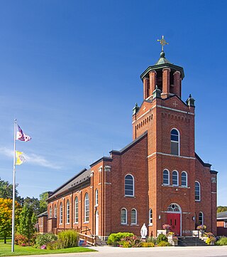
Belleville is a city and the county seat of St. Clair County, Illinois, United States. It is located within Greater St. Louis. The population was 42,404 at the 2020 census, making it the most-populated city in Southern Illinois and in the Metro East region of Greater St. Louis. Due to its proximity to Scott Air Force Base, the population receives a boost from military and federal civilian personnel, defense contractors, and military retirees. It is also the seat of the Roman Catholic Diocese of Belleville and the National Shrine of Our Lady of the Snows.

<span class="mw-page-title-main">Centreville, Illinois</span> City in Illinois, United States

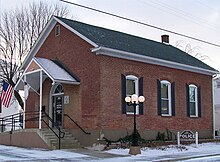
Centreville was a city in St. Clair County, Illinois, United States. The population was 5,309 in 2010, down from 5,951 at the 2000 census. On May 6, 2021, the city ceased to exist, being incorporated into the new city of Cahokia Heights.

<span class="mw-page-title-main">Freeburg, Illinois</span> Village in Illinois, United States

Freeburg is a village in St. Clair County, Illinois, United States. Located within Greater St. Louis, it is a southeastern exurb with many residents commuting to Downtown St. Louis or the Belleville area for employment. As of 2010, Freeburg had a population of 4,354.

<span class="mw-page-title-main">Shiloh, Illinois</span> Village in Illinois, United States

Shiloh is a village in St. Clair County, Illinois, United States. The 2010 census recorded a population of 12,651. Shiloh is located within the St. Louis metropolitan area

<span class="mw-page-title-main">Swansea, Illinois</span> Village in Illinois, United States

Swansea is a village in St. Clair County, Illinois. It is a part of the St. Louis metropolitan area and Metro East in southern Illinois. It is surrounded by the communities of Fairview Heights, Belleville, O’Fallon, and Shiloh. The population was 13,430 at the 2010 census, an increase from 10,579 in 2000.

<span class="mw-page-title-main">Merrillville, Indiana</span> Town in Indiana, United States

Merrillville is a town in Ross Township, Lake County, Indiana, United States. The population was 35,246 at the 2010 census. Merrillville is in east-central Lake County, in the Chicago metropolitan area. On January 1, 2015, Merrillville became the most populated town in Indiana, as Fishers in Hamilton County was converted from a town to a city. The town serves as a major shopping hub for Northwest Indiana.

<span class="mw-page-title-main">Centerville, Indiana</span> Town in Indiana, United States

Centerville is a town in Center Township, Wayne County, in the U.S. state of Indiana. The population was 2,552 at the 2010 United States Census.

<span class="mw-page-title-main">Centerville Township, Michigan</span> Civil township in Michigan, United States

Centerville Township is a civil township of Leelanau County in the U.S. state of Michigan. The population was 1,243 at the 2020 census. The township is bounded to the east by Lake Leelanau.

<span class="mw-page-title-main">Centreville, Michigan</span> Village in Michigan, United States

Centreville is a village in the U.S. state of Michigan and the county seat of St. Joseph County. The population was 1,425 at the 2010 census.

<span class="mw-page-title-main">Centerville, Missouri</span> City in Missouri, United States

Centerville is a city in Reynolds County, Missouri, United States, situated along the West Fork of the Black River. The population was 167 at the 2020 census. It is the county seat of Reynolds County.

<span class="mw-page-title-main">Centerville, New York</span> Town in New York, United States

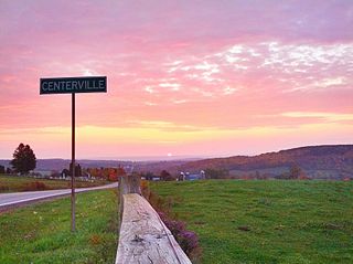
Centerville is a town in Allegany County, New York, United States. The population was 822 at the 2010 census. The town is in the northwest corner of Allegany County and is named after its principal settlement.

<span class="mw-page-title-main">Centerville, Gallia County, Ohio</span> Village in Ohio, United States

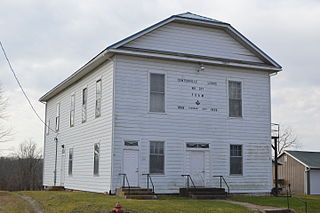
Centerville, also known as Thurman, is a village in Gallia County, Ohio, United States. The population was 87 at the 2020 census. It is part of the rural Point Pleasant micropolitan area. It is located near U.S. Route 35 near the eastern terminus of State Route 279 as the highways parallel each other for about 1/2 mile.

<span class="mw-page-title-main">Belleville, Wisconsin</span> Village in Wisconsin, United States

Belleville is a village in Dane and Green counties in the U.S. state of Wisconsin. The population was 2,491 at the 2020 census. Of this, 1,909 were in Dane County, and 582 were in Green County.

<span class="mw-page-title-main">Lancaster (village), New York</span> Village in New York, United States

Lancaster is a village in Erie County, New York, United States. As of the 2010 census, the village population was 10,352. It is part of the Buffalo–Niagara Falls Metropolitan Statistical Area.

References

  1. "2020 U.S. Gazetteer Files". United States Census Bureau. Retrieved March 15, 2022.
  2. 1 2 U.S. Geological Survey Geographic Names Information System: Millstadt, Illinois
  3. "American FactFinder - Results". Archived from the original on 2020-02-10. Retrieved 2009-12-27.
  4. 1 2 Johnson, John H., ed. (November 1959). "Landrace hog breeder:Illinois doctor imports special breeding stock from Europe". Ebony. Chicago, Illinois: Johnson Publishing Company, Inc. 15 (1): 75–79.
  5. "140-Year-Old Millstadt Murder Mystery Gets New Life in "The Ax Murders of Saxtown'".
  6. "Census of Population and Housing". Census.gov. Retrieved June 4, 2015.
  7. "U.S. Census website". United States Census Bureau . Retrieved 2008-01-31.
  8. "2010 Census U.S. Gazetteer Files for Places – Illinois". United States Census. Archived from the original on 2012-08-10. Retrieved 2012-10-13.
  9. Ludt, Billy (2022-02-24). "Solar-powered barn from the 1800s runs Midwest family farm". Solar Power World. Retrieved 2022-04-04.