Milton, North Carolina

Last updated
Milton, North Carolina
Milton, North Carolina 05.jpg
Broad Street
NCMap-doton-Milton.PNG
Location of Milton, North Carolina
Coordinates: 36°32′14″N79°12′29″W / 36.53722°N 79.20806°W / 36.53722; -79.20806
Country United States
State North Carolina
County Caswell
Area
[1]
  Total0.39 sq mi (1.01 km2)
  Land0.39 sq mi (1.01 km2)
  Water0.00 sq mi (0.00 km2)
Elevation
[2]
420 ft (130 m)
Population
 (2020)
  Total155
  Density398.46/sq mi (153.86/km2)
Time zone UTC-5 (Eastern (EST))
  Summer (DST) UTC-4 (EDT)
ZIP code
27305
Area code 336
FIPS code 37-43300 [3]
GNIS feature ID2406167 [2]

Milton is a town in Caswell County, North Carolina, United States. The population was 166 at the 2010 census. [4] It is adjacent to the Virginia International Raceway, just across the state line in Virginia.

Contents

The town's name was derived from its beginnings as Mill Town. A mill was established prior to the incorporation of the town.

History

Woodside, a historic plantation home, is located 2 miles (3 km) southeast of town along Highway 57. It was the home of Caleb Hazard and Mary Dodson Richmond during the mid-19th century. General Stephen Dodson Ramseur, a distinguished American Civil War hero, was a nephew of Caleb Hazard and Mary Dodson Richmond and stayed with them while recuperating from injuries received in the Battle of Malvern Hill. While there he fell in love with their daughter, Ellen, and they were married in the parlor. Ramseur was killed almost a year later at the Battle of Cedar Creek. Three days after his death, their only daughter was born at Woodside. A historic marker stands at the front of the yard to honor Ramseur. Inside the house is the book about him, titled Lee's Gallant General. The parlor where the marriage took place is named the Ramseur Parlor, and the portraits of General and Mrs. Ramseur are highlighted in two recessed alcoves in remembrance of their story. [5]

Milton is the northernmost point of the Colonial Heritage Byway. Founded in 1796, Milton is also notable for being the home of Thomas Day, a free Black man who was a renowned cabinetmaker. Day had a workshop and residence in the historic Union Tavern building that is in the process of being restored through an ongoing restoration campaign. Fire damaged the building in 1989.

In addition to Woodside, Longwood, Milton Historic District, Milton State Bank, and Union Tavern are listed on the National Register of Historic Places. [6]

Geography

Milton is located in northeastern Caswell County just to the east of the Dan River. The town is bordered to the north by the state line, with Halifax County, Virginia, to the north.

North Carolina Highways 57 and 62 intersect in the center of town. NC 57 leads southeast 18 miles (29 km) to Roxboro, while NC 62 leads southwest 13 miles (21 km) to Yanceyville, the Caswell County seat. NC 62 turns northwest in Milton, crosses the Dan River, and becomes Virginia State Route 62, which leads northwest to U.S. Route 58. By this route it is 12 miles (19 km) from Milton to Danville, Virginia.

According to the United States Census Bureau, Milton has a total area of 0.4 square miles (1.0 km2), all land. [4]

Demographics

Historical population
CensusPop.Note
1880 613
1890 70515.0%
1900 490−30.5%
1910 419−14.5%
1920 375−10.5%
1930 314−16.3%
1940 3294.8%
1950 317−3.6%
1960 235−25.9%
1970 2350.0%
1980 2350.0%
1990 185−21.3%
2000 132−28.6%
2010 16625.8%
2020 155−6.6%
U.S. Decennial Census [7]

As of the census [3] of 2010, there were 166 people, 65 households, and 41 families residing in the town. The population density was 346.8 inhabitants per square mile (133.9/km2). There were 86 housing units at an average density of 226.0 per square mile (87.3/km2). The racial makeup of the town was 58.33% White, 40.91% African American, and 0.76% from two or more races. Hispanic or Latino of any race were 0.76% of the population.

There were 65 households, out of which 10.8% had children under the age of 18 living with them, 43.1% were married couples living together, 15.4% had a female householder with no husband present, and 36.9% were non-families. 33.8% of all households were made up of individuals, and 20.0% had someone living alone who was 65 years of age or older. The average household size was 2.03 and the average family size was 2.51.

In the town, the population was spread out, with 12.1% under the age of 18, 5.3% from 18 to 24, 21.2% from 25 to 44, 26.5% from 45 to 64, and 34.8% who were 65 years of age or older. The median age was 52 years. For every 100 females, there were 63.0 males. For every 100 females age 18 and over, there were 61.1 males.

The median income for a household in the town was $37,917, and the median income for a family was $41,750. Males had a median income of $35,000 versus $20,625 for females. The per capita income for the town was $20,343. There were 11.8% of families and 19.9% of the population living below the poverty line, including 43.5% of under eighteens and 17.0% of those over 64.

Related Research Articles

<span class="mw-page-title-main">Perquimans County, North Carolina</span> County in North Carolina, United States

Perquimans County is a county located in the U.S. state of North Carolina. As of the 2020 census, the population was 13,005. Its county seat is Hertford. The county was originally created as Berkeley Precinct. It was renamed Perquimans Precinct around 1684 and gained county status in 1739. Perquimans County is part of the Elizabeth City, NC Micropolitan Statistical Area, which is also included in the Virginia Beach-Norfolk, VA-NC Combined Statistical Area. The Harvey Point Defense Testing Activity facility is located in Perquimans County.

<span class="mw-page-title-main">Pender County, North Carolina</span> County in North Carolina, United States

Pender County is a county located in the U.S. state of North Carolina. As of the 2020 census, the population was 60,203. Its county seat is Burgaw. Pender County is part of the Wilmington, NC Metropolitan Statistical Area.

<span class="mw-page-title-main">Camden County, North Carolina</span> County in North Carolina, United States

Camden County is a consolidated city-county located in the U.S. State of North Carolina. As of the 2020 census, the population was 10,335, making it the fourth-least populous county in North Carolina. Its county seat is Camden. Camden County is part of the Elizabeth City, NC Micropolitan Statistical Area, which is also included in the Virginia Beach-Norfolk, VA-NC Combined Statistical Area.

<span class="mw-page-title-main">Brunswick County, North Carolina</span> County in North Carolina, United States

Brunswick County is the southernmost county in the U.S. state of North Carolina. As of the 2020 census, the population was 136,693. Its population was only 73,143 in 2000, making it one of the fastest-growing counties in the state. With a nominal growth rate of approximately 47% in ten years, much of the growth is centered in the eastern section of the county in the suburbs of Wilmington such as Leland, Belville and Southport. The county seat is Bolivia, which at a population of around 150 people is among the least populous county seats in the state.

<span class="mw-page-title-main">Bertie County, North Carolina</span> County in North Carolina, United States

Bertie County is a county located in the northeast area of the U.S. state of North Carolina. As of the 2020 census, the population was 17,934. Its county seat is Windsor. The county was created in 1722 as Bertie Precinct and gained county status in 1739.

<span class="mw-page-title-main">Graham, North Carolina</span> City in North Carolina, United States

Graham is a city in Alamance County, North Carolina, United States. It is part of the Burlington, North Carolina Metropolitan Statistical Area. As of the 2020 census the population was 17,153. It is the county seat of Alamance County.

<span class="mw-page-title-main">Crossnore, North Carolina</span> Small town in Western North Carolina, United States.

Crossnore is a town in Avery County, North Carolina, United States. The population was 143 at the 2020 census.

<span class="mw-page-title-main">Boiling Spring Lakes, North Carolina</span> City in North Carolina, United States

Boiling Spring Lakes is a city in Brunswick County, North Carolina, United States. The population was 5,943 at the 2020 census, up from 5,372 in 2010.

<span class="mw-page-title-main">Yanceyville, North Carolina</span> Town in North Carolina, United States

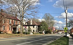
Yanceyville is a town in and the county seat of Caswell County, North Carolina, United States. Located in the Piedmont Triad region of the state, the town had a population of 1,937 at the 2020 census.

<span class="mw-page-title-main">Kenansville, North Carolina</span> Town in North Carolina, United States

Kenansville is a town in Duplin County, North Carolina, United States. Its population was 855 at the 2010 census. It is the county seat of Duplin County. The town was named for James Kenan, a member of the North Carolina Senate, whose family home Liberty Hall Plantation is in Kenansville.

<span class="mw-page-title-main">Walstonburg, North Carolina</span> Town in North Carolina, United States

Walstonburg is a town in Greene County, North Carolina, United States. The population was 219 at the 2010 census. It is located north of Snow Hill on North Carolina Highway 91. The town is part of the Greenville Metropolitan Area.

<span class="mw-page-title-main">Summerfield, North Carolina</span> Town in North Carolina, United States

Summerfield is a town in Guilford County, North Carolina. The population was 7,018 at the 2000 census. At the 2010 census, the population had risen to 10,232.

<span class="mw-page-title-main">Weldon, North Carolina</span> Town in North Carolina, United States

Weldon is a town in Halifax County, North Carolina, United States. The population was 1,655 at the 2010 census. It is part of the Roanoke Rapids, North Carolina Micropolitan Statistical Area.

<span class="mw-page-title-main">Lincolnton, North Carolina</span> City in North Carolina, United States

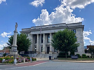
Lincolnton is a city in Lincoln County, North Carolina, United States within the Charlotte metropolitan area. The population was 10,486 at the 2010 census. Lincolnton is northwest of Charlotte, on the South Fork of the Catawba River. The city is the county seat of Lincoln County, and is the only legally incorporated municipality which is wholly within the county.

<span class="mw-page-title-main">Bethel, North Carolina</span> Town in North Carolina, United States

Bethel is a town in Pitt County, North Carolina, United States. The population was 1,577 at the 2010 Census. The town is a part of the Greenville Metropolitan Area located in North Carolina's Inner Banks region. Confusingly, there are three other towns in the state named "Bethel." One is between Edenton and Hertford in the "Finger Counties" region in the northeastern corner of the state, another is in the north-central part, in Caswell County and the third is located in the Mountain Region of North Carolina, in Haywood County. There is also a community named Bethel located in Watauga County.

<span class="mw-page-title-main">Ramseur, North Carolina</span> Town in North Carolina, United States

Ramseur is a town in Randolph County, North Carolina, United States. The population was 1,692 at the 2010 census.

Newton Grove is a town in Sampson County, North Carolina, United States. It was chartered in 1879. The population was 585 at the 2020 U.S. census.

<span class="mw-page-title-main">Wagram, North Carolina</span> Town in North Carolina, United States

Wagram is a town in Scotland County, North Carolina, United States. The population was 840 at the 2010 Census. The town was named for the Battle of Wagram, a Napoleonic battle at Deutsch-Wagram in Austria.

<span class="mw-page-title-main">Badin, North Carolina</span> Town in North Carolina, United States

Badin is a town located in Stanly County, North Carolina, United States. At the 2010 census, the town had a total population of 1,974.

<span class="mw-page-title-main">Virgilina, Virginia</span> Town in Virginia, United States

Virgilina is a town in Halifax County, Virginia, United States. The population was 154 at the 2010 census. Virgilina was once a copper mining town. It was a stop on the Atlantic and Danville Railway as recently as the 1950s. It is named "Virgilina" because it is located on the Virginia and North Carolina border.

References

  1. "ArcGIS REST Services Directory". United States Census Bureau. Retrieved September 20, 2022.
  2. 1 2 U.S. Geological Survey Geographic Names Information System: Milton, North Carolina
  3. 1 2 "U.S. Census website". United States Census Bureau . Retrieved 2008-01-31.
  4. 1 2 "Geographic Identifiers: 2010 Demographic Profile Data (G001): Milton town, North Carolina". U.S. Census Bureau, American Factfinder. Archived from the original on February 12, 2020. Retrieved December 26, 2014.
  5. The Woodside House
  6. "National Register Information System". National Register of Historic Places . National Park Service. July 9, 2010.
  7. "Census of Population and Housing". Census.gov. Retrieved June 4, 2015.