
Phelps is an unincorporated community in Lawrence County, Missouri, United States. It lies along former U.S. Route 66, twenty-one miles east of Carthage.
Holman is an extinct town in Webster County, in the U.S. state of Missouri. The GNIS classifies it as a populated place. The site is located on Missouri Supplemental Route OO, approximately fifteen miles (24 km) northeast of Springfield.

Logan is an unincorporated community in eastern Lawrence County, Missouri, United States. It is located off U.S. Route 60, one mile northeast of Marionville. Several homes are located there.
Jenkins is an unincorporated community in Barry County, Missouri, United States. It is located on Route 39, just north of Route 248, approximately fourteen miles northeast of Cassville. Mail is delivered via Aurora.

Koch is a former community in St. Louis County, Missouri. It was named for Robert Koch, a German bacteriologist. The location was at what is now Interstate 255 east of Route 231. It had a post office, which is now closed.

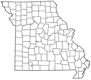
Chesapeake is a village in Lawrence County, Missouri, United States. It is located on Route 174, approximately five miles east of Mount Vernon.

Reeds Spring Junction is an unincorporated community in eastern Stone County, Missouri, United States. It was so named as it was located on U.S. Route 160 at Route 248, a road which continued to the city of Reeds Spring two miles to the west. It had previously been known as Stutts.
Nady is an unincorporated community in Arkansas County, Arkansas, United States. It is the location of a National Historic Landmark, the Menard-Hodges Site.
Minden is a ghost town in Warren County, Missouri, United States. It possessed a post office in 1899.

Postal is an unincorporated community in Pettis County, Missouri, United States. It is located at 38°53′51″N93°5′0″W, and its altitude is 823 feet (251 m).

Lawrence is an extinct village in section 16 of St. Lawrence Township, Scott County, in the U.S. state of Minnesota. The GNIS classifies it as a populated place.
Perche Township is one of ten townships in Boone County, Missouri, USA. As of the 2012, its population was 4,037. The village of Harrisburg is the only incorporated settlement inside the township.
Hailey is an extinct town in Barry County, in the U.S. state of Missouri. The GNIS classifies it as a populated place.
Rushs Ridge is an extinct town in Mississippi County, in the U.S. state of Missouri. The GNIS classifies it as a populated place.
New Liberty is an extinct town in northeastern Oregon County, in the U.S. state of Missouri. The GNIS classifies it as a populated place.
Sharp is an unincorporated community in Ozark County, Missouri. The village location is a quarter mile south of US 160 between Caulfield and Tecumseh at the head of Hickory Stump Hollow.
Terre Haute is an extinct town in Putnam County, in the U.S. state of Missouri. The GNIS classifies it as a populated place.
Radical is an extinct town in Stone County, in the U.S. state of Missouri. The GNIS classifies it as a populated place.
Melva is an extinct town in southern Taney County, in the Ozarks of southwest Missouri. The GNIS classifies it as a populated place. The site was located south of Hollister on the east bank of Turkey Creek along the Missouri Pacific Railroad line.
Nance is an extinct town in eastern Taney County, in the Ozarks of southwest Missouri. The GNIS classifies it as a populated place. The townsite sits above the east bank of the west fork of Big Creek about one mile north of U.S. Route 160 and about 1.7 miles west of the Taney - Ozark county line. The site is at an elevation of 876 feet.


