
Heatonville is a small unincorporated community in Lawrence County, Missouri, United States. It lies along former U.S. Route 66, approximately six miles (10 km) north-east of Mount Vernon.

Albatross is an unincorporated community in Lawrence County, Missouri, United States]. It lies near the intersection of Routes 39 and 96, approximately six miles (10 km) north of Mount Vernon and two miles south of Miller.

Phelps is an unincorporated community in Lawrence County, Missouri, United States. It lies along former U.S. Route 66, twenty-one miles east of Carthage.
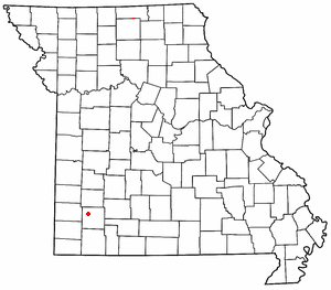
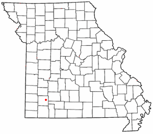
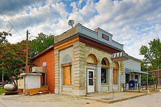
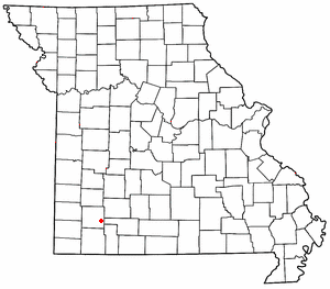
Rescue is a small unincorporated community in western Lawrence County, Missouri, United States. It lies along Route 96, approximately eighteen miles east of Carthage.
Spencer is a small unincorporated crossroads in eastern Lawrence County, Missouri, United States. It lies along former U.S. Route 66 approximately six miles (10 km) west of Halltown.

Logan is an unincorporated community in eastern Lawrence County, Missouri, United States. It is located off U.S. Route 60, one mile northeast of Marionville. Several homes are located there.

Millersville is an unincorporated community in western Cape Girardeau County, Missouri, United States. It is located six miles (10 km) west of Jackson on Route 72.
Tebbetts is an unincorporated community in southern Callaway County, Missouri, United States. It is part of the Jefferson City, Missouri Metropolitan Statistical Area. Tebbetts is located on Route 94, approximately eight miles east of Jefferson City, on the north edge of the Missouri River floodplain, at 38°37′14″N91°57′45″W.
McKinley is an unincorporated community in Lawrence County, Missouri, United States. It is located on Route 14, approximately five miles west of Billings.
New Hamburg is an unincorporated community in Scott County, in the U.S. state of Missouri.
Ontario is a community within the corporate limits of the city of Ames, in Story County, Iowa, United States.
Sinking Creek is a stream in Lawrence and Dade counties of southwest Missouri. It is a tributary of Turnback Creek.
Grays Point is an unincorporated community in Lawrence County, in the U.S. state of Missouri.
Lawrenceburg is an unincorporated community in Lawrence County, in the U.S. state of Missouri.
Olinger is an unincorporated community in Lawrence County, in the U.S. state of Missouri.
Orange is an unincorporated community in Lawrence County, in the U.S. state of Missouri.
Stinson is an unincorporated community in Lawrence County, in the U.S. state of Missouri.
Hoberg Township is an inactive township in Lawrence County, in the U.S. state of Missouri.
Gilead is an unincorporated community in Lewis County, in the U.S. state of Missouri.
Johnson City is an unincorporated community in St. Clair County, in the U.S. state of Missouri.

