Related Research Articles

The Cromford and High Peak Railway (C&HPR) was a standard-gauge line between the Cromford Canal wharf at High Peak Junction and the Peak Forest Canal at Whaley Bridge. The railway, which was completed in 1831, was built to carry minerals and goods through the hilly rural terrain of the Peak District within Derbyshire, England. The route was marked by a number of roped worked inclines. Due to falling traffic, the entire railway was closed by 1967.

The High Peak Trail is a 17-mile (27 km) trail for walkers, cyclists and horse riders in the Peak District of England. Running from Dowlow (53.2059°N 1.8349°W), near Buxton, to High Peak Junction, Cromford (53.1004°N 1.5354°W), it follows the trackbed of the former Cromford and High Peak Railway, which was completed in 1831 to carry minerals and goods between the Cromford Canal wharf at High Peak Junction and the Peak Forest Canal at Whaley Bridge.

The history of Derbyshire can be traced back to human settlement since the last Ice Age, over 10,000 years ago. The county of Derbyshire in England dates back to the 11th century.

The Limestone Way is a waymarked long-distance footpath in Derbyshire, England. It runs for 46 miles (74 km) through the White Peak of the Peak District National Park, from Castleton south to Rocester over the county boundary into Staffordshire. The trail is named for the limestone scenery along its route. It was devised by Brian Spencer of Matlock Rotary Club and developed and opened in 1986 by the West Derbyshire District Council. It originally ran to Matlock, but was extended to its current, longer route in 1992 to join up with the Staffordshire Way.

High Peak Junction, near Cromford, Derbyshire, England, is the name now used to describe the site where the former Cromford and High Peak Railway (C&HPR), whose workshops were located here, meets the Cromford Canal. It lies within Derwent Valley Mills World Heritage Site, designated in 2001, and today marks the southern end of the High Peak Trail, a 17 miles (27 km) trail for walkers, cyclists and horse riders. The Derwent Valley Heritage Way also passes this point, and popular walks lead from here along the towpath in both directions.
Shallcross is a small village in northwestern Derbyshire, England. It is located 15 miles (24 km) south of Manchester, at the edge of the Peak District, on the eastern side of the River Goyt. Located between Whaley Bridge and Fernilee, it is now administered as part of the larger community of Whaley Bridge. The area attracts many outdoors enthusiasts, especially hikers, because of the beauty and variety of the scenery. The country rises steeply as it ascends the Goyt Valley from the canal terminal at Whaley Bridge, past the Fernilee Reservoir, and onto the highlands of Axe Edge Moor.

Chinley, Buxworth and Brownside is a civil parish within the High Peak district, which is in the county of Derbyshire, England. Partially rural with several villages contained within, its population was 2,796 residents in the 2011 census. The parish is 150 miles (240 km) north west of London, 35 miles (56 km) north west of the county city of Derby, and 1+1⁄3 miles (2.1 km) north of the nearest market town of Chapel-en-le-Frith. Being on the edge of the county border, it shares a boundary with the parishes of Chapel-en-le-Frith, Edale, Hayfield, New Mills and Whaley Bridge. A substantial portion of the parish is within the Peak District national park.
Cromford Incline is a former railway incline in Cromford, Derbyshire. Historically on the Cromford and High Peak Railway. The incline was one of six inclines along the entire line from Cromford to Whaley Bridge in High Peak, Derbyshire. The incline was opened in 1830 and was in use until 1967 when the entire line from Whaley Bridge to Middleton was closed. With the section to Cromford closing in 1963. Today, the incline is used as part of the High Peak Trail. Cromford Incline was also 1 in 9 gradient. Like the other ones along the former railway.
Steeplehouse and Wirksworth Goods Yard was a goods station located on the Cromford and High Peak Railway in Wirksworth, Derbyshire. It consisted of three sidings and a few goods sheds. Mostly for moving mineral and quarry traffic. It closed in 1967 along with the rest of the line. And today, nothing remains of the goods yard. Today, a section of the former line is used by the Steeplehouse Grange Light Railway.
Longcliffe Goods Yard was a goods station located on the Cromford and High Peak Railway in Longcliffe, Derbyshire. Mostly for moving mineral and quarry traffic. It closed in 1967 along with the rest of the line. And today, nothing remains of the goods yard. The trackbed now forms part of the High Peak Trail.
Friden Goods Yard was a goods station located on the Cromford and High Peak Railway near the villages of Friden in Derbyshire. Mostly for moving mineral and quarry traffic. It closed in 1967 along with the rest of the line. And today, nothing remains of the goods yard. The trackbed now forms part of the High Peak Trail.
Friden Goods Yard railway station was a minor railway station located on the Cromford and High Peak Railway near the village of Friden in Derbyshire. Located on a line mostly used for mineral and quarry traffic. It opened to passengers in 1855 and closed in 1876 due to relatively but not uncommon low usage. The goods station then closed in 1967 along with the rest of the line. And today, nothing remains of the goods yard or the passenger station. The trackbed now forms part of the High Peak Trail.
Harpur Hill railway station was a minor railway station located on the Cromford and High Peak Railway near the village of Harpur Hill in Derbyshire. Located on a line mostly used for mineral and quarry traffic. It opened to passengers in 1855 and closed in 1876 due to relatively but not uncommon low usage. The goods station then closed in 1967 along with the rest of the line. And today, nothing remains of the station. The trackbed is still traceable but unkept.
Ladmanlow railway station was a minor railway station located on the Cromford and High Peak Railway near Buxton in Derbyshire. It was located on a line mostly used for mineral and quarry traffic. It opened to passengers in 1855 and closed in 1876 due to relatively but not uncommonly low usage. The goods station then closed in 1967 along with the rest of the line. Today, nothing remains of the station. It was also the terminus of the line originally for passengers until 1874 when it was extended to Buxton/Whaley Bridge. The trackbed now forms part of the A54 Road.
Bunsail railway station was a minor railway station located on the Cromford and High Peak Railway near Buxton in Derbyshire. Located on a line mostly used for mineral and quarry traffic. It opened to passengers in 1855 and closed in 1876 due to relatively but not uncommon low usage. The goods station then closed in 1967 along with the rest of the line. And today, nothing remains of the station. The trackbed and tunnel are still traceable on maps but have returned to mostly agriculture and minor roads.
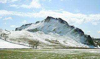
Hartington Middle Quarter is a civil parish within the Derbyshire Dales district, which is in the county of Derbyshire, England. Formerly a part of Hartington parish, for which it is named, it has a mix of a number of villages and hamlets amongst a mainly rural and undulating landscape, and is wholly within the Peak District National Park. It had a population of 379 residents in 2011. The parish is 130 miles (210 km) north west of London, 20 miles (32 km) north west of the county city of Derby, and 5 miles (8.0 km) south east of the nearest market town of Buxton. Being on the edge of the county border, it shares a boundary with the parishes of Chelmorton, Flagg, Hartington Town Quarter, Hartington Upper Quarter, Middleton and Smerrill, Monyash in Derbyshire, as well as Hollinsclough, Longnor and Sheen in Staffordshire.

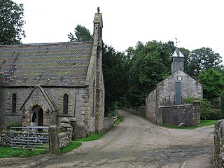
Ivonbrook Grange is a civil parish within the Derbyshire Dales district, in the county of Derbyshire, England. Largely rural, Ivonbrook Grange's population is reported with the population of neighbouring parishes for a total of 180 residents in 2011. It is 130 miles (210 km) north west of London, 15 miles (24 km) north west of the county city of Derby, and 3+1⁄2 miles (5.6 km) south west of the nearest market town of Matlock. Ivonbrook Grange is wholly within the Peak District national park on its southern edge, and shares a border with the parishes of Aldwark, Bonsall, Brassington, Ible as well as Winster. There is one listed structure in Ivonbrook Grange.
Middleton and Smerrill is a civil parish within the Derbyshire Dales district, in the county of Derbyshire, England. Largely rural except for the village of Middleton-by-Youlgreave and isolated farms, Middleton and Smerrill's population is 137 residents in 2011. It is 130 miles (210 km) north west of London, 20 miles (32 km) north west of the county city of Derby, and 4+1⁄2 miles (7.2 km) south west of the nearest market town of Bakewell. Middleton and Smerrill is wholly within the Peak District national park, in the southern part of the area. It is one of the largest parishes but among the smallest by way of residents, and shares a border with the parishes of Gratton, Hartington Middle Quarter, Hartington Nether Quarter, Hartington Town Quarter, Monyash and Youlgreave. There are 31 listed structures in Middleton and Smerrill.

Brampton is a civil parish in North East Derbyshire, England, with a population of 1,201 in 2011. Lying 130 miles (210 km) north west of London, 20 miles (32 km) north of Derby, and 2 miles (3.2 km) west of the market town of Chesterfield, Brampton encompasses part of the Peak District national park to the west, and shares a border with the Borough of Chesterfield, Barlow, Baslow and Bubnell, Beeley, and Holymoorside and Walton. The parish does not include the nearby built-up suburb of Brampton which is now within the Chesterfield unparished area.

Holymoorside and Walton is a civil parish within the North East Derbyshire district, which is in the county of Derbyshire, England. Named for its main settlements, with a mix of a number of villages and hamlets amongst a large rural area, it had a population of 2,223 residents in 2011. The parish is 130 miles (210 km) north west of London, 20 miles (32 km) north of the county city of Derby, and 2 miles (3.2 km) south west of the nearest market town of Chesterfield. It is adjacent with the Peak District national park to the west, and shares a border with the district of Chesterfield, along with the parishes of Ashover, Beeley, Brampton as well as Wingerworth. The parish paradoxically does not include the majority of the nearby built-up suburb of Walton, Chesterfield which is now within an adjacent unparished area of the borough.
References
- ↑ "MDR9118 - Minninglow Goods Yard, Cromford & High Peak Railway, Ballidon - Derbyshire Historic Environment Record". her.derbyshire.gov.uk.
- ↑ "MDR9117 - Level crossing, Minninglow Goods Yard, Cromford & High Peak Railway, Ballidon - Derbyshire Historic Environment Record". her.derbyshire.gov.uk.
- ↑ "Minninglow To Friden via Gotham Curve".
- ↑ "Minninglow Royston 29 Mar 2017". www.ambervalleyramblers.org.uk.
- ↑ https://rchs.org.uk/wp-content/uploads/2018/02/Cromford-High-Peak-Railway-Nov-2001.pdf [ bare URL PDF ]
| | This article on a railway station in the East Midlands is a stub. You can help Wikipedia by expanding it. |