
U.S. Route 160 (US 160) is a 1,465-mile-long (2,358 km) east–west United States Numbered Highway in the Midwestern and Western United States. The western terminus of the route is at US 89 five miles (8.0 km) west of Tuba City, Arizona. The eastern terminus is at US 67 and Missouri 158 southwest of Poplar Bluff, Missouri. Its route, if not its number, was made famous in song in 1975, as the road from Wolf Creek Pass to Pagosa Springs, Colorado in C.W. McCall's country music song "Wolf Creek Pass".

U.S. Route 71 or U.S. Highway 71 is a major north–south United States highway that extends for over 1500 miles (2500 km) in the central United States. This original 1926 route has remained largely unchanged by encroaching Interstate highways. Currently, the highway's northern terminus is in International Falls, Minnesota at the Canada–US border, at the southern end of the Fort Frances-International Falls International Bridge to Fort Frances, Ontario. U.S. Route 53 also ends here. On the other side of the bridge, Trans-Canada Highway is an east–west route while Ontario Highway 71 is a north–south route. US 71's southern terminus is between Port Barre and Krotz Springs, Louisiana at an intersection with U.S. Route 190. For the entirety south of Kansas City, Missouri, US 71 runs parallel and concurrent with the existing and future Interstate 49. North of Kansas City, US 71 runs halfway between Interstate 29 and Interstate 35, which they split in the city at an interchange with Interstate 70.
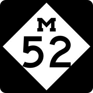
M-52 is a north–south state trunkline highway in the US state of Michigan. The southern terminus is on the Ohio border, where it continues as State Route 109. The highway passes through communities like Adrian, where it intersects US Highway 223 (US 223), Chelsea and Webberville along its 127.3-mile-long (204.9 km) course. It crosses some major rivers, including the River Raisin and the Shiawassee. The section of the highway between M-50 and Manchester was built as a limited-access highway. M-52's northern terminus is at M-46, nine miles (14 km) west of Saginaw.
K-66 is a 5.527-mile-long (8.895 km) east–west state highway in the southeastern corner of the U.S. state of Kansas. Its western terminus is at U.S. Route 69 Alternate and US-400 in Riverton. Its eastern terminus is at the Missouri state line near Galena. This road is noteworthy in the fact that it used to be part of the famed US-66. After 1961, the nearby Interstate 44 (I-44) offered a more direct route between Missouri and Oklahoma. In 1985, US-66 was decommissioned nationally. Kansas replaced the US-66 designation with K-66 on the portion of historic highway not numbered as US-69 Alt.

U.S. Route 54 is an east–west United States Highway that runs northeast–southwest for 1,197 miles (1,926 km) from El Paso, Texas, to Griggsville, Illinois. The Union Pacific Railroad's Tucumcari Line runs parallel to US 54 from El Paso to Pratt, Kansas, which comprises about two-thirds of the route.
U.S. Route 177 (US-177) is a spur of U.S. Route 77. It currently runs for 233 miles (375 km) from South Haven, Kansas at US-81 to Madill, Oklahoma at US-70. It passes through the states of Kansas and Oklahoma.

Route 13 is a highway in Missouri which runs almost the entire north–south length of the state. Its northern terminus is at U.S. Route 69/136 in Bethany. Its southern terminus is at the Arkansas state line in downtown Blue Eye, Missouri–Arkansas where it continues as Highway 21. It is one of the original state highways of Missouri.

Route 7 is a state highway with its northern terminus at U.S. Route 24 in northeast Independence and its southern terminus at Interstate 44 southeast of Richland. The section between Harrisonville and Clinton provides an important link for traffic between Springfield and Kansas City.

Route 52 is an east/west highway running from its eastern terminus at Route 133 7 miles (11 km) east of St. Elizabeth to the Kansas state line where it continues as K-52. Highway 52 comprises 173 miles (278 km) of primarily two-lane roadway in Missouri.

K-171 is a state highway in the southeastern part of the U.S. state of Kansas. The 4.890-mile (7.870 km) highway mostly lies on the Crawford County/Cherokee County line except for the easternmost 0.4 miles (0.64 km) of the highway when it is entirely in Cherokee County. Its western terminus is at the intersection of U.S. Route 69 (US-69), US-160 and US-400 south of Pittsburg and its eastern terminus is a continuation as Missouri Route 171 at the Missouri state line near Opolis. K-171's current route was established on May 14, 2003, and the routing has not changed since.

Route 2 is a highway in western Missouri. Its western terminus is at the Kansas state line about three miles (4.8 km) southwest of West Line; it continues into Kansas as K-68. Its eastern terminus is at Route 52 in Windsor.

Route 10 is a highway in Clay, Ray, and Carroll counties in western Missouri, United States. Its eastern terminus is at the concurrency of US 24/US 65 in Carrollton. Its western terminus is at US 69 in Excelsior Springs. A business loop of Route 10 travels through Richmond.

K-126 is a 26.918-mile-long (43.320 km) mostly east–west state highway located entirely within Crawford County in southeastern Kansas. Its western terminus is at U.S. Route 400 (US-400) just south of McCune, and its eastern terminus is the Missouri state line where it continues as Route 126. Along the way the highway passes through the city of McCune and also the city of Pittsburg, where it intersects US-69 and US-160.
State Highway 10 is a state highway in northeastern Oklahoma. It makes a 233.1 miles (375.1 km) crescent through the northeast corner of the state, running from SH-99 in Osage County to Interstate 40 (I-40) near Gore. It has two lettered spur routes.

K-52 is an approximately 23-mile-long (37 km) east–west state highway in eastern Kansas. Its western terminus is at an intersection with K-31 southeast of Mound City. K-52 then overlaps U.S. Route 69 for eight miles (13 km) through Pleasanton and Trading Post, then splits off to the east. three miles (4.8 km) later, it crosses into Missouri, becoming Route 52.

State Route 49 is a state highway in the western part of the U.S. state of Ohio. It begins in Drexel, an area within the city of Trotwood, at US 35 and runs northwesterly to Greenville, and then runs roughly along near the western edge of the state near the Indiana state line to the Michigan state line where it meets with Michigan's M-49.

Interstate 44 (I-44) in the US state of Missouri runs northeast from the Oklahoma state line near Joplin to I-70 in Downtown St. Louis. It runs for about 293 miles (472 km) in the state, and is the longest Interstate Highway in the state.

K-150 is a 16.645-mile (26.788 km) east–west state highway in the U.S. state of Kansas. The route begins at a roundabout with U.S. Route 56 (US-56) and US-77 northeast of Marion and runs east to a junction with US-50 southwest of Elmdale. It runs through the Flint Hills region of Kansas, and is a two-lane road its entire length. There are no cities or towns along the road, but it provides a direct link for traffic from Marion, Hillsboro, McPherson and points west to Emporia and the Kansas Turnpike.

A total of eight special routes of U.S. Route 65 exist, divided between the U.S. states of Arkansas and Missouri. Currently, they are all business loops, although a spur route in Pine Bluff, Arkansas and bypass routes in Baton Rouge, Louisiana and Springfield, Missouri both existed in the past.

U.S. Route 59 (US-59) is a part of the U.S. Highway System that runs from the Mexico–US border in Laredo, Texas, as a continuation of Mexican Federal Highway 85D north to the Lancaster–Tolstoi Border Crossing on the Canada–US border, where it continues as Manitoba Highway 59. In the U.S. state of Kansas, US-59 is a main north–south highway that travels from Chetopa to Atchison.


