Mount Cory, Ohio

Last updated

Mount Cory, Ohio
Main south of Washington, Mount Cory.jpg
Houses on Main Street
OHMap-doton-Mount Cory.png
Location of Mount Cory, Ohio
Map of Hancock County Ohio Highlighting Mount Cory.png
Location of Mount Cory in Hancock County
Coordinates: 40°56′06″N83°49′25″W / 40.93500°N 83.82361°W / 40.93500; -83.82361
Country United States
State Ohio
County Hancock
Government
  Type Village council
Area
[1]
  Total0.39 sq mi (1.00 km2)
  Land0.39 sq mi (1.00 km2)
  Water0.00 sq mi (0.00 km2)
Elevation
[2]
814 ft (248 m)
Population
 (2020)
  Total225
  Density582.90/sq mi (225.08/km2)
Time zone UTC-5 (Eastern (EST))
  Summer (DST) UTC-4 (EDT)
ZIP code
45868
Area code 419
FIPS code 39-52668 [3]
GNIS feature ID2399409 [2]

Mount Cory is a village in Hancock County, Ohio, United States. The population was 225 at the 2020 census.

Contents

History

Mount Cory was originally called Cory, and under the latter name was laid out in 1872 when the railroad was extended to that point. [4] The village was named for D. J. Cory, proprietor of the town site. [4] [5] A post office has been in operation at Mount Cory since 1873. [6]

Geography

According to the United States Census Bureau, the village has a total area of 0.38 square miles (0.98 km2), all land. [7]

Demographics

Historical population
CensusPop.Note
1890 334
1900 312−6.6%
1910 290−7.1%
1920 252−13.1%
1930 237−6.0%
1940 27315.2%
1950 30210.6%
1960 301−0.3%
1970 3020.3%
1980 276−8.6%
1990 245−11.2%
2000 203−17.1%
2010 2040.5%
2020 22510.3%
U.S. Decennial Census [8]

2010 census

As of the census [9] of 2010, there were 204 people, 77 households, and 64 families living in the village. The population density was 536.8 inhabitants per square mile (207.3/km2). There were 87 housing units at an average density of 228.9 per square mile (88.4/km2). The racial makeup of the village was 96.1% White, 0.5% Native American, 1.5% Asian, and 2.0% from two or more races.

There were 77 households, of which 40.3% had children under the age of 18 living with them, 68.8% were married couples living together, 6.5% had a female householder with no husband present, 7.8% had a male householder with no wife present, and 16.9% were non-families. 15.6% of all households were made up of individuals, and 7.8% had someone living alone who was 65 years of age or older. The average household size was 2.65 and the average family size was 2.89.

The median age in the village was 39.7 years. 28.4% of residents were under the age of 18; 5.4% were between the ages of 18 and 24; 23.1% were from 25 to 44; 29% were from 45 to 64; and 14.2% were 65 years of age or older. The gender makeup of the village was 50.5% male and 49.5% female.

2000 census

As of the census [3] of 2000, there were 203 people, 80 households, and 61 families living in the village. The population density was 528.1 inhabitants per square mile (203.9/km2). There were 86 housing units at an average density of 223.7 per square mile (86.4/km2). The racial makeup of the village was 97.04% White, 0.49% Native American, and 2.46% from two or more races. Hispanic or Latino of any race were 0.99% of the population.

There were 80 households, out of which 32.5% had children under the age of 18 living with them, 62.5% were married couples living together, 8.8% had a female householder with no husband present, and 23.8% were non-families. 21.3% of all households were made up of individuals, and 11.3% had someone living alone who was 65 years of age or older. The average household size was 2.54 and the average family size was 2.90.

In the village, the population was spread out, with 27.1% under the age of 18, 5.4% from 18 to 24, 31.0% from 25 to 44, 23.2% from 45 to 64, and 13.3% who were 65 years of age or older. The median age was 39 years. For every 100 females there were 103.0 males. For every 100 females age 18 and over, there were 92.2 males.

The median income for a household in the village was $40,833, and the median income for a family was $45,000. Males had a median income of $37,500 versus $21,250 for females. The per capita income for the village was $20,250. None of the families and 1.0% of the population were living below the poverty line.

Related Research Articles

<span class="mw-page-title-main">Hancock County, Ohio</span> County in Ohio, United States

Hancock County is a county located in the U.S. state of Ohio. As of the 2020 census, the population was 74,920. Its county seat and largest city is Findlay. The county was created in 1820 and later organized in 1828. It was named for John Hancock, the first signer of the Declaration of Independence.

<span class="mw-page-title-main">Aberdeen, Ohio</span> Village in Ohio, United States

Aberdeen is a village in Huntington Township, Brown County, Ohio, United States, along the Ohio River 50 miles (80 km) southeast of Cincinnati. The population was 1,515 at the 2020 census.

<span class="mw-page-title-main">Warsaw, Ohio</span> Village in Ohio, United States

Warsaw is a village in Coshocton County, Ohio, United States, along the Walhonding River. The population was 624 at the 2020 census.

<span class="mw-page-title-main">Gordon, Ohio</span> Village in Ohio, United States

Gordon is a village in Darke County, Ohio, United States. The population was 245 at the 2020 census.

<span class="mw-page-title-main">Addyston, Ohio</span> Village in Ohio, United States

Addyston is a village in Miami Township, Hamilton County, Ohio, United States. Located along the Ohio River, it is a western suburb of the neighboring city of Cincinnati. The population was 927 at the 2020 census.

<span class="mw-page-title-main">Cleves, Ohio</span> City in Ohio, United States

Cleves is a village in Miami Township, Hamilton County, Ohio, United States. Located along the Ohio River, it is a western suburb of Cincinnati. The population was 3,414 at the 2020 census.

<span class="mw-page-title-main">North Bend, Ohio</span> Village in Ohio, United States

North Bend is a village in Miami Township, Hamilton County, Ohio, United States, along the Ohio River. It is a part of the Greater Cincinnati area. The population was 835 at the 2020 census.

<span class="mw-page-title-main">Arcadia, Ohio</span> Village in Ohio, United States

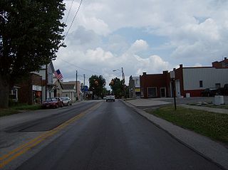
Arcadia is a village in Hancock County, Ohio, United States. The population was 564 at the 2020 census.

<span class="mw-page-title-main">Arlington, Ohio</span> Village in Ohio, United States

Arlington is a village in Hancock County, Ohio, United States. The population was 1,492 at the 2020 census.

<span class="mw-page-title-main">Benton Ridge, Ohio</span> Village in Ohio, United States

Benton Ridge is a village in Hancock County, Ohio, United States. The population was 272 at the 2020 census. It is within the boundaries of the Liberty-Benton Local School district.

<span class="mw-page-title-main">Jenera, Ohio</span> Village in Ohio, United States

Jenera is a village in Hancock County, Ohio, United States. The population was 257 at the 2020 census. It is surrounded by Van Buren Township and is part of the Cory-Rawson Local School District.

<span class="mw-page-title-main">McComb, Ohio</span> Village in Ohio, United States

McComb is a village in Hancock County, Ohio, United States. The population was 1,558 at the time of the 2020 census. The village holds one school district, McComb Local School District.

<span class="mw-page-title-main">Mount Blanchard, Ohio</span> Village in Ohio, United States

Mount Blanchard is a village in Hancock County, Ohio, United States. The population was 471 at the 2020 census.

<span class="mw-page-title-main">Rawson, Ohio</span> Village in Ohio, United States

Rawson is a village in Hancock County, Ohio, United States. The population was 567 at the 2020 census.

<span class="mw-page-title-main">Van Buren, Ohio</span> Village in Ohio, United States

Van Buren is a village in Hancock County, Ohio, United States. The population was 396 at the 2020 census.

<span class="mw-page-title-main">Vanlue, Ohio</span> Village in Ohio, United States

Vanlue is a village in Hancock County, Ohio, United States. The population was 341 at the 2020 census.

<span class="mw-page-title-main">Macksburg, Ohio</span> Village in Ohio, United States

Macksburg is a village in Washington County, Ohio, United States, along the West Fork of Duck Creek. The population was 120 at the 2020 census. The village is about 28 miles (45 km) south of Cambridge, Ohio.

<span class="mw-page-title-main">Bluffton, Ohio</span> Village in Ohio, United States

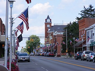
Bluffton, originally known as Shannon, is a village in Allen and Hancock counties in the U.S. state of Ohio. The population was 3,967 at the 2020 census. Bluffton is home to Bluffton University, a four-year educational institution affiliated with Mennonite Church USA. Bluffton is served by the Bluffton general aviation airport. Bluffton participates in the Tree City USA program.

<span class="mw-page-title-main">Gratiot, Ohio</span> Village in Ohio, United States

Gratiot is a village in Licking and Muskingum counties in the U.S. state of Ohio. The population was 215 at the 2020 census.

<span class="mw-page-title-main">Hancock, Wisconsin</span> Village in Wisconsin, United States

Hancock is a village in Waushara County, Wisconsin, United States. The population was 417 at the 2010 census. The village is located within the Town of Hancock.

References

  1. "ArcGIS REST Services Directory". United States Census Bureau. Retrieved September 20, 2022.
  2. 1 2 U.S. Geological Survey Geographic Names Information System: Mount Cory, Ohio
  3. 1 2 "U.S. Census website". United States Census Bureau . Retrieved January 31, 2008.
  4. 1 2 History of Hancock County, Ohio: Containing a History of the County, Its Townships, Towns. Warner, Beers. 1886. p. 497.
  5. Overman, William Daniel (1958). Ohio Town Names. Akron, OH: Atlantic Press. p. 92.
  6. "Hancock County". Jim Forte Postal History. Retrieved January 3, 2016.
  7. "US Gazetteer files 2010". United States Census Bureau. Archived from the original on July 2, 2012. Retrieved January 6, 2013.
  8. "Census of Population and Housing". Census.gov. Retrieved June 4, 2015.
  9. "U.S. Census website". United States Census Bureau . Retrieved January 6, 2013.