Rawson, Ohio

Last updated

Rawson, Ohio
Rawson post office 45881.jpg
Post office on Main Street
OHMap-doton-Rawson.png
Location of Rawson, Ohio
Map of Hancock County Ohio Highlighting Rawson.png
Location within Hancock County
Coordinates: 40°57′25″N83°47′06″W / 40.95694°N 83.78500°W / 40.95694; -83.78500
Country United States
State Ohio
County Hancock
Government
  Type Village council
Area
[1]
  Total0.38 sq mi (0.99 km2)
  Land0.38 sq mi (0.99 km2)
  Water0.00 sq mi (0.00 km2)
Elevation
[2]
817 ft (249 m)
Population
 (2020)
  Total567
  Density1,484.29/sq mi (572.79/km2)
Time zone UTC-5 (Eastern (EST))
  Summer (DST) UTC-4 (EDT)
ZIP codes
45841, 45881
Area code 419
FIPS code 39-65634 [3]
GNIS feature ID2399047 [2]

Rawson is a village in Hancock County, Ohio, United States. The population was 567 at the 2020 census.

Contents

History

Rawson was laid out in 1855 when the railroad was extended to that point. [4] The village was named for L. Q. Rawson, the president of the Fremont and Indiana Railroad. [4] Rawson was incorporated in 1884. [4] In 1889 White Caps were active in Rawson, twice destroying a Rawson saloon. [5] [6]

Geography

According to the United States Census Bureau, the village has a total area of 0.40 square miles (1.04 km2), all land. [7]

Demographics

Historical population
CensusPop.Note
1880 227
1890 458101.8%
1900 4733.3%
1910 470−0.6%
1920 416−11.5%
1930 4538.9%
1940 441−2.6%
1950 407−7.7%
1960 4070.0%
1970 46614.5%
1980 4772.4%
1990 4821.0%
2000 465−3.5%
2010 57022.6%
2020 567−0.5%
U.S. Decennial Census [8]

2010 census

As of the census [9] of 2010, there were 570 people, 191 households, and 152 families living in the village. The population density was 1,425.0 inhabitants per square mile (550.2/km2). There were 209 housing units at an average density of 522.5 per square mile (201.7/km2). The racial makeup of the village was 95.6% White, 1.9% African American, 0.9% Asian, 0.2% from other races, and 1.4% from two or more races. Hispanic or Latino of any race were 1.9% of the population.

There were 191 households, of which 45.5% had children under the age of 18 living with them, 63.4% were married couples living together, 12.6% had a female householder with no husband present, 3.7% had a male householder with no wife present, and 20.4% were non-families. 15.2% of all households were made up of individuals, and 3.1% had someone living alone who was 65 years of age or older. The average household size was 2.98 and the average family size was 3.28.

The median age in the village was 30.8 years. 33.5% of residents were under the age of 18; 7.6% were between the ages of 18 and 24; 29.1% were from 25 to 44; 21.7% were from 45 to 64; and 8.1% were 65 years of age or older. The gender makeup of the village was 49.1% male and 50.9% female.

2000 census

As of the census [3] of 2000, there were 465 people, 159 households, and 127 families living in the village. The population density was 1,168.6 inhabitants per square mile (451.2/km2). There were 166 housing units at an average density of 417.2 per square mile (161.1/km2). The racial makeup of the village was 97.85% White, 0.22% Native American, 0.22% Asian, 0.43% from other races, and 1.29% from two or more races. Hispanic or Latino of any race were 1.08% of the population.

There were 159 households, out of which 43.4% had children under the age of 18 living with them, 65.4% were married couples living together, 11.3% had a female householder with no husband present, and 19.5% were non-families. 16.4% of all households were made up of individuals, and 6.9% had someone living alone who was 65 years of age or older. The average household size was 2.92 and the average family size was 3.21.

In the village, the population was spread out, with 32.0% under the age of 18, 8.0% from 18 to 24, 32.3% from 25 to 44, 17.0% from 45 to 64, and 10.8% who were 65 years of age or older. The median age was 33 years. For every 100 females there were 101.3 males. For every 100 females age 18 and over, there were 96.3 males.

The median income for a household in the village was $42,969, and the median income for a family was $43,542. Males had a median income of $31,528 versus $22,500 for females. The per capita income for the village was $14,259. About 6.3% of families and 5.9% of the population were below the poverty line, including 4.5% of those under age 18 and none of those age 65 or over.

Notable person

Related Research Articles

<span class="mw-page-title-main">Tekonsha, Michigan</span> Village in Michigan, United States

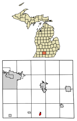
Tekonsha is a village in Tekonsha Township, Calhoun County in the U.S. state of Michigan. It is part of the Battle Creek, Michigan Metropolitan Statistical Area. The population was 653 at the 2020 census.

<span class="mw-page-title-main">Port Austin, Michigan</span> Village in Michigan, United States

Port Austin is a village in Huron County in the U.S. state of Michigan. The population was 664 at the 2010 census. The village is within Port Austin Township.

<span class="mw-page-title-main">Peck, Michigan</span> Village in Michigan, United States

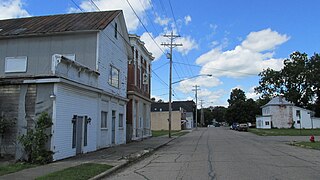
Peck is a village in Sanilac County of the U.S. state of Michigan. The population was 632 at the 2010 census. The village is in Elk Township.

<span class="mw-page-title-main">Parkdale, Missouri</span> Village in Missouri, United States

Parkdale is a village in northern Jefferson County, Missouri, United States. The population was 170 at the 2010 census.

<span class="mw-page-title-main">Avoca, Nebraska</span> Village in Nebraska, United States

Avoca is a village in Cass County, Nebraska, United States. The population was 178 at the 2020 census.

<span class="mw-page-title-main">Donnelsville, Ohio</span> Village in Ohio, United States

Donnelsville is a village in Clark County, Ohio, United States. The population was 255 at the 2020 census. It is part of the Springfield, Ohio Metropolitan Statistical Area.

<span class="mw-page-title-main">Brooklyn Heights, Ohio</span> Village in Ohio, United States

Brooklyn Heights is a village in Cuyahoga County, Ohio, United States. The population was 1,519 at the 2020 census. A suburb of Cleveland, it is a part of the Cleveland metropolitan area.

<span class="mw-page-title-main">Oakwood, Cuyahoga County, Ohio</span> Village in Ohio, United States

Oakwood is a village in Cuyahoga County, Ohio, United States. The population was 3,572 at the 2020 census. An eastern suburb of Cleveland, it is a part of the Cleveland metropolitan area.

<span class="mw-page-title-main">Wayne Lakes, Ohio</span> Village in Ohio, United States

Wayne Lakes is a village in Darke County, Ohio, United States. The population was 693 at the 2020 census.

<span class="mw-page-title-main">Cleves, Ohio</span> City in Ohio, United States

Cleves is a village in Miami Township, Hamilton County, Ohio, United States. Located along the Ohio River, it is a western suburb of Cincinnati. The population was 3,414 at the 2020 census.

<span class="mw-page-title-main">Jenera, Ohio</span> Village in Ohio, United States

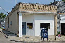
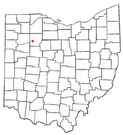
Jenera is a village in Hancock County, Ohio, United States. The population was 257 at the 2020 census. It is surrounded by Van Buren Township and is part of the Cory-Rawson Local School District.

<span class="mw-page-title-main">Mowrystown, Ohio</span> Village in Ohio, United States

Mowrystown is a village in Highland County, Ohio, United States. The population was 385 at the 2020 census.

<span class="mw-page-title-main">Spencer, Ohio</span> Village in Ohio, United States

Spencer is a village in Spencer Township located in Medina County, Ohio, United States. The population was 684 at the 2020 census.

<span class="mw-page-title-main">Covington, Ohio</span> Village in Ohio, United States

Covington is a village in Miami County, Ohio, United States. The population was 2,548 at the 2020 census. It is part of the Dayton Metropolitan Statistical Area. The village was incorporated as Covington in 1835 on the site of the 1793 Fort Rowdy.

<span class="mw-page-title-main">Williamsport, Ohio</span> Village in Ohio, United States

Williamsport is a village in Pickaway County, Ohio, United States. The population was 970 at the 2020 census.

<span class="mw-page-title-main">Eldorado, Ohio</span> Village in Ohio, United States

Eldorado is a village in Preble County, Ohio, United States. The population was 458 at the 2020 census. It is part of the Dayton Metropolitan Statistical Area.

<span class="mw-page-title-main">Cloverdale, Ohio</span> Village in Ohio, United States

Cloverdale is a village in Perry Township, Putnam County, Ohio, United States. The population was 170 at the 2020 census.

<span class="mw-page-title-main">Risingsun, Ohio</span> Village in Ohio, United States

Risingsun is a village in Wood County, Ohio, United States. The population was 541 at the 2020 census.

<span class="mw-page-title-main">Ionia, Missouri</span> Village in Missouri, United States

Ionia is a village in northern Benton and southern Pettis counties in the U.S. state of Missouri. The population was 88 at the 2010 census.

<span class="mw-page-title-main">Dorchester, Wisconsin</span> Village in Wisconsin, United States

Dorchester is a village in Clark and Marathon counties in the U.S. state of Wisconsin, along the 45th parallel. It is part of the Wausau, Wisconsin Metropolitan Statistical Area. The population was 876 at the 2010 census. Of this, 871 were in Clark County, and only 5 were in Marathon County.

References

  1. "ArcGIS REST Services Directory". United States Census Bureau. Retrieved September 20, 2022.
  2. 1 2 U.S. Geological Survey Geographic Names Information System: Rawson, Ohio
  3. 1 2 "U.S. Census website". United States Census Bureau . Retrieved January 31, 2008.
  4. 1 2 3 History of Hancock County, Ohio. Warner, Beers. 1886. p. 496.
  5. "VISITED BY WHITE CAPS". The New York Times. May 2, 1889. Retrieved April 13, 2022.
  6. "The Cultivator & Country Gentleman". Luther Tucker & Son. 1889. Retrieved April 13, 2022.
  7. "US Gazetteer files 2010". United States Census Bureau. Archived from the original on January 25, 2012. Retrieved January 6, 2013.
  8. "Census of Population and Housing". Census.gov. Retrieved June 4, 2015.
  9. "U.S. Census website". United States Census Bureau . Retrieved January 6, 2013.