Mount Gilead, North Carolina | |
---|---|
Motto(s): "Small Town. Big Ideas. Lots to do." "Surrounded by nature - forests, lakes, rivers...Embedded with culture, history..." | |
Coordinates: 35°12′59″N80°00′18″W / 35.21639°N 80.00500°W | |
Country | United States |
State | North Carolina |
County | Montgomery |
Government | |
• Mayor | Sheldon Poplin Morley |
• Town Manager | Dylan Haman |
Area | |
• Total | 3.49 sq mi (9.04 km2) |
• Land | 3.49 sq mi (9.04 km2) |
• Water | 0.00 sq mi (0.00 km2) |
Elevation | 410 ft (120 m) |
Population (2020) | |
• Total | 1,171 |
• Density | 335.53/sq mi (129.56/km2) |
Time zone | UTC-5 (Eastern (EST)) |
• Summer (DST) | UTC-4 (EDT) |
ZIP code | 27306 |
Area codes | 910, 472 |
FIPS code | 37-44900 [3] |
GNIS feature ID | 2406206 [2] |
Website | www.mtgileadnc.com |
Mount Gilead is a town in Montgomery County, in the Piedmont region of North Carolina, United States. The population was 1,181 at the 2010 census.
According to the United States Census Bureau, the town has a total area of 3.3 square miles (8.5 km2), all land.
Census | Pop. | Note | %± |
---|---|---|---|
1900 | 395 | — | |
1910 | 723 | 83.0% | |
1920 | 975 | 34.9% | |
1930 | 1,011 | 3.7% | |
1940 | 915 | −9.5% | |
1950 | 1,201 | 31.3% | |
1960 | 1,229 | 2.3% | |
1970 | 1,286 | 4.6% | |
1980 | 1,423 | 10.7% | |
1990 | 1,336 | −6.1% | |
2000 | 1,389 | 4.0% | |
2010 | 1,181 | −15.0% | |
2020 | 1,171 | −0.8% | |
U.S. Decennial Census [4] |
Race | Number | Percentage |
---|---|---|
White (non-Hispanic) | 570 | 48.68% |
Black or African American (non-Hispanic) | 506 | 43.21% |
Native American | 13 | 1.11% |
Asian | 25 | 2.13% |
Other/Mixed | 40 | 3.42% |
Hispanic or Latino | 17 | 1.45% |
As of the 2020 United States census, there were 1,171 people, 476 households, and 273 families residing in the town.
As of the census [3] of 2000, there were 1,389 people, 502 households, and 367 families residing in the town. The population density was 424.2 inhabitants per square mile (163.8/km2). There were 553 housing units at an average density of 168.9 per square mile (65.2/km2). The racial makeup of the town was 50.04% African American, 46.29% White, 0.50% Native American, 2.16% Asian, 0.29% from other races, and 0.72% from two or more races. Hispanic or Latino of any race were 0.58% of the population.
There were 502 households, out of which 31.9% had children under the age of 18 living with them, 49.8% were married couples living together, 20.9% had a female householder with no husband present, and 26.7% were non-families. 25.1% of all households were made up of individuals, and 13.9% had someone living alone who was 65 years of age or older. The average household size was 2.64 and the average family size was 3.14.
In the town, the population was spread out, with 26.6% under the age of 18, 7.1% from 18 to 24, 25.3% from 25 to 44, 22.2% from 45 to 64, and 18.9% who were 65 years of age or older. The median age was 38 years. For every 100 females, there were 80.9 males. For every 100 females age 18 and over, there were 74.4 males.
The median income for a household in the town was $31,250, and the median income for a family was $36,250. Males had a median income of $29,375 versus $21,750 for females. The per capita income for the town was $16,236. About 15.6% of families and 18.3% of the population were below the poverty line, including 25.5% of those under age 18 and 14.8% of those age 65 or over.
This region was occupied by the Pee Dee culture, part of the Southern Appalachian Mississippian culture, from about 980 to 1150 CE. They built the earthwork platform mound and other structures at Town Creek Indian Mound, which has been designated a National Historic Landmark since 1966. It is the only Native American site in the state to be designated as a national landmark. In the 21st century, the Pee Dee are based in South Carolina, where the state has recognized several bands as tribes.
Mount Gilead was incorporated in 1899 as the textile industry built mills in the Piedmont section of the state above the fall line of rivers. They processed the commodity crop of cotton, which had been important to the South since before the Civil War. The textile mills provided jobs to white residents of the region, later also employing blacks and supporting relative prosperity in the region.
Since the late 20th century, many textile jobs moved offshore in a restructuring of the industry as it sought lower labor costs. Like many small southern towns, Mount Gilead suffered economic and population decline following the loss of these textile jobs.
The town has begun to emphasize the appeal of its historic resources. Its Historic District has been inventoried and was listed on the National Register of Historic Places in 2005. Mount Gilead was selected to participate in the N.C. Small Town Main Street Program (co-sponsored by the National Trust for Historic Preservation) and received a S.T.E.P. (Small Town Economic Prosperity) grant of $220,000 to help revitalize the downtown area and create jobs, respectively.[ citation needed ]
The Mount Gilead Museum is located in a restored Victorian house near the downtown area. The house belonged to the McAulay family, who played an important role in Mount Gilead business, church, social, and civic life. The museum houses many documents, photographs, and historic artifacts that tell the story of Mount Gilead's past.
The Haywood plantation house where Oscar Haywood lived is in Mount Gilead. He is buried in Sharon Cemetery in the town.
Mount Gilead is the birthplace of civil rights attorney Julius L. Chambers (b. 1936). [6] A graduate of the University of North Carolina at Chapel Hill (J.D., 1962), Chambers served as editor-in-chief of the school's Law Review. He next earned a master of law degree from New York's Columbia University in 1964.
The Piedmont Center of the Arts and The Ford Place Restaurant, Pub & Special Events Center were developed with funding from the North Carolina Rural Center. The arts facility houses a wood-turner who gives lessons, the office of the Mount Gilead Arts Guild, a retail co-op store, and a clock repair shop. The restaurant is based in an adapted Ford dealership. Customers see much of the town's history preserved on the walls and under glass on the tables.
Mount Gilead has a number of visual and performing artists who routinely show their work at the arts complex.
The Mount Gilead Community Concerts Association (MGCCA) is a non-profit organization presenting a program of diverse performing arts to the local area. Incorporated in 2001, the organization presents an annual Concert Series featuring visiting musicians. When possible, these artists present a program for local school students. MGCCA is governed by a volunteer board of directors and supported through the contributions of local individuals and companies.
The Mount Gilead Community Choir has produced annual concerts since its founding in 1995. This group of volunteer singers traditionally presents a Christmas concert on the first Sunday in December. The choir is supported in part by the Mount Gilead Community Concerts Association (MGCCA), and more information can be found of the organization's website.
Community Radio WMTG-LP (88.1 FM) is a non-commercial, low-power station that serves the town by airing announcements of local interest. The station programs a mix of oldies and adult contemporary music and broadcasts 24 hours a day. WMTG is a service of the Mount Gilead Community Concerts Association (MGCCA).
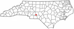
Montgomery County is a rural county located in the southern Piedmont of the U.S. state of North Carolina. As of the 2020 census, the population was 25,751. Its county seat is Troy.
Marlboro County is a county located in the Pee Dee region on the northern border of the U.S. state of South Carolina. As of the 2020 census, its population was 26,667. Its county seat is Bennettsville. The Great Pee Dee River runs through it.
Greenwood County is a county located in the U.S. state of South Carolina. As of the 2020 census, its population was 69,351. Its county seat is Greenwood.
Dillon County is a county located in the U.S. state of South Carolina. As of the 2020 census, the county's population was 28,292. The county seat is Dillon.
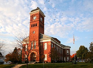
Morrow County is a county located in the central portion of the U.S. state of Ohio. As of the 2020 census, the population was 34,950. Its county seat is Mount Gilead. The county was organized in 1848 from parts of four neighboring counties and named for Jeremiah Morrow who was the Governor of Ohio from 1822 to 1826. Shawnee people used the area for hunting purposes before white settlers arrived in the early 19th century.
Anson County is a county located in the U.S. state of North Carolina. As of the 2020 census, the population was 22,055. Its county seat is Wadesboro.
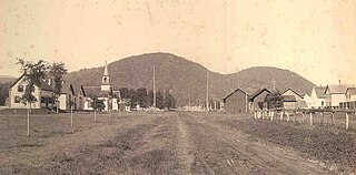
Gilead is a town in Oxford County, Maine, United States. Upon incorporation in 1804, it was named for the large quantity of Balm of Gilead trees in the town center. The population was 195 at the 2020 census.
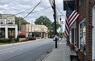
Mount Pleasant is a town located in eastern Cabarrus County, North Carolina, United States. As of the 2010 census, the town population was 1,652. The town center is located at the crossroads of Mount Pleasant Road and North Carolina Highway 73. NC Highway 49 skirts the town to the north on its way from Charlotte to Asheboro.
Mount Holly is a small suburban city in northeastern Gaston County, North Carolina, United States. The city is situated just west of the Catawba River, north of Interstate 85, south of North Carolina State Highway 16. The population was 17,703 at the 2020 census, up from 13,656 in 2010.
Clyde is a town in Haywood County, North Carolina, United States. The 2010 census recorded the population at 1,223 people. It is part of the Asheville Metropolitan Statistical Area.
Troy is a town in Montgomery County, North Carolina, United States. The population was 3,188 at the 2010 census. It is the county seat of Montgomery County. A short story by Charles W. Chesnutt, The Sheriff's Children, is set in Troy.
St. Pauls is a town in Robeson County, North Carolina, United States. The population was 2,035 at the 2010 census.
Norwood is a town in Stanly County, North Carolina, United States. The population was 2,379 at the 2010 census.
Unionville is a rural town in Union County, North Carolina, United States. The population was 6,643 at the 2020 census.
Ronda is a town in Wilkes County, North Carolina, United States. The population was 417 at the 2010 census, and 413 at the 2020 census. Ronda was named after a nearby estate called "Roundabout", which was the residence of Benjamin Cleveland, a locally prominent planter and a colonel in the North Carolina militia during the Revolutionary War. The town is home to East Wilkes High School, one of Wilkes County's five public high schools.
Burnsville is a town that serves as the county seat of Yancey County, North Carolina, United States. Located in the Blue Ridge Mountains of western North Carolina, sits in the shadow of Mount Mitchell, the highest peak in the Eastern Continental United States. The population was 1,612 at the 2020 census.
Mount Gilead is a village and the county seat of Morrow County, Ohio, United States. It is located 41 miles (66 km) northeast of Columbus. The population was 3,503 at the 2020 census. It is the center of population of Ohio. The village was established in 1832, eight years after white settlers arrived in the region. Before their arrival, the forest was a hunting area for the Shawnee tribe.
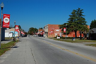
McColl is a town in Marlboro County, South Carolina, United States. It lies in the state's Pee Dee region, 8 miles (13 km) from the North Carolina border. The population was 2,174 at the 2010 census.
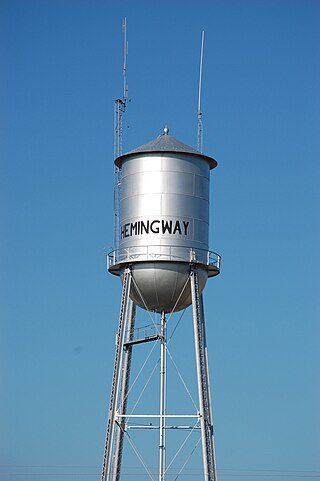
Hemingway is a town in Williamsburg County, South Carolina, United States. The population was 459 at the 2010 census.
Mount Olive is a town in Duplin and Wayne counties in the U.S. state of North Carolina. The population was 4,589 at the 2010 census. It is included in the Goldsboro, North Carolina Metropolitan Statistical Area. The town is home to the Mt. Olive Pickle Company and the University of Mount Olive.