Mount Olympus, Utah

Last updated
Mount Olympus
Former CDP
UTMap-doton-MountOlympus.PNG
Location of Mount Olympus, Utah
Coordinates: 40°41′3″N111°47′32″W / 40.68417°N 111.79222°W / 40.68417; -111.79222 Coordinates: 40°41′3″N111°47′32″W / 40.68417°N 111.79222°W / 40.68417; -111.79222
Country United States
State Utah
County Salt Lake
Area
  Total3.4 sq mi (8.8 km2)
  Land3.4 sq mi (8.8 km2)
  Water0.0 sq mi (0.0 km2)
Elevation
5,118 ft (1,560 m)
Population
 (2000)
  Total7,103
  Density2,097.3/sq mi (809.8/km2)
Time zone UTC-7 (Mountain (MST))
  Summer (DST) UTC-6 (MDT)
Area code(s) 385, 801
FIPS code 49-52900 [1]
GNIS feature ID1867580 [2]

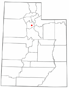
Mount Olympus or Olympus Cove is a neighborhood in Millcreek, Utah built on the northwestern slopes of Mount Olympus of the Wasatch Range. It was formerly a census-designated place (CDP), but was consolidated into the Millcreek CDP for census purposes in 2010. Millcreek incorporated as a city in 2016. The commercial center of the neighborhood is the relatively flat area south of the crossing of Mill Creek by Interstate 215, which includes the Olympus Hills Shopping Center, Skyline High School, a trailhead for non-motorized access to Mill Creek Canyon, and a Utah Transit Authority park and ride lot. As of the 2000 census, the CDP population was 7,103, a slight decrease from the 1990 figure of 7,413.

Contents

Geography

According to the United States Census Bureau, the CDP had a total area of 3.4 square miles (8.8 km2), all of it land.

Demographics

Historical population
CensusPop.
1970 5,909
1980 6,0682.7%
1990 7,41322.2%
2000 7,103−4.2%
source: [3]

As of the census [1] of 2000, there were 7,103 people, 2,575 households, and 2,065 families residing in the CDP. The population density was 2,097.3 people per square mile (809.0/km2). There were 2,673 housing units at an average density of 789.3/sq mi (304.4/km2). The racial makeup of the CDP was 94.61% White, 0.21% African American, 0.18% Native American, 3.11% Asian, 0.03% Pacific Islander, 0.41% from other races, and 1.45% from two or more races. Hispanic or Latino of any race were 1.77% of the population.

There were 2,575 households, out of which 31.0% had children under the age of 18 living with them, 72.2% were married couples living together, 5.6% had a female householder with no husband present, and 19.8% were non-families. 15.9% of all households were made up of individuals, and 8.4% had someone living alone who was 65 years of age or older. The average household size was 2.76 and the average family size was 3.09.

In the CDP, the population was spread out, with 24.0% under the age of 18, 6.4% from 18 to 24, 21.4% from 25 to 44, 27.9% from 45 to 64, and 20.3% who were 65 years of age or older. The median age was 44 years. For every 100 females, there were 101.4 males. For every 100 females age 18 and over, there were 96.6 males.

The median income for a household in the CDP was $84,684, and the median income for a family was $92,950. Males had a median income of $61,316 versus $41,447 for females. The per capita income for the CDP was $44,286. About 0.9% of families and 1.8% of the population were below the poverty line, including 1.2% of those under age 18 and 2.4% of those age 65 or over.

Related Research Articles

Volcano, Hawaii Census-designated place in Hawaii, U.S.

Volcano is a census-designated place (CDP) in Hawaii County, Hawaii, United States located in the District of Puna with a small portion of the CDP in the District of Kaʻū. The population was 2,575 at the 2010 census, up from 2,231 at the 2000 census.

Holiday City-Berkeley, New Jersey Census-designated place in New Jersey, United States

Holiday City-Berkeley is an unincorporated community and census-designated place (CDP) located within Berkeley Township, in Ocean County, New Jersey, United States. As of the 2010 United States Census, the CDP's population was 13,884.

Newmanstown, Pennsylvania Census-designated place in Pennsylvania, United States

Newmanstown is an unincorporated community and census-designated place (CDP) in Millcreek Township, Lebanon County, Pennsylvania, United States. The population was 2,478 at the 2010 census, up from 1,536 at the 2000 census.

Riverside, Utah CDP in Utah, United States

Riverside is a census-designated place (CDP) in Box Elder County, Utah, United States. The population was 760 at the 2010 census.

South Willard, Utah CDP in Utah, United States

South Willard is a census-designated place (CDP) in Box Elder County, Utah, United States. The population was 1,571 at the 2010 census.

Cache, Utah CDP in Utah, United States

Cache Junction is a census-designated place (CDP) in Cache County, Utah, United States. The population was 38 at the 2010 census. It is included in the Logan, Utah-Idaho (partial) Metropolitan Statistical Area.

Cove, Utah Census-designated place in Utah, United States

Cove is a census-designated place (CDP) in Cache County, Utah, United States. The population was 460 at the 2010 census. It is included in the Logan, Utah-Idaho Metropolitan Statistical Area.

Neola, Utah Census-designated place in Utah, United States

Neola is a census-designated place (CDP) in Duchesne County, Utah, United States. The population was 461 at the 2010 census. Neola was established in 1912.

Canyon Rim was a census-designated place (CDP) in Salt Lake County, Utah, United States, that was consolidated with neighboring Millcreek CDP in 2010. The consolidated CDP was incorporated in 2016. The population was 10,428 at the 2000 census, a minuscule decrease from the 1990 figure of 10,527. The area formerly in Canyon Rim CDP is located just south of Interstate 80 and the Sugar House neighborhood of Salt Lake City near the mouth of Parley's Canyon. Canyon rim is notable for Canyon Rim Park, Tanner Park, and Parleys Historic Nature Park.

East Millcreek, Utah Former CDP in Utah, United States

East Millcreek was a census-designated place (CDP) in Salt Lake County, Utah, United States, that was consolidated with neighboring Millcreek in 2010. The consolidated CDP was incorporated in 2016. The population was 21,385 at the 2000 census, a minute increase over the 1990 figure of 21,184. It was originally proposed to be included in the corporate limits of the city of Holladay, which was incorporated on November 29, 1999. However, inclusion of East Millcreek was rejected by voters in 2008. East Millcreek was then incorporated with the former Millcreek CDP as the city of Millcreek on December 28, 2016.

Halchita, Utah CDP in Utah, United States

Halchita is a census-designated place (CDP) in San Juan County, Utah, United States. The population was 270 at the 2000 census.

Montezuma Creek, Utah Census-designated place in Utah, United States

Montezuma Creek is a census-designated place (CDP) in San Juan County, Utah, United States. The population was 335 at the 2010 census, a decrease from the 2000 figure of 507.

Tselakai Dezza, Utah CDP in Utah, United States

Tselakai Dezza is a census-designated place (CDP) in San Juan County, Utah, United States. The population was 103 at the 2000 census.

Snyderville, Utah CDP in Utah, United States

Snyderville is a census-designated place (CDP) near the southwestern edge of Summit County, Utah, United States. Prior to the 2010 Census, the area was designated as South Snyderville Basin CDP. The population was 3,636 at the 2000 census.

Summit Park, Utah CDP in Utah, United States

Summit Park is a census-designated place (CDP) on the western edge of Summit County, Utah, United States. The population was 6,597 at the 2000 census.

Woodland, Utah CDP in Utah, United States

Woodland is a census-designated place (CDP) in Summit County, Utah, United States. The population was 335 at the 2000 census.

Benjamin, Utah CDP in Utah, United States

Benjamin is a census-designated place (CDP) in Utah County, Utah, United States. It is part of the Provo–Orem Metropolitan Statistical Area. The population was 1,145 at the 2010 census.

Lake Shore, Utah CDP in Utah, United States

Lake Shore is a census-designated place (CDP) in Utah County, Utah, United States. It is part of the Provo–Orem Metropolitan Statistical Area. The population was 817 at the 2010 census.

West Mountain, Utah CDP in Utah, United States

West Mountain is a census-designated place (CDP) in Utah County, Utah, United States. It is part of the Provo–Orem Metropolitan Statistical Area. As of the 2010 census, the CDP population was 1,186. The town is at the base of West Mountain and bears its name.

Oljato–Monument Valley, Utah CDP in Utah, United States

Oljato-Monument Valley is a census-designated place (CDP) in San Juan County, Utah, United States. The population was 864 at the 2000 census.

References

  1. 1 2 "U.S. Census website". United States Census Bureau . Retrieved 2008-01-31.
  2. "US Board on Geographic Names". United States Geological Survey. 2007-10-25. Retrieved 2008-01-31.
  3. "CENSUS OF POPULATION AND HOUSING (1790-2000)". U.S. Census Bureau . Retrieved 2010-07-31.

Commons-logo.svg Media related to Mount Olympus, Utah at Wikimedia Commons