
Mukono is one of the districts in the Central Region of Uganda. The town of Mukono is home to the district's main commercial center and district headquarters.
Kamwenge District is a district in Western Uganda. It is named after its 'chief town', Kamwenge, where the district headquarters are located. Kamwenge District is part of the Kingdom of Toro, one of the ancient traditional monarchies in Uganda. The kingdom is coterminous with Toro sub-region. The districts that constitute the sub-region are: (a) Bunyangabu District (b) Kabarole District (c) Kamwenge District (d) Kyegegwa District (e) Kitagwenda District and (f) Kyenjojo District.

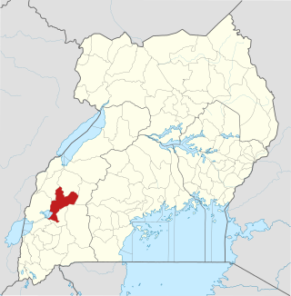
Kasese District is a district in Western Uganda. Like most other Ugandan districts, the town of Kasese is the site of the district headquarters.

Queen Elizabeth National Park is a national park in Uganda.

Kasese is a town north of Lake George in the Western Region of Uganda. It originally grew around the copper mine at Kilembe, while attention later turned to cobalt mining. It is the chief town of Kasese District, and the district headquarters are located there. Kasese is also the largest town in the Rwenzururu region. Charles Mumbere, the Omusinga of Rwenzururu, maintains a palace in the town.

Murchison Falls National Park (MFNP) is a national park in Uganda and managed by the Ugandan Wildlife Authority. It is in north-western Uganda, spreading inland from the shores of Lake Albert, around the Victoria Nile, up to the Karuma Falls.
Kamwenge is a town in the Western Region of Uganda. It is the site of the Kamwenge District headquarters.
The Kampala–Jinja Highway is a road in Uganda, connecting the cities of Kampala and Jinja. Sometimes referred to as Kampala–Jinja Road, it is a busy road, with several towns, trading centers and other points of interest along the way. As of October 2016, a new, wider, four-lane dual carriageway expressway, the Kampala–Jinja Expressway, is proposed to be constructed south of the present highway to relieve traffic and complement existing transport infrastructure between Kampala and Jinja.
Ishasha border point is a border crossing station and customs post in the Kanungu District in the Western Region of Uganda. It is inset approximately 350 metres (1,150 ft) from the Ishasha River, which is the Uganda-Democratic Republic of the Congo (DRC) border locally, and is 1.3 kilometres (0.81 mi) from the town of Ishasha, Democratic Republic of the Congo, across the river in the DRC.
Mweya is a location in the Western Region of Uganda.
Mpanga Power Station is an 18 megawatts (24,000 hp) mini hydroelectric power project located across River Mpanga, in Kitagwenda County, Kitagwenda District in Western Uganda.
Karuma Falls is a town in Uganda.
Nshyugyezi Hydroelectric Power Station, also Nsongezi Hydroelectric Power Station, is a planned 39 megawatts (52,000 hp) hydroelectric power station in Uganda. The power project is under development, as of September 2017.
Nyamwamba I Hydroelectric Power Station, also referred to as Nyamwamba I Power Station, is a 9.2 megawatts mini-hydroelectric power station in Uganda.
Nkusi Hydroelectric Power Station, also referred to as Nkusi Power Station, is a 9.6 MW (12,900 hp) hydroelectric power station in the Western Region of Uganda.
Bihanga is a settlement in Ibanda District in the Western Region of Uganda. It is the location of the headquarters of Bihanga Parish, Nyamarebe sub-county.
Kibale County is a county in Kamwenge District in the Western Region of Uganda.
Kitagwenda District is a district in Western Uganda. The district is named after Kitagwenda County, which is coterminous with the district.
Ntara is a settlement in Kitagwenda District, in Western Uganda. It is the political, administrative and commercial headquarters of the district. Ntara is one of the two municipalities in the newly-created Kitagwenda District, the other being Kabujogera Town Council.
Kabujogera is a settlement in Kitagwenda District, in Western Uganda. It is one of the two municipalities in the newly created Kitagwenda District, the other being Ntara Town Council, where the district headquarters are located.
