The New Georgia Islands are part of the Western Province of Solomon Islands. They are located to the northwest of Guadalcanal. The larger islands are mountainous and covered in rain forest. The main islands are New Georgia, Vella Lavella, Kolombangara, Ghizo, Vangunu, Rendova and Tetepare. They are surrounded by coral reefs and include the largest saltwater lagoon in the world: Marovo lagoon.

New Georgia, with an area of 2,037 km2 (786 sq mi), is the largest of the islands in Western Province, Solomon Islands, and the 200th-largest island in the world.

Kolombangara is an island in the New Georgia Islands group of the nation state of Solomon Islands in the southwestern Pacific Ocean. The name is from a local language, a rough translation of its meaning is "Water Lord" with approximately 80 rivers and streams running down its flanks.

The Battle of Blackett Strait was a naval battle of the Pacific campaign of World War II, fought on 6 March 1943 in the Blackett Strait, between Kolombangara and Arundel Island in the Solomon Islands. The battle was a chance encounter between two Japanese destroyers that had been undertaking a resupply run to Vila and a U.S. Navy force of three light cruisers and three destroyers that had been tasked with bombarding the Japanese shore facilities around Vila. The two forces clashed as the Japanese destroyers were withdrawing through the Kula Gulf. In the short battle that followed the two Japanese destroyers were sunk after which the U.S. ships completed their bombardment of Vila before returning to their base.

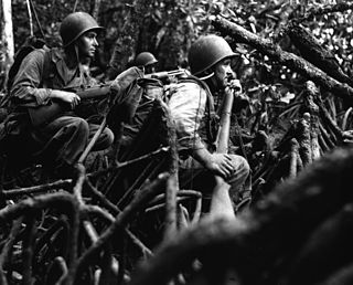
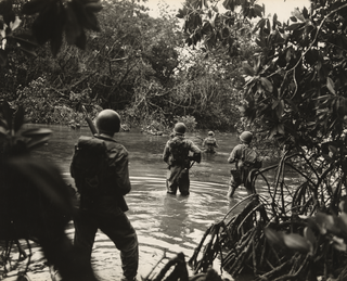
The New Georgia campaign was a series of land and naval battles of the Pacific campaign of World War II between Allied forces and the Empire of Japan. It was part of Operation Cartwheel, the Allied strategy in the South Pacific to isolate the Japanese base around Rabaul. The campaign took place in the New Georgia group of islands, in the central Solomon Islands and followed the Allied capture of the Russell Islands. The main fighting took place on New Georgia island itself, although significant actions also took place around the island chain throughout the campaign.

Rennell Island, locally known as Mugaba, is the main island of two inhabited islands that make up the Rennell and Bellona Province in the nation state of Solomon Islands. Rennell Island has a land area of 660 square kilometres (250 sq mi) that is about 80 kilometres (50 mi) long and 14 kilometres (8.7 mi) wide. It is the second largest raised coral atoll in the world with the largest lake in the insular Pacific, Lake Tegano, a lake that is listed as a World Heritage Site. Rennell Island has a population of about 1,840 persons of Polynesian descent who primarily speak Rennellese, Pijin and some English. Rennell and Bellona Islands are two of the few islands in the otherwise Melanesian Solomon Islands archipelago classified as a Polynesian outlier; others being Sikaiana, Ontong Java, Tikopia, Anuta, Duff Islands, and some Reef Islands.

Western Province is the largest of the nine provinces of Solomon Islands. The area is renowned for its beautiful tropical islands, excellent diving and snorkelling, coral reefs and World War II wrecks, ecotourism lodges, and head-hunting shrines. The province contains many small lagoons and most of the country's tourist trade outside Honiara.
Bairoko Harbor is situated along the northwestern shore of the island of New Georgia in the Solomon Islands.
Kennedy Island, is a 1.17 hectares, uninhabited island in Solomon Islands that was named after John F. Kennedy, following an incident involving Kennedy during his World War II naval career. Kennedy Island lies 15 minutes by boat from Gizo, the provincial capital of the Western Province of Solomon Islands.

The Battle of Vella Lavella was fought from 15 August – 6 October 1943 between Japan and the Allied forces from New Zealand and the United States at the end of the New Georgia campaign. Vella Lavella, an island located in the Solomon Islands, had been occupied by Japanese forces early during the war in the Pacific. Following the fighting around Munda Point, the Allies recaptured the island in late 1943, following a decision to bypass a large concentration of Japanese troops on the island of Kolombangara.

Gizo is the capital of the Western Province in Solomon Islands. With a population of 7,177, it is the second largest town in the country. It is situated on Ghizo Island approximately 380 kilometres west-northwest of the capital, Honiara, and is just southwest of the larger island of Kolombangara.

Rendova is an island in the Western Province of the Solomon Islands in the South Pacific, east of Papua New Guinea.

Arundel Island is an island of the New Georgia Islands archipelago in the Western Province of Solomon Islands. Its indigenous names are Kohinggo and Ndokulu.
Biuku Gasa and Eroni Kumana were Solomon Islanders of Melanesian descent, who found John F. Kennedy and his surviving PT-109 crew following the boat's collision with the Japanese destroyer Amagiri near Plum Pudding Island on 1 August 1943. They were from the Western Province of the Solomon Islands.
Munda Airport is an international airport adjacent to the town of Munda, Western Province in Solomon Islands.

The Battle of Munda Point was a battle, from 22 July – 5 August 1943, between primarily United States Army and Imperial Japanese Army forces during the New Georgia Campaign in the Solomon Islands in the Pacific War. The battle took place following a landing by U.S. troops on the western coast of New Georgia from Rendova, as part of an effort to capture the Japanese airfield that had been constructed at Munda Point. This advance had become bogged down and while the Allies brought forward reinforcements and supplies, the Japanese had launched a counterattack on 17–18 July. This effort was ultimately unsuccessful and afterwards U.S. forces launched a corps-level assault to reinvigorate their effort to capture the airfield. Against this drive, Japanese defenders from three infantry regiments offered stubborn resistance, but were ultimately forced to withdraw, allowing U.S. forces to capture the airfield on 5 August. The airfield later played an important role in supporting the Allied campaign on Bougainville in late 1943.
Kiambe is an island in the Solomon Islands; it is located in the Western Province.

Sir Edward George Sayers was a New Zealand medical doctor, parasitologist, Methodist missionary, military medical administrator, consultant physician and, from 1958 to 1968, Dean of the University of Otago, School of Medicine. Having trained as a doctor, from 1927 to 1934 he worked at the Methodist mission in the Solomon Islands where he carried out fieldwork in the treatment of malaria. The significance of this work became apparent when Sayers used his knowledge to reduce deaths of American, Australia and New Zealand military forces during the invasion of Pacific Islands during World War II. He served as a doctor with the 2nd Division 2 NZEF during 1941–42 in Greece and North Africa. In 1942 he was transferred to the Pacific to serve with the 3rd Division, 2 NZEF IP.

The Battle of Arundel Island was fought from 27 August – 21 September 1943, primarily between United States Army and Imperial Japanese Army forces on Arundel Island during the New Georgia campaign in the Pacific War. The battle took place towards the end of the campaign after the capture of Munda airfield and mopping up operations in western New Georgia had resulted in the Japanese evacuation of mainland New Georgia. The US high command decided to occupy the island so that it could be used as a base for artillery to fire on the main Japanese troop concentration on Kolombangara.
John Francis Goldie founded the Methodist Mission in New Georgia Islands, which are part of the Solomon Islands. He was chairman of the Solomon Island District of the Methodist Mission from 1902 until his retirement in 1951.


