Municipal Borough of Stretford

Last updated

Stretford
Area
  19113,240 acres (13.1 km2)
  19613,532 acres (14.29 km2)
Population
  190130,436
  193156,791
  197154,316
History
  Created1868
  Abolished1974
  Succeeded by Metropolitan Borough of Trafford
Status Local Government District 1868–1894

Urban district 1894–1933

Municipal borough 1933–1974
Government
   HQ Stretford Town Hall
   Motto Service and Efficiency
Stretford Borough Council arms.jpg

Stretford was, from 1868 to 1974, a local government district coterminate with the town of Stretford, Lancashire, England. [1]

Contents

Local Board and Urban District

In 1868 the township of Stretford adopted the Local Government Act 1858, and a local board was formed to govern the town. [2] In 1889 the district became part of the administrative county of Lancashire.

The Local Government Act 1894 reconstituted the local board's area as Stretford Urban District. An urban district council of eighteen members replaced the local board. The urban district was divided into six wards, each returning three councillors: Clifford, Cornbrook, Longford, Stretford, Talbot and Trafford. [3]

In 1933 the urban district was enlarged when the Davyhulme area was added on the abolition of the neighbouring Barton upon Irwell Rural District by a county review order. [1]

Municipal borough

In 1933 the urban district was granted a charter of incorporation and Stretford became a municipal borough. The charter was formally presented by the Earl of Derby, Lord Lieutenant of Lancashire at a Charter Day celebration held on 16 September. [4] At the same time the Earl officially opened the Town Hall. [5]

Political control

The borough council consisted of a mayor, eight aldermen and twenty-four councillors. The charter mayor was Sir Thomas Robinson, who had been Member of Parliament for the Stretford constituency until 1931. [4] One third of the councillors were elected annually, while half of the aldermen were chosen by the council every three years. The Conservative Party controlled the borough from 1933 to 1945. From 1945 to 1947 the council was under no overall control. [6] The Conservatives regained control in 1947 and held it until 1962. [7] After two years with no party in a majority, the Labour and Conservative parties alternated in power for the last ten years of the borough's existence: Labour had a majority from 1964 to 1967, Conservatives 1967 to 1972 and Labour from 1972 to 1974. [8]

Coat of arms

On 20 February 1933, Stretford Urban District Council was granted armorial bearings by the College of Arms. [9] The arms continued in use when the borough was incorporated. The arms were blazoned as follows:

Argent, on a fesse gules between in chief a flail and a scythe in saltire proper between two roses of the second, barbed and seeded, and in base upon waves of the sea a lymphad, sails furled, oars in action, proper a lion passant Or; and for a Crest: Issuant from a coronet composed of eight roses as in the Arms set upon a rim Or, a cubit arm, the hand proper grasping a thunderboltgold. Mantled gules doubled Or. [9]

The lion in the centre of the shield represented John of Gaunt, while the red roses were the county emblems for Lancashire. The "lymphad" or ancient ship at the base of the arms indicated that the area had maritime connections via the Rivers Mersey and Irwell. The arms were completed by a crossed flail and scythe. The scythe was emblematic of the agricultural past of the area, while the flail came from the arms of the Trafford family.

The crest on the helm above the shield was an arm grasping a golden thunderbolt, symbolising the modern industries of Stretford. The design was completed by a coronet of Lancastrian roses. [10]

Abolition

The borough was abolished by the Local Government Act 1972, and its former area transferred to the new county of Greater Manchester in 1974, to form part of the Metropolitan Borough of Trafford.

Local elections

Related Research Articles

<span class="mw-page-title-main">Trafford</span> Borough in Greater Manchester, England

Trafford is a metropolitan borough of Greater Manchester, England, with an estimated population of 235,546 in 2021. It covers 106 square kilometres (41 sq mi) and includes the area of Old Trafford and the towns of Altrincham, Stretford, Urmston, Partington and Sale. The borough was formed in 1974 as a merger of six former districts and part of a seventh. The River Mersey flows through the borough, separating North Trafford from South Trafford, and the historic counties of Lancashire and Cheshire. Trafford is the seventh-most populous district in Greater Manchester.

<span class="mw-page-title-main">Stretford</span> Town in Greater Manchester, England

Stretford is a market town in Trafford, Greater Manchester, England. It is situated on flat ground between the River Mersey and the Manchester Ship Canal, 4 miles (6.4 km) south of Manchester, 3 miles (4.8 km) south of Salford and 4 miles (6.4 km) north-east of Altrincham. Stretford borders Chorlton-cum-Hardy to the east, Moss Side and Whalley Range to the south-east, Hulme to the north-east, Urmston to the west, Salford to the north, and Sale to the south. The Bridgewater Canal bisects the town.

<span class="mw-page-title-main">Municipal Borough of Bromley</span>

Bromley was a local government district in northwest Kent from 1867 to 1965 around the town of Bromley. The area was suburban to London, and formed part of the Metropolitan Police District and from 1933 was included in the area of the London Passenger Transport Board.

<span class="mw-page-title-main">Municipal Borough of Finchley</span>

Finchley, which is now in north London, was a local government district in Middlesex, England, from 1878 to 1965. Finchley Local Board first met in 1878. It became Finchley Urban District Council in 1895 and the Municipal Borough of Finchley in 1933. In 1965 Middlesex was abolished and Finchley became part of the London Borough of Barnet.

<span class="mw-page-title-main">Municipal Borough of Bexley</span> Abolished 1965

Bexley was a local government district in north west Kent from 1879 to 1965 around the town of Old Bexley.

<span class="mw-page-title-main">Barton upon Irwell</span> Suburb in Greater Manchester, England

Barton upon Irwell is a suburb of the City of Salford, Greater Manchester, England, with a population of 12,462 in 2014.

<span class="mw-page-title-main">Municipal Borough of Beddington and Wallington</span>

Beddington and Wallington was, from 1915 to 1965, a local government district in north east Surrey, England. It formed part of the London suburbs, lying within the Metropolitan Police District and the London Passenger Transport Area. In 1965 it was abolished on the creation of Greater London.

<span class="mw-page-title-main">Flixton, Greater Manchester</span> Suburb in Greater Manchester, England

Flixton is a suburb and electoral ward in the Metropolitan Borough of Trafford, Greater Manchester, England. The population of the ward at the 2011 census was 10,786. It lies six miles (9.7 km) southwest of Manchester city centre, in the historic county of Lancashire.

<span class="mw-page-title-main">County Borough of Salford</span> Former district of England

Salford was, from 1844 to 1974, a local government district in the county of Lancashire in the northwest of England, covering the city of Salford. It was granted city status in 1926.

<span class="mw-page-title-main">County Borough of Oldham</span>

Oldham was, from 1849 to 1974, a local government district in the northwest of England coterminous with the town of Oldham.

<span class="mw-page-title-main">Municipal Borough of Sale</span>

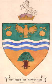
Sale was, from 1867 to 1974, a district in Cheshire, England. The district had in turn the status of local government district, urban district and municipal borough. Its area now forms part of the Metropolitan Borough of Trafford, Greater Manchester.

<span class="mw-page-title-main">County Borough of Stockport</span> Former municipal borough in present-day town of Stockport

Stockport County Borough was a county-level local authority between 1889 and 1974.

<span class="mw-page-title-main">Trafford Park</span> Industrial estate in Greater Manchester, England

Trafford Park is an area of the Metropolitan Borough of Trafford, Greater Manchester, England, opposite Salford Quays on the southern side of the Manchester Ship Canal, 3.4 miles (5.5 km) southwest of Manchester city centre and 1.3 miles (2.1 km) north of Stretford. Until the late 19th century, it was the ancestral home of the Trafford family, who sold it to financier Ernest Terah Hooley in 1896. Occupying an area of 4.7 square miles (12 km2), it was the first planned industrial estate in the world, and remains the largest in Europe well over a century later.

<span class="mw-page-title-main">County Borough of Bolton</span>

Bolton was, from 1838 to 1974, a local government district in the northwest of England conterminate with the town of Bolton.

<span class="mw-page-title-main">County Borough of Rochdale</span>

Rochdale was, from 1856 to 1974, a local government district coterminate with the town of Rochdale in the northwest of England.

<span class="mw-page-title-main">County Borough of Bury</span>

Bury was a local government district centred on Bury in the northwest of England from 1846 to 1974.

<span class="mw-page-title-main">Thomas Robinson (Stretford MP)</span>

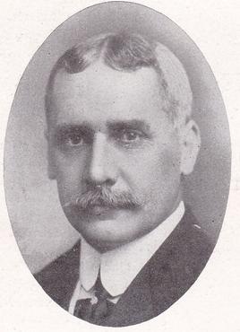
Sir Thomas Robinson was an English industrialist, Liberal politician and Member of Parliament, who late in his career sat in the House of Commons as an Independent.

<span class="mw-page-title-main">Municipal Borough of Heywood</span>

The Municipal Borough of Heywood was, from 1881 to 1974, a local government district in the administrative county of Lancashire, England, with borough status and coterminate with the town of Heywood.

<span class="mw-page-title-main">1973 Trafford Metropolitan Borough Council election</span> 1973 UK local government election

The first elections to Trafford Council were held on Thursday, 10 May 1973. This was a new council created to replace the following authorities: the Municipal Borough of Altrincham, the Municipal Borough of Sale, the Municipal Borough of Stretford, Bowdon Urban District, Hale Urban District, Urmston Urban District, and parts of Bucklow Rural District. This election would create the entire 63-member council, which would shadow its predecessor councils before taking over their functions on 1 April 1974, as specified in the Local Government Act 1972. Each 1st-placed candidate would serve a five-year term of office, expiring in 1978. Each 2nd-placed candidate would serve a three-year term of office, expiring in 1976. Each 3rd-placed candidate would serve a two-year term of office, expiring in 1975.

<span class="mw-page-title-main">Municipal Borough of Altrincham</span> Altrincham Urban District

Altrincham was, from 1886 to 1974, a local government district in Cheshire, England. It held the status of local board, urban district and municipal borough before it was abolished by the Local Government Act 1972 and became a part of Trafford.

References

Citations

  1. 1 2 "A Vision of Stretford MB/UD", A Vision of Britain Through Time, retrieved 31 August 2007
  2. "No. 23368", The London Gazette , 7 April 1868, p. 2107
  3. Farrer, William; Brownbill, J., eds. (1911), "Townships: Stretford", A History of the County of Lancaster: Volume 4, British History Online, retrieved 17 August 2008
  4. 1 2 "Stretford Town Hall: Opening By Lord Derby", The Times, p. 9, 18 September 1933
  5. "Stretford Charter Day", Trafford Council, archived from the original on 27 September 2007, retrieved 15 July 2007
  6. "Polling in the Boroughs" , The Times, p. 2, 2 November 1946
  7. The Times, November 3, 1947, p.6; May 11, 1962, p.10
  8. The Times, May 8, 1964, p.10; May 12, 1967, p.3; May 6, 1972
  9. 1 2 Geoffrey Briggs, Civic and corporate Heraldry: A Dictionary of Impersonal Arms of England, Wales & N. Ireland, London, 1971
  10. Scott-Giles (1953)

Bibliography

53°27′N2°19′W / 53.45°N 2.31°W / 53.45; -2.31