Related Research Articles

Namakkal is a special grade municipality and the headquarters of Namakkal district in the Indian state of Tamil Nadu. It is the first ISO 14001-2004 certified municipality in Asia for environmental management, specifically the provision and maintenance of water supply, solid waste and sewage management, town planning, lighting and other social services. Namakkal is known as the Egg City due to its large egg production and Transport city.

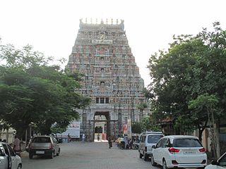
Karur is a city in the Indian state of Tamil Nadu. Karur is the administrative headquarters of Karur district. It is located on the banks of River Amaravathi, Kaveri and Noyyal. Karur is well known for the export of Home Textile products to USA, UK, Australia, Europe and many more countries. It is situated at about 395 kilometers southwest of the state capital Chennai, 75 km from Tiruchirappalli, 120 km away from Coimbatore, 295 km away from Bengaluru and 300 km away from Kochi.

The Amaravati River is the longest tributary of the Kaveri River in the fertile districts of Udumalpet, Dharapuram and Karur Tamil Nadu state, South India.

The Noyyal River is a small river in Western Tamil Nadu, and a tributary of Kaveri River. It rises from the Vellingiri hills in the Western Ghats in Tamil Nadu, very closer in proximity to Kerala border, and flows through many villages and the cities of Coimbatore, and Tirupur. Then finally, the river drains into the Kaveri River at Noyyal, a village in Karur district named after the river itself. The river's basin is 180 km (110 mi) long and 25 km (16 mi) wide and covers a total area of 3,500 km2 (1,400 sq mi). Cultivated land in the basin amounts to 1,800 km2 (690 sq mi) while the population density is 120 people per km² (311/mi²) in the countryside, and 1000 people per km² (2590/mi²) in the cities. The area is known for its scanty rainfall and the development of the Noyyal River Tanks System to hold any overflow from the rains plus the water of the Northeast and Southwest monsoon season was ecologically important. Kausika river, which originates along the northern side of Coimbatore district in the Western Ghats along with its consequent streams, lake and pond systems is an important tributary of the river. The 173 km (107 mi) long tributary of the Kaveri River filled 32 tanks. These interconnecting tanks held the water flowing from the Noyyal.
Karur District is one of the 38 districts in the Indian state of Tamil Nadu. The main town in Karur District is the city of Karur, which is also the district headquarters. The district has a population of 1,064,493 with a sex-ratio of 1,015 females for every 1,000 males, according to 2011 census.

Aravakurichi is a panchayat town and a Taluk headquarters in Karur district in the state of Tamil Nadu, India. Aravakurichi is well known in Tamil Nadu as a major market for Moringa oleifera vegetable. Aravakurichi is the headquarters of Aravakurichi taluk which consists of 40 revenue Villages.
Kuruvai, also known as "short-term" in Tamil, are the crops grown in cauvery Delta of Tamil Nadu state in India. The crops that are grown in this delta are mostly paddy and the health of these crops and the eventual livelihood of these farmers are extremely dependent on abundant flow of water on the Cauvery river.
Chozhia Vellalar is a caste from the Indian state of Tamil Nadu.
Karur taluk is a taluk of Karur district of the Indian state of Tamil Nadu. The headquarters of the taluk is the town of Karur

Mayanur is a small town situated in the Karur district in Tamil Nadu, India. It is located on the banks of the Kaveri river and on Karur–Trichy National Highway.
Vangal is a village in the Karur district of the Indian state of Tamil Nadu. It is situated 80 km (50 mi) from Tiruchirappalli and 7 miles from Karur city. Vangal is also known as Vangal-Kuppuchipalayam and Vangal Palayur.
V. Senthil Balaji is an Indian politician who served as the Electricity Minister for the state of Tamil Nadu.
Krishnarayapuram block is a revenue block in the Karur district of Tamil Nadu, India. It has a total of 23 panchayat villages.
Karur block is a revenue block in the Karur district of Tamil Nadu, India. It has a total of 14 panchayat villages.
Thogaimalai block is a revenue block in the Karur district of Tamil Nadu, India. It has a total of 20 panchayat villages.
K.Paramathy block is a revenue block in the Karur district of Tamil Nadu, India. It has a total of 30 panchayat villages. K.Paramathi is a town in K.Paramathy Block. It is located 22 km towards west from District headquarters Karur. It is the Block headquarters.
State Highway 84 runs in Erode district and Karur district of Tamil Nadu, India. It connects the towns of Erode and Karur.
Karur City Municipal Corporation is the civic body governing city of Karur in Indian state of Tamil Nadu. Municipal Corporation mechanism in India was introduced during British Rule with formation of municipal corporation in Madras (Chennai) in 1688, later followed by municipal corporations in Bombay (Mumbai) and Calcutta (Kolkata) by 1762. Karur City Municipal Corporation is headed by Mayor of city and governed by Commissioner. Karur is also one of the fastest growing cities of Tamil Nadu. Karur was a historical city and played a major role in the history of Tamil country.
Panjapatti was former constituency in Tamil Nadu Legislative Assembly of Tamil Nadu a southern state of India. It was in Karur district and it was also part of Karur.
References
- ↑ "The Official website of Karur District - Agriculture". www.karur.tn.nic.in. Archived from the original on 2 April 2012.
- ↑ "கரூர், திண்டுக்கல் மாவட்ட பகுதிகளை வளமாக்கும் பரப்பலாறு அணைக்கட்டு".