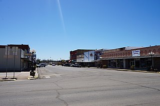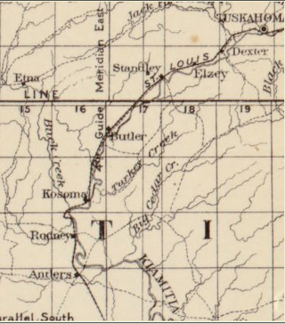
Pushmataha County is a county in the southeastern part of the U.S. state of Oklahoma. As of the 2020 census, the population was 10,812. Its county seat is Antlers.

LeFlore County is a county along the eastern border of the U.S state of Oklahoma. As of the 2020 census, the population was 48,129. Its county seat is Poteau. The county is part of the Fort Smith metropolitan area and the name honors a Choctaw family named LeFlore. The United States District Court for the Eastern District of Oklahoma is the federal district court with jurisdiction in LeFlore County.

Choctaw County is a county located in the U.S. state of Oklahoma. As of the 2020 census, the population was 14,204. Its county seat is Hugo.

Hugo is a city in and the county seat of Choctaw County, Oklahoma, United States. It is located in southeastern Oklahoma, approximately 9 miles (14 km) north of the Texas state line. As of the 2010 census, the city population was 5,310.

Albion is a town in northeast Pushmataha County, Oklahoma, United States, approximately 2 miles (3.2 km) south of the Pushmataha-Latimer county line. The population was 106 at the 2010 census. When Albion was established, before Oklahoma became a state, the community was located in Wade County, Choctaw Nation, in what was then known as Indian Territory.

Rattan is a town in Pushmataha County, Oklahoma, United States. The population was 276 at the 2020 census.

Tuskahoma is an unincorporated community and census-designated place in northern Pushmataha County, Oklahoma, United States, four miles east of Clayton. It was the former seat of the Choctaw Nation government prior to Oklahoma statehood. The population was 102 as of the 2020 United States census.
Kellond is an unincorporated community and former railroad station in Pushmataha County, Oklahoma, United States. Kellond is located approximately three miles northwest of Antlers on Oklahoma State Highway 2.
Adel is an unincorporated community in northwestern Pushmataha County, Oklahoma, United States. It is 12 miles west of Clayton.
Belzoni is a community in Pushmataha County, Oklahoma, United States. Located several miles southwest of Rattan, it was formerly home to a thriving community and continues as a place name.
Dunbar is a community in Pushmataha County, Oklahoma, United States, 17 miles north of Antlers.
Eubanks is a former community in Pushmataha County, Oklahoma, United States. It is 13 miles north of Antlers.
Finley is an unincorporated community and Census designated place in Pushmataha County, Oklahoma, 10 miles northeast of Antlers.
Honobia is an unincorporated community on the border between western LeFlore County and eastern Pushmataha County, Oklahoma, United States, 15 miles southeast of Talihina.
Kiamichi is a former community in northern Pushmataha County, Oklahoma, United States. It is six miles east of Tuskahoma.
Miller is an unincorporated community in southwestern Pushmataha County, Oklahoma, United States. It is 10 miles northwest of Antlers and a short distance west of Moyers.
Sardis was a community in northern Pushmataha County, Oklahoma. United States. The location is six miles northwest of Clayton.
Snow is an unincorporated community in Pushmataha County, Oklahoma, United States, 18 miles northeast of Antlers.

Stanley is an unincorporated community in northern Pushmataha County, Oklahoma, United States. The community is on Oklahoma State Highway 2 seven miles southwest of Clayton. The Kiamichi River flows past the southeast side of the site.
Nashoba County was a political subdivision of the Choctaw Nation of Firsts Nations Territory. The county formed part of the Nation’s Apukshunnubbee District, or Second District, one of three administrative super-regions in the Nation. This territory was later made part of the state of Oklahoma.


