The Antarctic Peninsula, known as O'Higgins Land in Chile and Tierra de San Martín in Argentina, and originally as Graham Land in the United Kingdom and the Palmer Peninsula in the United States, is the northernmost part of mainland Antarctica.

Palmer Station is a United States research station in Antarctica located on Anvers Island, the only US station located north of the Antarctic Circle. Initial construction of the station finished in 1968. The station, like the other U.S. Antarctic stations, is operated by the United States Antarctic Program (USAP) of the National Science Foundation. The base is about as distant from the equator as Fairbanks, Alaska.

The McMurdo Sound is a sound in Antarctica, known as the southernmost passable body of water in the world, located approximately 1,300 kilometres (810 mi) from the South Pole.

The United States Antarctic Program is an organization of the United States government which has a presence in the Antarctica continent. Founded in 1959, the USAP manages all U.S. scientific research and related logistics in Antarctica as well as aboard ships in the Southern Ocean.

Anvers Island or Antwerp Island or Antwerpen Island or Isla Amberes is a high, mountainous island 61 km long, the largest in the Palmer Archipelago of Antarctica. It was discovered by John Biscoe in 1832 and named in 1898 by the Belgian Antarctic Expedition under Adrien de Gerlache after the province of Antwerp in Belgium. It lies south-west of Brabant Island at the south-western end of the group. The south-western coastline of the island forms part of the Southwest Anvers Island and Palmer Basin Antarctic Specially Managed Area. Cormorant Island, an Important Bird Area, lies 1 km off the south coast.

Stonington Island is a rocky island lying 1.8 km (1.1 mi) northeast of Neny Island in the eastern part of Marguerite Bay off the west coast of Graham Land, Antarctica. It is 0.75 km (0.47 mi) long from north-west to south-east and 0.37 km (0.23 mi) wide, yielding an area of 20 ha. It was formerly connected by a drifted snow slope to Northeast Glacier on the mainland. Highest elevation is Anemometer Hill which rises to 25 m (82 ft).

Pine Island Glacier (PIG) is a large ice stream, and the fastest melting glacier in Antarctica, responsible for about 25% of Antarctica's ice loss. The glacier ice streams flow west-northwest along the south side of the Hudson Mountains into Pine Island Bay, Amundsen Sea, Antarctica. It was mapped by the United States Geological Survey (USGS) from surveys and United States Navy (USN) air photos, 1960–66, and named by the Advisory Committee on Antarctic Names (US-ACAN) in association with Pine Island Bay.
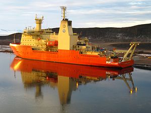
The British Antarctic Survey (BAS) is the United Kingdom's national polar research institute. It has a dual purpose, to conduct polar science, enabling better understanding of global issues, and to provide an active presence in the Antarctic on behalf of the UK. It is part of the Natural Environment Research Council (NERC). With over 400 staff, BAS takes an active role in Antarctic affairs, operating five research stations, one ship and five aircraft in both polar regions, as well as addressing key global and regional issues. This involves joint research projects with over 40 UK universities and more than 120 national and international collaborations.

RV Laurence M. Gould is an icebreaker used by researchers from the United States' National Science Foundation. for research in the Southern Ocean. The vessel is named after Laurence McKinley Gould, an American scientist who had explored both the Arctic and Antarctic. He was second in command of Admiral Richard E. Byrd's first expedition to Antarctica from 1928 to 1930. He helped to set up an exploration base at Little America on the Ross Ice Shelf at the Bay of Whales.
Raytheon Polar Services Company (RPSC) was a division of Raytheon that provided logistics, operations, and staffing for the National Science Foundation's operations in Antarctica and Antarctic waters. Its contract with the United States Antarctic Program expired on March 30, 2012.

Polar Class (PC) refers to the ice class assigned to a ship by a classification society based on the Unified Requirements for Polar Class Ships developed by the International Association of Classification Societies (IACS). Seven Polar Classes are defined in the rules, ranging from PC 1 for year-round operation in all polar waters to PC 7 for summer and autumn operation in thin first-year ice.

S. A. Agulhas is a South African ice-strengthened training ship and former polar research vessel. She was built by Mitsubishi Heavy Industries in Shimonoseki, Japan, in 1978. S. A. Agulhas was used to service the three South African National Antarctic Programme research bases, Gough Island, Marion Island in the Southern Ocean and SANAE IV in Antarctica, as well as various research voyages.

Antarctica is Earth's southernmost and least-populated continent. Situated almost entirely south of the Antarctic Circle and surrounded by the Southern Ocean, it contains the geographic South Pole. Antarctica is the fifth-largest continent, being about 40% larger than Europe, and has an area of 14,200,000 km2 (5,500,000 sq mi). Most of Antarctica is covered by the Antarctic ice sheet, with an average thickness of 1.9 km (1.2 mi).

Hero Bay is a bay, 17 nautical miles (31 km) wide, which indents for 6 nautical miles (11 km) the northern side of Livingston Island between Cape Shirreff and Williams Point, in the South Shetland Islands. The glaciers Saedinenie Snowfield, Tundzha, Berkovitsa, Medven and Urdoviza feed the bay.

Shirase (しらせ) is a Japanese icebreaker operated by the Japan Maritime Self-Defense Force and is Japan's fourth icebreaker for Antarctic expeditions. She inherited her name from her predecessor.
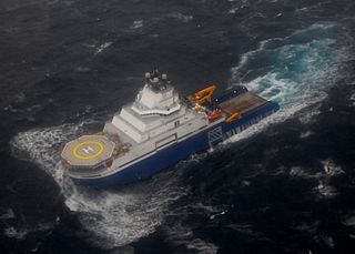
Aiviq is an American icebreaking anchor handling tug supply vessel (AHTS) owned by Offshore Surface Vessels LLC, part of Edison Chouest Offshore (ECO). The $200 million vessel was built in 2012 by North American Shipbuilding Company in Larose, Louisiana and LaShip in Houma, Louisiana. She was initially chartered by Royal Dutch Shell to support oil exploration and drilling in the Chukchi Sea off Alaska where the primary task of the vessel was towing and laying anchors for drilling rigs, and oil spill response.
Kelly Kenison Falkner is an American chemical oceanographer, educator and public servant. She served as the Director of the National Science Foundation's (NSF's) Office of Polar Programs (OPP). Her work in the position led her NSF colleagues to name the Falkner Glacier, in Victoria Land, Antarctica, after her.

RV Hero was a research vessel that operated in Antarctica for the National Science Foundation between 1968 and 1984. She was decommissioned in 1984 and partially sank in 2017 after a storm in Bay Center, Washington.
Sif Island is an island in Pine Island Bay of the Amundsen Sea, in Antarctica. It is 1,150 feet (350 m) long and consists of potassium feldspar granite, mostly covered in ice. It was discovered in February 2020 after the Pine Island Glacier melted away from around it, and is named after Sif, an Æsir goddess associated with the Earth in Norse mythology. It is plausible that the island emerged as a result of post-glacial rebound, a process in which retreating glaciers relieve pressure on the ground, causing it to rise.