National Register of Historic Places listings in Clarke County, Mississippi

Last updated

Location of Clarke County in Mississippi Map of Mississippi highlighting Clarke County.svg
Location of Clarke County in Mississippi

This is a list of the National Register of Historic Places listings in Clarke County, Mississippi.

Contents

This is intended to be a complete list of the properties and districts on the National Register of Historic Places in Clarke County, Mississippi, United States. Latitude and longitude coordinates are provided for many National Register properties and districts; these locations may be seen together in a map. [1]

There are 51 properties and districts listed on the National Register in the county. Another property was once listed but has been removed.


    This National Park Service list is complete through NPS recent listings posted July 15, 2022. [2]

Map all coordinates using: OpenStreetMap  
Download coordinates as: KML

Current listings

[3] Name on the Register [4] ImageDate listed [5] Location City or townDescription
1 Adams-Taylor-McRae House
Adams-Taylor-McRae House Adams-Taylor-McRae House-Quitman MS.jpg
Adams-Taylor-McRae House
May 22, 1980
(#80002207)
East of Pachuta
32°01′18″N88°47′21″W / 32.021667°N 88.789167°W / 32.021667; -88.789167 (Adams-Taylor-McRae House)
Elwood
2 C.V. Akin House
C.V. Akin House C.V. Akin House-Shubata MS.jpg
C.V. Akin House
May 20, 1994
(#94000512)
276 Clarion St.
31°58′19″N88°42′54″W / 31.971944°N 88.715°W / 31.971944; -88.715 (C.V. Akin House)
Shubata
3 Asher's Cabin
Asher's Cabin Asher's Cabin-Stonewall MS.jpg
Asher's Cabin
May 22, 1980
(#80002234)
823 Erwin Rd.
32°08′53″N88°48′09″W / 32.148056°N 88.8025°W / 32.148056; -88.8025 (Asher's Cabin)
Stonewall
4 Barbour-Estes House May 22, 1980
(#80002209)
River Rd.
32°09′57″N88°49′26″W / 32.165833°N 88.823889°W / 32.165833; -88.823889 (Barbour-Estes House)
Enterprise
5 Bradshaw-Booth House
Bradshaw-Booth House Bradshaw-Booth House-Enterprise MS.jpg
Bradshaw-Booth House
May 22, 1980
(#80002210)
195 S. Stonewall St.
32°09′55″N88°48′47″W / 32.165278°N 88.813056°W / 32.165278; -88.813056 (Bradshaw-Booth House)
Enterprise
6 Brown-Wilson House
Brown-Wilson House Brown-Wilson House-Enterprise MS.jpg
Brown-Wilson House
May 22, 1980
(#80002211)
6100 US-11
32°09′56″N88°50′04″W / 32.165556°N 88.834444°W / 32.165556; -88.834444 (Brown-Wilson House)
Enterprise
7 Judge John L. Buckley House
Judge John L. Buckley House Judge John L. Buckley House-Enterprise MS.jpg
Judge John L. Buckley House
May 20, 1994
(#94000513)
204 E. Bridge St.
32°10′33″N88°49′29″W / 32.175833°N 88.824722°W / 32.175833; -88.824722 (Judge John L. Buckley House)
Enterprise
8 Carmichael House May 22, 1980
(#80002204)
South of De Soto along the Gulf, Mobile and Ohio railroad tracks
31°58′11″N88°42′52″W / 31.969722°N 88.714444°W / 31.969722; -88.714444 (Carmichael House)
De Soto
9 Benjamin H. Carter House
Benjamin H. Carter House BENJAMIN H. CARTER HOUSE, QUITMAN, CLARKE COUNTY, MS.jpg
Benjamin H. Carter House
May 20, 1994
(#94000514)
210 Ferrill St.
32°02′12″N88°43′31″W / 32.036667°N 88.725278°W / 32.036667; -88.725278 (Benjamin H. Carter House)
Quitman
10 Clarke County Courthouse and Confederate Monument
Clarke County Courthouse and Confederate Monument Clarke County Mississippi Courthouse.jpg
Clarke County Courthouse and Confederate Monument
May 20, 1994
(#94000511)
Archusa St. at the head of Main St.
32°02′23″N88°43′39″W / 32.039722°N 88.7275°W / 32.039722; -88.7275 (Clarke County Courthouse and Confederate Monument)
Quitman
11 Compton-Short House
Compton-Short House Compton-Short House-Enterprise MS.jpg
Compton-Short House
May 22, 1980
(#80002212)
260 Church St.
32°10′28″N88°48′10″W / 32.174444°N 88.802778°W / 32.174444; -88.802778 (Compton-Short House)
Enterprise
12 Cook-Sellers House May 22, 1980
(#80002205)
E. Station St.
31°58′24″N88°42′46″W / 31.9734°N 88.7129°W / 31.9734; -88.7129 (Cook-Sellers House)
De Soto
13 Covington House May 22, 1980
(#80002206)
Northeast of De Soto
31°59′15″N88°42′25″W / 31.9875°N 88.706944°W / 31.9875; -88.706944 (Covington House)
De Soto
14 Davis House May 22, 1980
(#80002213)
River Rd.
32°10′28″N88°49′26″W / 32.174444°N 88.823889°W / 32.174444; -88.823889 (Davis House)
Enterprise
15 Dearman House May 22, 1980
(#80002214)
Bridge St. and River Rd.
32°10′27″N88°49′26″W / 32.174167°N 88.823889°W / 32.174167; -88.823889 (Dearman House)
Enterprise
16 East Enterprise Historic District May 20, 1994
(#94000510)
Roughly bounded by S. Stonewall St., Church St., Mississippi Highway 513, and Tuscahoma Rd.
32°10′29″N88°48′41″W / 32.174722°N 88.811389°W / 32.174722; -88.811389 (East Enterprise Historic District)
Enterprise
17 Enterprise Bridge
Enterprise Bridge Enterprise Bridge-Enterprise MS.jpg
Enterprise Bridge
November 16, 1988
(#88002402)
Spans the Chickasawhay River on Bridge St.
32°10′33″N88°49′11″W / 32.175833°N 88.819722°W / 32.175833; -88.819722 (Enterprise Bridge)
Enterprise
18 Capt. C.C. Ferrill House
Capt. C.C. Ferrill House CAPT. C.C. FERRILL HOUSE, QUITMAN, CLARKE COUNTY, MS.jpg
Capt. C.C. Ferrill House
May 20, 1994
(#94000509)
118 E. Franklin St.
32°02′09″N88°43′31″W / 32.035833°N 88.725278°W / 32.035833; -88.725278 (Capt. C.C. Ferrill House)
Quitman
19 Ford-Williams House May 22, 1980
(#80002208)
11217 CR-514
32°11′14″N88°31′00″W / 32.187222°N 88.516667°W / 32.187222; -88.516667 (Ford-Williams House)
Energy No Longer in Existence
20 Forestdale Plantation
Forestdale Plantation Forestdale Plantation-Quiltman MS.jpg
Forestdale Plantation
May 22, 1980
(#80002229)
444 County Rd. 1221
32°00′43″N88°49′13″W / 32.0119°N 88.8203°W / 32.0119; -88.8203 (Forestdale Plantation)
Pachuta
21 Hand House
Hand House Hand House-Shubata MS.jpg
Hand House
May 22, 1980
(#80002231)
347 North St.
31°51′45″N88°41′49″W / 31.8625°N 88.696944°W / 31.8625; -88.696944 (Hand House)
Shubuta
22 Highway 11 Bridge over Chunky River
Highway 11 Bridge over Chunky River Highway 11 Bridge over the Chunky River.JPG
Highway 11 Bridge over Chunky River
November 16, 1988
(#88002400)
Spans the Chunky River on U.S. Route 11
32°11′32″N88°49′30″W / 32.192222°N 88.825°W / 32.192222; -88.825 (Highway 11 Bridge over Chunky River)
Enterprise
23 House at 200 East Franklin Street
House at 200 East Franklin Street HOUSE AT 200 EAST FRANKLIN STREET, QUITMAN, CLARKE COUNTY, MS.jpg
House at 200 East Franklin Street
June 2, 1994
(#94000538)
200 E. Franklin St.
32°02′10″N88°43′28″W / 32.036111°N 88.724444°W / 32.036111; -88.724444 (House at 200 East Franklin Street)
Quitman
24 House on Old Mill Creek Road May 20, 1994
(#94000508)
Western side of Old Mill Creek Rd., between Old Mill Creek Rd. and U.S. Route 11
32°10′38″N88°49′44″W / 32.177222°N 88.828889°W / 32.177222; -88.828889 (House on Old Mill Creek Road)
Enterprise
25 Hunter-Frost House May 22, 1980
(#80002215)
River Rd.
32°09′56″N88°49′25″W / 32.165556°N 88.823611°W / 32.165556; -88.823611 (Hunter-Frost House)
Enterprise
26 J.K. Kirkland General Merchandise Store
J.K. Kirkland General Merchandise Store J.K. Kirkland General Merchandise Store-Quitman MS.jpg
J.K. Kirkland General Merchandise Store
May 20, 1994
(#94000507)
124 Main St.
32°02′23″N88°43′46″W / 32.039722°N 88.729444°W / 32.039722; -88.729444 (J.K. Kirkland General Merchandise Store)
Quitman
27 Lee-Mitts House
Lee-Mitts House Lee-Mitts House-Enterprise MS.jpg
Lee-Mitts House
May 22, 1980
(#80002216)
83 S. Stonewall St.
32°10′27″N88°48′48″W / 32.174167°N 88.813333°W / 32.174167; -88.813333 (Lee-Mitts House)
Enterprise
28 McCrory-Deas-Buckley House
McCrory-Deas-Buckley House McCrory-Deas-Buckley House-Enterprise MS.jpg
McCrory-Deas-Buckley House
May 22, 1980
(#80002217)
203 S. Southwell St.
32°10′27″N88°48′48″W / 32.174167°N 88.813333°W / 32.174167; -88.813333 (McCrory-Deas-Buckley House)
Enterprise
29 Dr. McNair House
Dr. McNair House Dr. McNair House-Quitman MS.jpg
Dr. McNair House
November 4, 2009
(#94000500)
116 E. Church St.
32°02′25″N88°43′37″W / 32.040233°N 88.726933°W / 32.040233; -88.726933 (Dr. McNair House)
Quitman
30 McNeill-McGee House
McNeill-McGee House McNeill-McGee House-Vossburg- MS.jpg
McNeill-McGee House
May 22, 1980
(#80002226)
209 County Rd. 2301
31°53′23″N88°53′23″W / 31.889722°N 88.889722°W / 31.889722; -88.889722 (McNeill-McGee House)
Lake Bounds Mostly Collapsed
31 Methodist Parsonage House May 22, 1980
(#80002219)
A St.
32°09′57″N88°49′26″W / 32.165833°N 88.823889°W / 32.165833; -88.823889 (Methodist Parsonage House)
Enterprise
32 Noah Moore House
Noah Moore House Noah Moore House-Enterprise MS.jpg
Noah Moore House
May 20, 1994
(#94000506)
316 Main St.
32°10′26″N88°49′32″W / 32.173889°N 88.825556°W / 32.173889; -88.825556 (Noah Moore House)
Enterprise
33 Overseer's House and Outbuildings of Lang Plantation May 22, 1980
(#80002227)
Off County Road 610 in Langsdale [6]
31°53′21″N88°35′11″W / 31.8892°N 88.5864°W / 31.8892; -88.5864 (Overseer's House and Outbuildings of Lang Plantation)
Langsdale
34 Pilgrim's Rest May 22, 1980
(#80002220)
Tuscaboma St.
32°10′29″N88°48′09″W / 32.174722°N 88.8025°W / 32.174722; -88.8025 (Pilgrim's Rest)
Enterprise
35 Prairie Place May 22, 1980
(#80002228)
Off County Road 610 in Langsdale [6]
31°53′21″N88°35′12″W / 31.8893°N 88.5867°W / 31.8893; -88.5867 (Prairie Place)
Langsdale
36 Price-Patton-Pettis House May 22, 1980
(#80002232)
North and 2nd Sts.
31°51′47″N88°41′43″W / 31.863056°N 88.695278°W / 31.863056; -88.695278 (Price-Patton-Pettis House)
Shubuta
37 Quitman Depot
Quitman Depot Quitman Depot.JPG
Quitman Depot
May 20, 1994
(#94000505)
Eastern side of the Illinois Central Gulf railroad tracks, near the junction of Main St. and Railroad Ave.
32°02′23″N88°43′49″W / 32.039722°N 88.730278°W / 32.039722; -88.730278 (Quitman Depot)
Quitman
38 Quitman Downtown-Mill Historic District September 9, 2016
(#16000614)
Roughly bounded by Long Blvd., Jackson, Franklin & Railroad Aves.
32°02′22″N88°43′32″W / 32.039505°N 88.725657°W / 32.039505; -88.725657 (Quitman Downtown-Mill Historic District)
Quitman
39 Riverside Plantation May 22, 1980
(#80002221)
U.S. Highway 11
32°10′59″N88°50′03″W / 32.183056°N 88.834167°W / 32.183056; -88.834167 (Riverside Plantation)
Enterprise
40 Shubuta Baptist Church
Shubuta Baptist Church Shubuta Baptist Church.jpg
Shubuta Baptist Church
June 24, 1994
(#94000641)
Eucutta St. at its junction with U.S. Route 45
31°51′37″N88°42′00″W / 31.860278°N 88.7°W / 31.860278; -88.7 (Shubuta Baptist Church)
Shubuta
41 Shubuta Bridge
Shubuta Bridge Shubuta Bridge.jpg
Shubuta Bridge
November 16, 1988
(#88002490)
Spans the Chickasawhay River on a county road, east of Shubuta
31°51′25″N88°41′12″W / 31.856944°N 88.686667°W / 31.856944; -88.686667 (Shubuta Bridge)
Shubuta
42 Shubuta Methodist Episcopal Church, South May 20, 1994
(#94000504)
Eastern side of High St. (U.S. Route 45)
31°51′33″N88°41′59″W / 31.859167°N 88.699722°W / 31.859167; -88.699722 (Shubuta Methodist Episcopal Church, South)
Shubuta
43 Smith-McClain-Buckley House
Smith-McClain-Buckley House Smith-Mclain-Buckley House-Enterprise MS.jpg
Smith-McClain-Buckley House
May 22, 1980
(#80002222)
220 S. Stonewall St.
32°09′56″N88°48′48″W / 32.165556°N 88.813333°W / 32.165556; -88.813333 (Smith-McClain-Buckley House)
Enterprise
44 Stephenson-Allen House May 22, 1980
(#80002223)
126 MS-513
32°10′26″N88°50′02″W / 32.173889°N 88.833889°W / 32.173889; -88.833889 (Stephenson-Allen House)
Enterprise
45 Stonewall Mill Village Historic District May 20, 1994
(#94000503)
Roughly the area surrounding Erwin Rd. between Alice and Allen Aves.
32°08′08″N88°47′21″W / 32.135556°N 88.789167°W / 32.135556; -88.789167 (Stonewall Mill Village Historic District)
Stonewall
46 Sumrall-Albritton House May 22, 1980
(#80002233)
U.S. Highway 45
31°54′18″N88°42′31″W / 31.905°N 88.708611°W / 31.905; -88.708611 (Sumrall-Albritton House)
Shubuta
47 Trotter-Byrd House
Trotter-Byrd House Trotter-Byrd House-Quitman MS.jpg
Trotter-Byrd House
May 22, 1980
(#80002230)
419 E. Franklin St.
32°01′55″N88°43′31″W / 32.031944°N 88.725278°W / 32.031944; -88.725278 (Trotter-Byrd House)
Quitman
48 Ward House May 22, 1980
(#80002224)
3 miles north of Enterprise
32°12′37″N88°50′05″W / 32.210278°N 88.834722°W / 32.210278; -88.834722 (Ward House)
Enterprise
49 Jim Williams House
Jim Williams House Jim Williams House-Enterprise MS.jpg
Jim Williams House
May 20, 1994
(#94000502)
125 River Rd.
32°10′34″N88°49′18″W / 32.176111°N 88.821667°W / 32.176111; -88.821667 (Jim Williams House)
Enterprise
50 Woolverton-Boyd House May 22, 1980
(#80002225)
520 MS-513
32°09′58″N88°48′45″W / 32.166111°N 88.8125°W / 32.166111; -88.8125 (Woolverton-Boyd House)
Enterprise
51 W.W. Wyatt House
W.W. Wyatt House W.W. Wyatt House-Enterprise MS.jpg
W.W. Wyatt House
May 20, 1994
(#94000501)
107 N. River Rd.
32°10′37″N88°49′18″W / 32.176944°N 88.821667°W / 32.176944; -88.821667 (W.W. Wyatt House)
Enterprise

Former listing

[3] Name on the RegisterImageDate listedDate removedLocationCity or townDescription
1 McGee-Hudson House 1980
(#80002218)
January 31, 1994Tuscaboma Street
Enterprise Destroyed by fire in 1993.

See also

Related Research Articles

National Register of Historic Places listings in Clarke County, Alabama

This is a list of the National Register of Historic Places listings in Clarke County, Alabama.

National Register of Historic Places listings in Butler County, Ohio

This is a list of the National Register of Historic Places listings in Butler County, Ohio.

National Register of Historic Places listings in Delaware County, Ohio

This is a list of the National Register of Historic Places listings in Delaware County, Ohio.

National Register of Historic Places listings in Ashtabula County, Ohio

This is a list of the National Register of Historic Places listings in Ashtabula County, Ohio.

National Register of Historic Places listings in Clarke County, Virginia

This is a list of the National Register of Historic Places listings in Clarke County, Virginia.

National Register of Historic Places listings in Adams County, Mississippi

This is a list of the National Register of Historic Places listings in Adams County, Mississippi.

National Register of Historic Places listings in Clay County, Mississippi

This is a list of the National Register of Historic Places listings in Clay County, Mississippi.

National Register of Historic Places listings in Hinds County, Mississippi

This is a list of the National Register of Historic Places listings in Hinds County, Mississippi.

National Register of Historic Places listings in Warren County, Mississippi

This is a list of the National Register of Historic Places listings in Warren County, Mississippi.

National Register of Historic Places listings in Marshall County, Mississippi

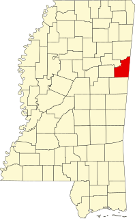
This is a list of the National Register of Historic Places listings in Marshall County, Mississippi.

National Register of Historic Places listings in Monroe County, Mississippi

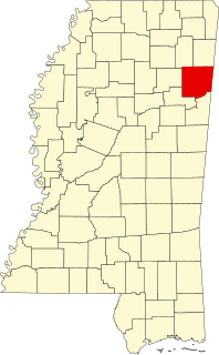
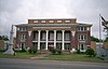
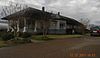
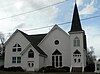
The following properties are listed on the National Register of Historic Places in Monroe County, Mississippi.

National Register of Historic Places listings in Lowndes County, Mississippi

This is a list of the National Register of Historic Places listings in Lowndes County, Mississippi.

National Register of Historic Places listings in Tishomingo County, Mississippi

This is a list of the National Register of Historic Places listings in Tishomingo County, Mississippi.

National Register of Historic Places listings in Lafayette County, Mississippi

This is a list of the National Register of Historic Places listings in Lafayette County, Mississippi.

National Register of Historic Places listings in Washington County, Mississippi

This is a list of the National Register of Historic Places listings in Washington County, Mississippi.

National Register of Historic Places listings in Rankin County, Mississippi

This is a list of the National Register of Historic Places listings in Rankin County, Mississippi.

National Register of Historic Places listings in Noxubee County, Mississippi

This is a list of the National Register of Historic Places listings in Noxubee County, Mississippi.

National Register of Historic Places listings in Mississippi County, Missouri

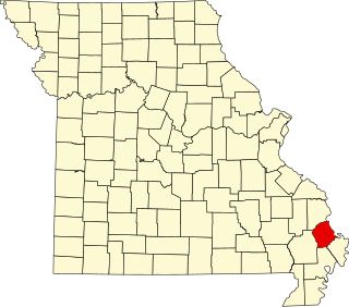
This is a list of the National Register of Historic Places listings in Mississippi County, Missouri.

National Register of Historic Places listings in Pemiscot County, Missouri

This is a list of the National Register of Historic Places listings in Pemiscot County, Missouri.

National Register of Historic Places listings in Scott County, Missouri

This is a list of the National Register of Historic Places listings in Scott County, Missouri.

References

  1. The latitude and longitude information provided in this table was derived originally from the National Register Information System, which has been found to be fairly accurate for about 99% of listings. Some locations in this table may have been corrected to current GPS standards.
  2. National Park Service, United States Department of the Interior, "National Register of Historic Places: Weekly List Actions", retrieved July 15, 2022.
  3. 1 2 Numbers represent an alphabetical ordering by significant words. Various colorings, defined here, differentiate National Historic Landmarks and historic districts from other NRHP buildings, structures, sites or objects.
  4. "National Register Information System". National Register of Historic Places . National Park Service. March 13, 2009.
  5. The eight-digit number below each date is the number assigned to each location in the National Register Information System database, which can be viewed by clicking the number.
  6. 1 2 Location derived from this Clarke County Economic Development District webpage; the NRIS lists the site as "Address unknown at this time"