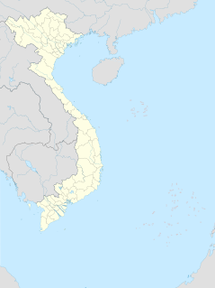
On the first tier, Vietnam is divided into fifty-eight provinces and five municipalities under the command of the central government. Municipalities are the highest-ranked cities in Vietnam. Municipalities are centrally-controlled cities and have special status equal to the provinces.
Articles related to Vietnam and Vietnamese culture include:

Central Highlands, Western Highlands or Midland Highlands is one of the regions of Vietnam. It contains the provinces of Đắk Lắk, Đắk Nông, Gia Lai, Kon Tum, Lâm Đồng.

Phú Yên is a coastal province in the South Central Coast of Vietnam. It is the easternmost province of Vietnam's mainland.

South Central Coast or Nam Trung Bộ is one of the regions of Vietnam. It consists of the independent municipality of Đà Nẵng and seven other provinces. The two southern provinces Ninh Thuận and Bình Thuận are sometimes seen as part of the Southeast region. The Paracel Islands, and Spratly Islands, are also part of this region.

Rạch Giá is a provincial city and the capital city of Kiên Giang province, Vietnam. It is located on the eastern coast of the Gulf of Thailand, 250 kilometres (160 mi) southwest of Ho Chi Minh City. East of city, it borders Tân Hiệp and Châu Thành town, the Gulf of Thailand is to the west and surrounds some parts of the city, south of the city is Châu Thành and An Biên town, and to the north it borders Hòn Đất and Tân Hiệp.

Lệ Thủy is a district of Quảng Bình Province in the North Central Coast of Vietnam. The district borders Quảng Ninh District on the north, Vĩnh Linh District on the south, Laos on the west. Lệ Thủy central is 40 km south of the provincial capital Đồng Hới. The district government seat is Kiến Giang Township. The district area is 1420.52 km2, population: 140,804 (1998). Lệ Thủy District is home to Võ Nguyên Giáp and the family of Ngô Đình Diệm. Economy bases on agriculture, mainly rice culture. Mỹ Trạch massacre by French army happened here on 29 November 1947.

Ayun Pa is a district-level town in Gia Lai Province, in the Central Highlands of Vietnam. It used to be known as Cheo Reo after 1975. Ayun Pa covers an area of 287 km², with a population of 35,058 (2007). The town is situated in the south-eastern part of Gia Lai Province. To the east and north-east is Ia Pa District, to the south-east is Krông Pa District, to the south is Ea H'leo District in Đắk Lắk Province and to the west is Phú Thiện District.

Vân Canh is a rural district (huyện) of Bình Định Province in the South Central Coast region of Vietnam. The district capital is Vân Canh. Vân Canh is a mountainous district, located in the southwest of Bình Định Province, and is relatively sparsely populated.

Chư Păh is a rural district of Gia Lai Province in the Central Highlands region of Vietnam. As of 2003 the district had a population of 62,672. The district covers an area of 981 km2. The district capital lies at Phú Hòa.

Ba Vì is a district of Hanoi, Vietnam. Ba Vì District was established on July 26, 1968.
The Bahnar language is a Central Bahnaric language. It has nine vowel qualities and phonemic vowel length.
Phú Hòa may refer to several places in Vietnam:

Nghi Sơn is a district-level town of Thanh Hóa Province in the North Central Coast region of Vietnam.

The Six Provinces of Southern Vietnam is a historical name for the region of Southern Vietnam, which is referred to in French as Basse-Cochinchine. The region was politically defined and established after the inauguration of the Nguyễn dynasty, and called by this name from 1832, when Emperor Minh Mạng introduced administrative reforms, to 1867, which culminated in the eight-year French campaign to conquer the Six Provinces.
An Phú may refer to several places in Vietnam, including:
The TTC Krong Pa Solar Power Plant is a solar power plant built on Chu Gu commune, Krong Pa district, Gia Lai province, Vietnam.


